Shikoku
Welcome to Shikoku, a Temperate island in the Philippine Sea, part of the majestic Pacific Ocean. This guide offers a comprehensive overview of what makes Shikoku unique – from its geography and climate to its population, infrastructure, and beyond. Dive into the details:
- Geography and Size: Explore the island’s size and location.
- Climate and Weather: Weather patterns and temperature.
- Topography and Nature: Uncover the natural wonders of the island.
- Infrastructure and Travelling: Insights on reaching, staying, and making the most of your visit.
- News and Headlines: Latest News.
Geography and size of Shikoku
Size: 18373 km²
Coastline: 2310 km
Ocean: Pacific Ocean
Sea: Philippine Sea
Continent: Asia
Shikoku is a Giant Island spanning 18373 km² with a coastline of 2310 km.
Archipel: Japan – An East Asian archipelago comprising four main islands and numerous smaller ones, known for its rich history, technological advances, and distinct culture.
Tectonic Plate: Amur – A minor tectonic plate in the region of the Amur River at the border of Russia and China, involved in complex interactions with the Pacific and Eurasian plates.
The geographic heart of the island is pinpointed at these coordinates:
Latitude: 33.66351224 / Longitude: 133.46756387
Climate and weather of Shikoku
Climate Zone: Temperate
Climate Details: Humid Subtropical Climate
Temperature: Hot Summer
Climate Characteristics: With continuous rainfall and hot summers, this climate is common in some coastal regions, supporting diverse vegetation.
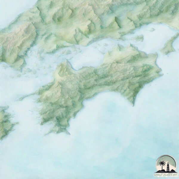
Topography and nature of Shikoku
Timezone: UTC+09:00
Timezone places: Asia/Tokyo
Max. Elevation: 1982 m Tengu-dake
Mean Elevation: 416 m
Vegetation: Evergreen Needleleaf Forest
Tree Coverage: 67%
The mean elevation is 416 m. Dominating the island’s landscape, the majestic “Tengu-dake” rises as the highest peak, soaring to impressive heights. The island is characterized by Mountains: High, steeply elevated landforms. Characterized by both a high maximum elevation (over 500 meters) and a high mean elevation, creating rugged, mountainous terrains on islands.
Dominating Vegetation: Evergreen Needleleaf Forest
Dominated by evergreen coniferous trees such as pines and firs, which retain their needle-like leaves throughout the year. These forests are often found in cooler climates. Shikoku has a tree cover of 67 %.
Vegetation: 13 vegetation zones – Exceptionally Diverse Island
Islands with more than ten vegetation zones are among the most ecologically rich and varied in the world. These islands are akin to miniature continents, boasting an incredible array of ecosystems. The sheer range of habitats, from high peaks to deep valleys, rainforests to deserts, creates a mosaic of life that is unparalleled. They are crucial for conservation and ecological studies.
Infrastructure and Travelling to Shikoku
Does the island have a public airport? yes.
Shikoku has a public and scheduled airport. The following airports are located on this island: Kochi Ryoma Airport, Matsuyama Airport, Tokushima Awaodori Airport / JMSDF Tokushima Air Base, Takamatsu Airport.
Does the island have a major port? yes.
Shikoku is home to a major port. The following ports are situated on the island: TAKAMATSU, SUSAKI KO, UWAJIMA KO, YAWATAHAMA, MATSUYAMA, NIIHAMA, MISHIMA-KAWANOE KO, TAKUMA, MARUGAME KO, NAMIKATA.
The mean population of Shikoku is 197 per km². Shikoku is Moderately Inhabited. The island belongs to Japan.
The name of the island resonates across different cultures and languages. Here is how it is known around the world: Arabic: شيكوكو; German: Shikoku; Spanish: Shikoku; French: Shikoku; Portuguese: Shikoku; Russian: Сикоку; Chinese: 四國
Continuing your journey, Ōsakishimo Jima is the next notable island, situated merely km away.
7 Days on Japan's Smallest Main Island | Shikoku


Japan is classified as Developed region: G7: Group of Seven – Major advanced economies, including Canada, France, Germany, Italy, Japan, the United Kingdom, and the United States. The level of income is High income: OECD.
News – Latest Updates and Headlines from Shikoku
Stay informed with the most recent news and important headlines from Shikoku. Here’s a roundup of the latest developments.
Social Media Posts about Shikoku
Please note: The data used here has been primarily extracted from satellite readings. Deviations from exact values may occur, particularly regarding the height of elevations and population density. Land area and coastline measurements refer to average values at mean high tide.