Shkolnyy
Welcome to Shkolnyy, a Continental island in the Gulf of Finland, part of the majestic Atlantic Ocean. This guide offers a comprehensive overview of what makes Shkolnyy unique – from its geography and climate to its population, infrastructure, and beyond. Dive into the details:
- Geography and Size: Explore the island’s size and location.
- Climate and Weather: Weather patterns and temperature.
- Topography and Nature: Uncover the natural wonders of the island.
- Infrastructure and Travelling: Insights on reaching, staying, and making the most of your visit.
- News and Headlines: Latest News.
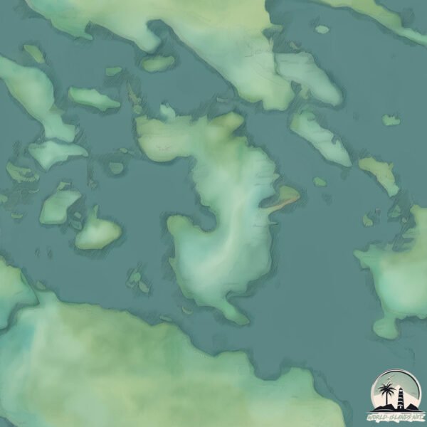
Geography and size of Shkolnyy
Size: 2.726 km²
Coastline: 12.2 km
Ocean: Atlantic Ocean
Sea: Gulf of Finland
Continent: Europe
Shkolnyy is a Small Island spanning 2.7 km² with a coastline of 12.2 km.
Archipel: –
Tectonic Plate: Eurasia – One of the world’s largest tectonic plates, the Eurasian Plate covers a significant portion of Europe and Asia. It’s characterized by diverse geological features, including the Ural Mountains, the European Plain, and the Himalayas formed from its collision with the Indian Plate.
The geographic heart of the island is pinpointed at these coordinates:
Latitude: 60.54129874 / Longitude: 28.59871866
Climate and weather of Shkolnyy
Climate Zone: Continental
Climate Details: Warm-Summer Humid Continental Climate
Temperature: Warm Summer
Climate Characteristics: Features warm summers and cold winters with consistent precipitation, common in higher latitudes.
Topography and nature of Shkolnyy
Timezone: UTC+04:00
Timezone places: Europe/Moscow
Max. Elevation: 29 m
Mean Elevation: 19 m
Vegetation: Mixed Forest
Tree Coverage: 83%
The mean elevation is 19 m. The highest elevation on the island reaches approximately 29 meters above sea level. The island is characterized by Plains: Flat, low-lying lands characterized by a maximum elevation of up to 200 meters. On islands, plains are typically coastal lowlands or central flat areas.
Dominating Vegetation: Mixed Forest
A combination of both deciduous and evergreen trees, often found in transitional zones between forest types. These forests offer a diverse habitat for various wildlife species. Shkolnyy has a tree cover of 83 %.
Vegetation: 5 vegetation zones – Highly Diverse Island
With five different vegetation zones, these islands offer a rich tapestry of ecosystems. The variety could include dense forests, open meadows, wetlands, coastal zones, and more. This level of diversity supports an intricate web of life, with each zone playing a vital role in the overall ecological health and balance of the island.
Infrastructure and Travelling to Shkolnyy
Does the island have a public airport? no.
There is no public and scheduled airport on Shkolnyy. The nearest airport is Lappeenranta Airport, located 73 km away.
Does the island have a major port? no.
There are no major ports on Shkolnyy. The closest major port is GAVAN VYSOTSK, approximately 7 km away.
The mean population of Shkolnyy is 29 per km². Shkolnyy is Gently Populated. The island belongs to Russia.
Continuing your journey, Ostrov Lisiy is the next notable island, situated merely km away.
STUDENTS ON THE ISLAND - CHIOMA NWAOHA, MIRACLE GODWIN, KOYIN SANUSI, SOMTO EZE


Russia is classified as Emerging region: BRIC: Brazil, Russia, India, and China – Economies noted for their rapid growth and increasing influence on global affairs. The level of income is Upper middle income.
News – Latest Updates and Headlines from Shkolnyy
Stay informed with the most recent news and important headlines from Shkolnyy. Here’s a roundup of the latest developments.
Please note: The data used here has been primarily extracted from satellite readings. Deviations from exact values may occur, particularly regarding the height of elevations and population density. Land area and coastline measurements refer to average values at mean high tide.