Simeulue
Welcome to Simeulue, a Tropical island in the Indian Ocean, part of the majestic Indian Ocean. This guide offers a comprehensive overview of what makes Simeulue unique – from its geography and climate to its population, infrastructure, and beyond. Dive into the details:
- Geography and Size: Explore the island’s size and location.
- Climate and Weather: Weather patterns and temperature.
- Topography and Nature: Uncover the natural wonders of the island.
- Infrastructure and Travelling: Insights on reaching, staying, and making the most of your visit.
- News and Headlines: Latest News.
Geography and size of Simeulue
Size: 1750 km²
Coastline: 538 km
Ocean: Indian Ocean
Sea: Indian Ocean
Continent: Asia
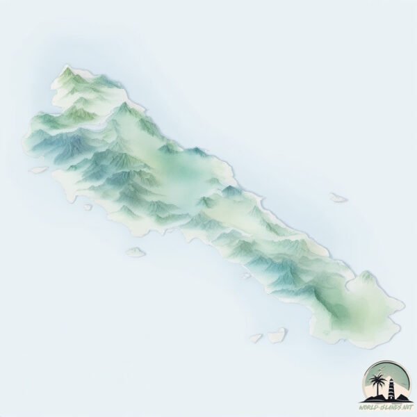
Simeulue is a Very Large Island spanning 1750 km² with a coastline of 538 km.
Archipel: Malay Archipelago – The world’s largest archipelago, located between mainland Southeast Asia and Australia, known for its immense biodiversity and cultural diversity.
Tectonic Plate: Burma – Also known as the Burma Plate, it’s a minor tectonic plate in Southeast Asia, largely covering Burma (Myanmar) and parts of the Indian Ocean. It’s involved in the subduction process under the Eurasian Plate, contributing to seismic activity in the region.
The geographic heart of the island is pinpointed at these coordinates:
Latitude: 2.63160139 / Longitude: 96.06560727
Climate and weather of Simeulue
Climate Zone: Tropical
Climate Details: Tropical Rainforest Climate
Temperature: Hot
Climate Characteristics: This climate is typified by heavy rainfall throughout the year, high humidity, and consistently high temperatures, leading to lush rainforests and rich biodiversity. Seasonal temperature variations are minimal.
Topography and nature of Simeulue
Timezone: UTC+07:00
Timezone places: Asia/Jakarta
Max. Elevation: 445 m
Mean Elevation: 77 m
Vegetation: Evergreen Broadleaf Forest
Tree Coverage: 73%
The mean elevation is 77 m. The highest elevation on the island reaches approximately 445 meters above sea level. The island is characterized by Hills: Gently sloping landforms with rounded tops, having a maximum elevation between 200 and 500 meters. Hills contribute to a varied landscape on islands.
Dominating Vegetation: Evergreen Broadleaf Forest
Characterized by dense, lush canopies of broadleaf trees that retain their leaves year-round. These forests are typically found in tropical and subtropical regions and are known for their high biodiversity. Simeulue has a tree cover of 73 %.
Vegetation: 14 vegetation zones – Exceptionally Diverse Island
Islands with more than ten vegetation zones are among the most ecologically rich and varied in the world. These islands are akin to miniature continents, boasting an incredible array of ecosystems. The sheer range of habitats, from high peaks to deep valleys, rainforests to deserts, creates a mosaic of life that is unparalleled. They are crucial for conservation and ecological studies.
Infrastructure and Travelling to Simeulue
Does the island have a public airport? yes.
Simeulue has a public and scheduled airport. The following airports are located on this island: Lasikin Airport.
Does the island have a major port? no.
There are no major ports on Simeulue. The closest major port is SIBOLGA, approximately 262 km away.
The mean population of Simeulue is 60 per km². Simeulue is Gently Populated. The island belongs to Indonesia.
The name of the island resonates across different cultures and languages. Here is how it is known around the world: Arabic: سيمولو; German: Simeuluë; Spanish: Isla de Simeulue; French: Simeulue; Portuguese: Simeulue; Russian: Симёлуэ; Chinese: 錫默盧島
Continuing your journey, Pulau Lasia is the next notable island, situated merely km away.
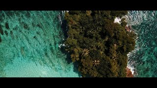
The Peak (aka Jackals), Simeulue, Aceh Sumatra


Indonesia is classified as Emerging region: MIKT: Mexico, Indonesia, South Korea, and Turkey – Economies recognized for their development potential and emerging market status. The level of income is Lower middle income.
News – Latest Updates and Headlines from Simeulue
Stay informed with the most recent news and important headlines from Simeulue. Here’s a roundup of the latest developments.
Social Media Posts about Simeulue
Please note: The data used here has been primarily extracted from satellite readings. Deviations from exact values may occur, particularly regarding the height of elevations and population density. Land area and coastline measurements refer to average values at mean high tide.