Welcome to Skråbjörkö, a Continental island in the Gulf of Bothnia, part of the majestic Atlantic Ocean. This guide offers a comprehensive overview of what makes Skråbjörkö unique – from its geography and climate to its population, infrastructure, and beyond. Dive into the details:
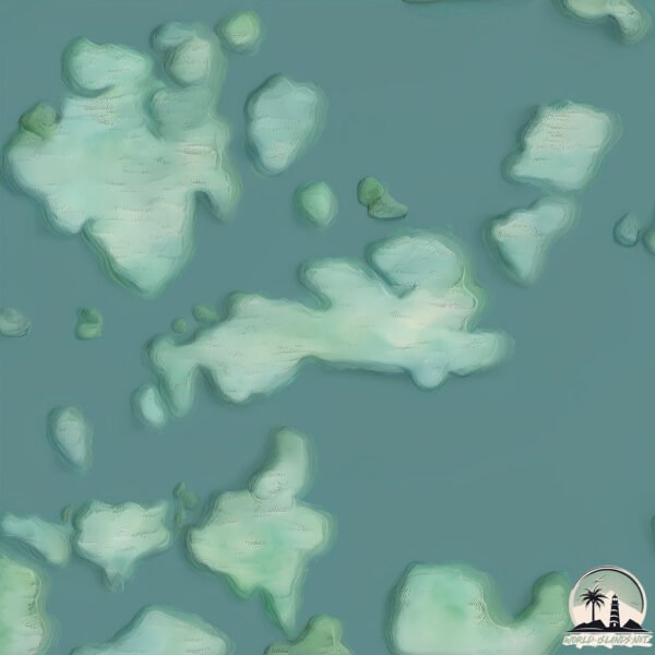
Geography and size of Skråbjörkö
Size: 1.826 km²
Coastline: 8.2 km
Ocean: Atlantic Ocean
Sea: Gulf of Bothnia
Continent: Europe
Skråbjörkö is a Small Island spanning 1.8 km² with a coastline of 8.2 km.
Archipel: –
Tectonic Plate: Eurasia – One of the world’s largest tectonic plates, the Eurasian Plate covers a significant portion of Europe and Asia. It’s characterized by diverse geological features, including the Ural Mountains, the European Plain, and the Himalayas formed from its collision with the Indian Plate.
The geographic heart of the island is pinpointed at these coordinates:
Latitude: 60.32283894 / Longitude: 19.70901094
Climate and weather of Skråbjörkö
Climate Zone: Continental
Climate Details: Warm-Summer Humid Continental Climate
Temperature: Warm Summer
Climate Characteristics: Features warm summers and cold winters with consistent precipitation, common in higher latitudes.
Topography and nature of Skråbjörkö
Timezone: UTC+02:00
Timezone places: Europe/Helsinki
Max. Elevation: 38 m
Mean Elevation: 29 m
Vegetation: Evergreen Needleleaf Forest
Tree Coverage: 81%
The mean elevation is 29 m. The highest elevation on the island reaches approximately 38 meters above sea level. The island is characterized by Plains: Flat, low-lying lands characterized by a maximum elevation of up to 200 meters. On islands, plains are typically coastal lowlands or central flat areas.
Dominating Vegetation: Evergreen Needleleaf Forest
Dominated by evergreen coniferous trees such as pines and firs, which retain their needle-like leaves throughout the year. These forests are often found in cooler climates. Skråbjörkö has a tree cover of 81 %.
Vegetation: 4 vegetation zones – Diverse Island
Four distinct vegetation zones mark these islands as ecologically diverse. They might feature varied landscapes such as forests, beaches, grasslands, and rocky areas. Such diversity reflects the island’s complex ecological interactions and varied habitats, which can support a rich array of wildlife and plant species.
Infrastructure and Travelling to Skråbjörkö
Does the island have a public airport? no.
There is no public and scheduled airport on Skråbjörkö. The nearest airport is Mariehamn Airport, located 29 km away.
Does the island have a major port? no.
There are no major ports on Skråbjörkö. The closest major port is MARIEHAMN, approximately 32 km away.
The mean population of Skråbjörkö is 12 per km². Skråbjörkö is Gently Populated. The island belongs to Finland.
Continuing your journey, Aland is the next notable island, situated merely km away.
Street luge in Geta, Åland islands
Midsummer streetluge session in Geta, Åland 2023 #aland #streetluge #speed #adrenalinerush #mittååå #visitaland.Street luge in Geta, Åland islands
Midsummer streetluge session in Geta, Åland 2023 #aland #streetluge ...
Midsummer streetluge session in Geta, Åland 2023 #aland #streetluge #speed #adrenalinerush #mittååå #visitaland.
DISCOVER Åland, Europe’s Most BREATHTAKING Secret!
DISCOVER Åland, Europe's Most BREATHTAKING Secret! DISCOVER Åland, ...
DISCOVER Åland, Europe's Most BREATHTAKING Secret! DISCOVER Åland, Europe's Most BREATHTAKING Secret! #travel ...
Spabanken på Havsvidden, Geta, Åland
Spabanken besöker Hotell Havsviddens spa i Geta, Åland.
Spabanken besöker Hotell Havsviddens spa i Geta, Åland.
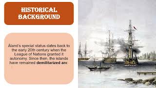
Åland - A Small Island You Never Heard Of
Åland is an autonomous and demilitarised region of Finland since 1920 ...
Åland is an autonomous and demilitarised region of Finland since 1920 by a decision of the League of Nations. It is the smallest ...
Mariehamn, Åland Islands, Finland
The Åland Islands or Åland (Swedish: Åland, Swedish pronunciation: ...
The Åland Islands or Åland (Swedish: Åland, Swedish pronunciation: [ˈoːland]; Finnish: Ahvenanmaa) is an autonomous, ...
Eckerö Kirkko - Aland Islands (Suomi)-Finland
57 Kyrkgatan, Ålands landsbygd Eckerö Kirkko|church - Ilhas Aland ...
57 Kyrkgatan, Ålands landsbygd Eckerö Kirkko|church - Ilhas Aland (Suomi)-Finland Evankelis-luterilainen kirkko Like the other ...
Åland
The Åland archipelago consists of the northernmost twelve of the ...
The Åland archipelago consists of the northernmost twelve of the sixteen islands of the Vind Chain that form the Straits of Valir ...
Getabergen
Hemestertips från Ålands Natur & Miljö!
Hemestertips från Ålands Natur & Miljö!
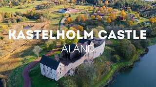
Kastelholm Castle - Åland island. Замок Кастельхольм - Аланды. Kastelholman linna - Ahvenanmaa.
Кастельхольм - красивый средневековый замок на острове Аланд, ...
Кастельхольм - красивый средневековый замок на острове Аланд, крупнейшем острове Аландского архипелага.
ОДИН ДЕНЬ В МАРИЕХАМНЕ, Аланды, Финляндия | Åland Islands
Мой отпуск 2021 начался, и я отправилась на Аландские острова из Турку ...
Мой отпуск 2021 начался, и я отправилась на Аландские острова из Турку на пароме Viking Line, взяв с собой ...
Bikepacking Across Åland Islands Documentary (Finland, Sweden, Norway)
Welcome to the final episode of bikepacking around the Scandinavia ...
Welcome to the final episode of bikepacking around the Scandinavia Penisula and Finland (back in 2017)! This episode will be ...
Åland – The Unique Nordic Archipelago #alandisland #åland
Åland – The Unique Nordic Archipelago Introduction to Åland Åland is ...
Åland – The Unique Nordic Archipelago Introduction to Åland Åland is an autonomous, Swedish-speaking region of Finland ...
Finnö Stugby - Geta - Finland
Save up to 25% with Smart Booking. Book it now: ...
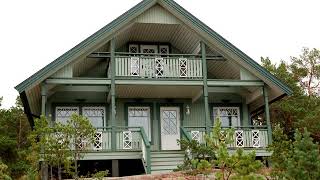
Klipphus 3 - Geta, Åland
Flying over Klipphus 3 - near Havsvidden in the middle of September.
Flying over Klipphus 3 - near Havsvidden in the middle of September.
Dånö Strandvillor - Geta - Finland
Compare prices: ...
BIKING THE WORLD - FERRY TO ALAND ISLANDS
For more Videos / Journals / Gear Lists go to: Website: ...
For more Videos / Journals / Gear Lists go to: Website: FinalFrontier.bike Instagram: FinalFrontier.bike Facebook: ...
Järsö to Geta @ a abdat
The core of the Åland Archipelago is a dozen or so larger islands that ...
The core of the Åland Archipelago is a dozen or so larger islands that are connected by bridges. Known as Fasta Åland ...
Solvarma klippor i Geta
En vacker sommarfilm ifrån Åland.
En vacker sommarfilm ifrån Åland.
360° Geta I 100 Moods From Finland
This space art project, built by tourists, is located in Geta, Åland. ...
This space art project, built by tourists, is located in Geta, Åland. These numerous stone blocks are a breathtaking sight. Just look ...
Experience the adorable Åland Islands#🇫🇮🇵🇭couple
The Åland Islands, or Åland, is an autonomous region of Finland. ...
The Åland Islands, or Åland, is an autonomous region of Finland. Comprising around 6700 islands, this Swedish-speaking ...
Sailing Aland Islands. Mariehamn to Kastelholm // Żeglując po Alandach
Żeglując po Alandach. Zapraszamy na pierwszą część żeglarskiego wypadu ...
Żeglując po Alandach. Zapraszamy na pierwszą część żeglarskiego wypadu na Wyspy Alandzkie. Ze stolicy Alandów, Mariehamn ...
Tre dagars äventyr med hund i följe
Tre gubbar, tre dagar till fots i Geta. Simma, fiska, grilla, och ...
Tre gubbar, tre dagar till fots i Geta. Simma, fiska, grilla, och mycket mer. Stugägaren storma in i stugan där två av herrarna ...
Alandzkie klimaty | The Åland Theme - Finland 2018 | Parrot Bebop 2 Drone
Northwestern regions of the main island - Fasta Åland.
Northwestern regions of the main island - Fasta Åland.
Åland Islands
The Åland Islands or Åland (Swedish: Åland, Swedish pronunciation: ...
The Åland Islands or Åland (Swedish: Åland, Swedish pronunciation: [ˈoːland]; Finnish: Ahvenanmaa) is an autonomous, ...
Finland is classified as Developed region: nonG7: Developed economies outside of the Group of Seven, characterized by high income and advanced economic structures. The level of income is High income: OECD.
News – Latest Updates and Headlines from Skråbjörkö
Stay informed with the most recent news and important headlines from Skråbjörkö. Here’s a roundup of the latest developments.
Loading...
Please note: The data used here has been primarily extracted from satellite readings. Deviations from exact values may occur, particularly regarding the height of elevations and population density. Land area and coastline measurements refer to average values at mean high tide.