Socotra
Welcome to Socotra, a Dry island in the Arabian Sea, part of the majestic Indian Ocean. This guide offers a comprehensive overview of what makes Socotra unique – from its geography and climate to its population, infrastructure, and beyond. Dive into the details:
- Geography and Size: Explore the island’s size and location.
- Climate and Weather: Weather patterns and temperature.
- Topography and Nature: Uncover the natural wonders of the island.
- Infrastructure and Travelling: Insights on reaching, staying, and making the most of your visit.
- News and Headlines: Latest News.
Geography and size of Socotra
Size: 3619 km²
Coastline: 334 km
Ocean: Indian Ocean
Sea: Arabian Sea
Continent: Asia
Socotra is a Very Large Island spanning 3619 km² with a coastline of 334 km.
Archipel: Socotra Archipelago – Located off the coast of Yemen, these islands are famous for their alien-like landscapes and unique biodiversity.
Tectonic Plate: Somalia – A large tectonic plate covering the Horn of Africa and parts of the Indian Ocean, known for the East African Rift where it’s splitting away from the African Plate.
The geographic heart of the island is pinpointed at these coordinates:
Latitude: 12.50800863 / Longitude: 53.86955399
Climate and weather of Socotra
Climate Zone: Dry
Climate Details: Hot Deserts Climate
Temperature: Hot
Climate Characteristics: Dominated by extremely hot temperatures, this climate is marked by minimal rainfall and barren landscapes. Nights often experience drastic temperature drops.
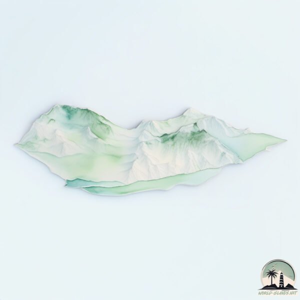
Topography and nature of Socotra
Timezone: UTC+03:00
Timezone places: Asia/Riyadh
Max. Elevation: 1505 m Hajhir
Mean Elevation: 314 m
Vegetation: Shrubland
Tree Coverage: 5%
The mean elevation is 314 m. Dominating the island’s landscape, the majestic “Hajhir” rises as the highest peak, soaring to impressive heights. The island is characterized by Mountains: High, steeply elevated landforms. Characterized by both a high maximum elevation (over 500 meters) and a high mean elevation, creating rugged, mountainous terrains on islands.
Dominating Vegetation: Shrubland
Dominated by shrubs and small bushes, these areas are typical in dry, rocky, or sandy environments, as well as in regions with poor soil fertility. Socotra has a tree cover of 5 %.
Vegetation: 13 vegetation zones – Exceptionally Diverse Island
Islands with more than ten vegetation zones are among the most ecologically rich and varied in the world. These islands are akin to miniature continents, boasting an incredible array of ecosystems. The sheer range of habitats, from high peaks to deep valleys, rainforests to deserts, creates a mosaic of life that is unparalleled. They are crucial for conservation and ecological studies.
Infrastructure and Travelling to Socotra
Does the island have a public airport? yes.
Socotra has a public and scheduled airport. The following airports are located on this island: Socotra International Airport.
Does the island have a major port? no.
There are no major ports on Socotra. The closest major port is NISHTUN, approximately 374 km away.
The mean population of Socotra is 18 per km². Socotra is Gently Populated. The island belongs to Yemen.
The name of the island resonates across different cultures and languages. Here is how it is known around the world: Arabic: سقطرى; German: Sokotra; Spanish: Socotra; French: Socotra; Portuguese: Socotorá; Russian: Сокотра; Chinese: 索科特拉岛
Continuing your journey, Jazīrat Samḩah is the next notable island, situated merely km away.
Entering The World’s Most Dangerous Island (Socotra)


Yemen is classified as Least developed region: Countries that exhibit the lowest indicators of socioeconomic development, with the lowest Human Development Index ratings. The level of income is Lower middle income.
News – Latest Updates and Headlines from Socotra
Stay informed with the most recent news and important headlines from Socotra. Here’s a roundup of the latest developments.
Social Media Posts about Socotra
Please note: The data used here has been primarily extracted from satellite readings. Deviations from exact values may occur, particularly regarding the height of elevations and population density. Land area and coastline measurements refer to average values at mean high tide.