Soroya
Welcome to Soroya, a Continental island in the Norwegian Sea, part of the majestic Arctic Ocean. This guide offers a comprehensive overview of what makes Soroya unique – from its geography and climate to its population, infrastructure, and beyond. Dive into the details:
- Geography and Size: Explore the island’s size and location.
- Climate and Weather: Weather patterns and temperature.
- Topography and Nature: Uncover the natural wonders of the island.
- Infrastructure and Travelling: Insights on reaching, staying, and making the most of your visit.
- News and Headlines: Latest News.
Geography and size of Soroya
Size: 807.9 km²
Coastline: 717.6 km
Ocean: Arctic Ocean
Sea: Norwegian Sea
Continent: Europe
Soroya is a Large Island spanning 808 km² with a coastline of 718 km.
Archipel: –
Tectonic Plate: North America – Covers North America and parts of the Atlantic and Arctic Oceans, characterized by diverse geological features and varying levels of seismic activity.
The geographic heart of the island is pinpointed at these coordinates:
Latitude: 70.63836539 / Longitude: 22.72865578
Climate and weather of Soroya
Climate Zone: Continental
Climate Details: Subarctic Climate
Temperature: Cold Summer
Climate Characteristics: Characterized by long, extremely cold winters and short, cool summers, often found in northern latitudes of North America and Eurasia.
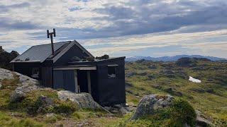
Topography and nature of Soroya
Timezone: UTC+01:00
Timezone places: Europe/Paris
Max. Elevation: 640 m
Mean Elevation: 227 m
Vegetation: Herbaceous Cover
Tree Coverage: 24%
The mean elevation is 227 m. The highest elevation on the island reaches approximately 640 meters above sea level. The island is characterized by Plateau: Elevated flatlands rising sharply above the surrounding area, with a maximum elevation over 500 meters but a mean elevation less than 300 meters, forming unique highland areas on islands.
Dominating Vegetation: Herbaceous Cover
Comprising mainly of grasses, herbs, and ferns, these areas are common in prairies, meadows, and savannas, and can vary widely in species composition. Soroya has a tree cover of 24 %.
Vegetation: 10 vegetation zones – Very Highly Diverse Island
Islands in this range are ecological powerhouses, showcasing a wide array of vegetation zones. Each zone, from lush rainforests to arid scrublands, coastal mangroves to mountainous regions, contributes to a complex and interdependent ecosystem. These islands are often hotspots of biodiversity, supporting numerous species and intricate ecological processes.
Infrastructure and Travelling to Soroya
Does the island have a public airport? yes.
Soroya has a public and scheduled airport. The following airports are located on this island: Hasvik Airport.
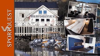
Does the island have a major port? yes.
Soroya is home to a major port. The following ports are situated on the island: SORVAER.
The mean population of Soroya is 6 per km². Soroya is Gently Populated. The island belongs to Norway.
Continuing your journey, Stjernoya is the next notable island, situated merely km away.
Sørøya på langs. The South Island in Finnmark, Norway, end to end.

Norway is classified as Developed region: nonG7: Developed economies outside of the Group of Seven, characterized by high income and advanced economic structures. The level of income is High income: OECD.
News – Latest Updates and Headlines from Soroya
Stay informed with the most recent news and important headlines from Soroya. Here’s a roundup of the latest developments.
Please note: The data used here has been primarily extracted from satellite readings. Deviations from exact values may occur, particularly regarding the height of elevations and population density. Land area and coastline measurements refer to average values at mean high tide.