South Brother Island


Welcome to South Brother Island, a Tropical island in the Andaman or Burma Sea, part of the majestic Indian Ocean. This guide offers a comprehensive overview of what makes South Brother Island unique – from its geography and climate to its population, infrastructure, and beyond. Dive into the details:
- Geography and Size: Explore the island’s size and location.
- Climate and Weather: Weather patterns and temperature.
- Topography and Nature: Uncover the natural wonders of the island.
- Infrastructure and Travelling: Insights on reaching, staying, and making the most of your visit.
- News and Headlines: Latest News.
Geography and size of South Brother Island
Size: 1.215 km²
Coastline: 4.6 km
Ocean: Indian Ocean
Sea: Andaman or Burma Sea
Continent: Seven seas (open ocean)
South Brother Island is a Small Island spanning 1.2 km² with a coastline of 4.6 km.
Archipel: Andaman Islands – Situated in the Bay of Bengal, the Andaman Islands are part of the Indian territory and are known for their picturesque beaches, clear waters, and lush forests. These islands are home to a variety of indigenous tribes and have a rich biodiversity, including unique flora and fauna. The Andamans also have a significant history, notably during the British colonial period.
Tectonic Plate: Somalia – A large tectonic plate covering the Horn of Africa and parts of the Indian Ocean, known for the East African Rift where it’s splitting away from the African Plate.
The geographic heart of the island is pinpointed at these coordinates:
Latitude: 10.93323673 / Longitude: 92.61303908
Climate and weather of South Brother Island
Climate Zone: Tropical
Climate Details: Tropical Monsoon Climate
Temperature: Hot
Climate Characteristics: Characterized by heavy rainfall, high humidity, and uniformly high temperatures, but with a distinct short dry season. It features a seasonal reversal of prevailing wind directions.
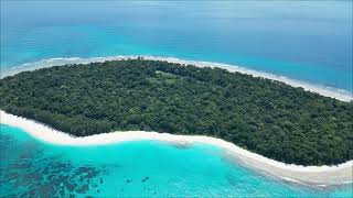
Topography and nature of South Brother Island
Timezone: UTC+05:30
Timezone places:
Max. Elevation: 11 m
Mean Elevation: 7 m
Vegetation: Evergreen Needleleaf Forest
Tree Coverage: 67%
The mean elevation is 7 m. The highest elevation on the island reaches approximately 11 meters above sea level. The island is characterized by Plains: Flat, low-lying lands characterized by a maximum elevation of up to 200 meters. On islands, plains are typically coastal lowlands or central flat areas.
Dominating Vegetation: Evergreen Needleleaf Forest
Dominated by evergreen coniferous trees such as pines and firs, which retain their needle-like leaves throughout the year. These forests are often found in cooler climates. South Brother Island has a tree cover of 67 %.
Vegetation: 3 vegetation zones – Moderately Diverse Island
These islands start to show a broader range of ecological niches. With three vegetation zones, they may offer a mix of ecosystems like coastal areas, inland woods, and perhaps a distinct wetland or dry area. This diversity supports a wider range of flora and fauna, making these islands more ecologically complex than those with minimal diversity.
Infrastructure and Travelling to South Brother Island
Does the island have a public airport? no.
There is no public and scheduled airport on South Brother Island. The nearest airport is Veer Savarkar International Airport / INS Utkrosh, located 79 km away.
Does the island have a major port? no.
There are no major ports on South Brother Island. The closest major port is PORT BLAIR, approximately 84 km away.
The mean population of South Brother Island is 382 per km². South Brother Island is Moderately Inhabited. The island belongs to India.
Continuing your journey, Little Andaman is the next notable island, situated merely km away.
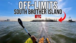
Urban Exploration | Kayaking & Exploring NYC's Abandoned SOUTH Brother Island


India is classified as Emerging region: BRIC: Brazil, Russia, India, and China – Economies noted for their rapid growth and increasing influence on global affairs. The level of income is Lower middle income.
News – Latest Updates and Headlines from South Brother Island
Stay informed with the most recent news and important headlines from South Brother Island. Here’s a roundup of the latest developments.
Please note: The data used here has been primarily extracted from satellite readings. Deviations from exact values may occur, particularly regarding the height of elevations and population density. Land area and coastline measurements refer to average values at mean high tide.