Welcome to South Farallon, a Temperate island in the North Pacific Ocean, part of the majestic Pacific Ocean. This guide offers a comprehensive overview of what makes South Farallon unique – from its geography and climate to its population, infrastructure, and beyond. Dive into the details:
Geography and size of South Farallon
Size: 0.558 km²
Coastline: 5.6 km
Ocean: Pacific Ocean
Sea: North Pacific Ocean
Continent: North America
South Farallon is a Tiny Island spanning 0.558 km² with a coastline of 5.6 km.
Archipel: –
Tectonic Plate: Pacific – The world’s largest tectonic plate, covering much of the Pacific Ocean, known for the Pacific Ring of Fire with extensive seismic and volcanic activity.
The geographic heart of the island is pinpointed at these coordinates:
Latitude: 37.69902145 / Longitude: -123.00579312
Climate and weather of South Farallon
Climate Zone: Temperate
Climate Details: Warm-Summer Mediterranean Climate
Temperature: Warm Summer
Climate Characteristics: Characterized by warm, dry summers and mild, wet winters, typical of coastal areas with abundant sunshine Rain is more common in the winter months, maintaining a moderate climate.
Topography and nature of South Farallon
Timezone: UTC-08:00
Timezone places: America/Los_Angeles
Max. Elevation: 2 m
Mean Elevation: -4 m
Vegetation: Shrubland
Tree Coverage: 76%
The mean elevation is -4 m. The highest elevation on the island reaches approximately 2 meters above sea level. The island is characterized by Plains: Flat, low-lying lands characterized by a maximum elevation of up to 200 meters. On islands, plains are typically coastal lowlands or central flat areas.
Dominating Vegetation: Shrubland
Dominated by shrubs and small bushes, these areas are typical in dry, rocky, or sandy environments, as well as in regions with poor soil fertility. South Farallon has a tree cover of 76 %.
Vegetation: 1 vegetation zones – Minimal Diversity Island
These islands exhibit the most basic level of ecological diversity, often characterized by a single dominant vegetation type. This could be due to extreme environmental conditions, limited land area, or significant human impact. They represent unique ecosystems where specific species have adapted to thrive in these singular environments.
Infrastructure and Travelling to South Farallon
Does the island have a public airport? no.
There is no public and scheduled airport on South Farallon. The nearest airport is San Francisco International Airport, located 70 km away.
Does the island have a major port? no.
There are no major ports on South Farallon. The closest major port is SAUSALITO, approximately 60 km away.
The mean population of South Farallon is 0 per km². South Farallon is Uninhabited. The island belongs to United States of America.
Continuing your journey, Sherman is the next notable island, situated merely km away.
Plans to eradicate invasive mice population at Farallon Island draws scrutiny
Lauren Toms reports on the invasive mice population at the Farallons. Website: http://kpix.com/ YouTube: ...Plans to eradicate invasive mice population at Farallon Island draws scrutiny
Lauren Toms reports on the invasive mice population at the Farallons. ...
Lauren Toms reports on the invasive mice population at the Farallons. Website:
http://kpix.com/ YouTube: ...
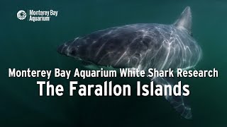
Project White Shark — The Farallon Islands
Episode 1/2. Here's the link to Ep. 2 — Shark Fin-gerprints: ...
Episode 1/2. Here's the link to Ep. 2 — Shark Fin-gerprints:
http://mbayaq.co/2tZtdyd Fins up if you've ever wanted to be a shark ...
Man Rescued After Getting Bitten By Shark Near Farallon Islands
A man was rescued Tuesday afternoon after suffering a shark bite near ...
A man was rescued Tuesday afternoon after suffering a shark bite near the Farallon Islands west of San Francisco, according to ...
The Islands of the Dead | San Francisco and the Farallon Islands 4K
San Francisco is home to many of the nation's most iconic landmarks ...
San Francisco is home to many of the nation's most iconic landmarks and a gateway to some of the greatest wonders in the United ...
Life on the Farallones: Science on the SPOT
The Farallon Islands off the coast of San Francisco are a vital home ...
The Farallon Islands off the coast of San Francisco are a vital home to many birds and marine mammals. While the forbidding and ...
Joe Locke Farallon Islands Swim: ABC7 interview
Joe Locke interviewed on ABC7 about swim from Farallon Islands to ...
Joe Locke interviewed on ABC7 about swim from Farallon Islands to Golden Gate Bridge.
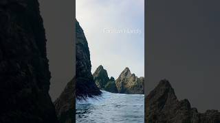
The Farallon Islands, "California's Galapagos" - KQED QUEST
Lying 28 miles off the coast of San Francisco, the Farallon Islands ...
Lying 28 miles off the coast of San Francisco, the Farallon Islands sit amid one of the most productive marine food webs on the ...
Farallon Islands Live Webcam | California Academy of Sciences
Get a rare view of the Farallon Islands' craggy peaks and rocky ...
Get a rare view of the Farallon Islands' craggy peaks and rocky shorelines and scan the islands for marine mammals and birds.
11 Foot Female White Shark, Farallon Islands
We recently completed our Research Page on our website: ...
We recently completed our Research Page on our website: californiawhitesharkproject.org If you are interested in seeing (or ...
Point Blue on the Farallon National Wildlife Refuge (Full Version)
Learn about the work Point Blue biologists do in partnership with the ...
Learn about the work Point Blue biologists do in partnership with the U.S. Fish and Wildlife Service on the Farallon Islands ...
MONSTER Rockfish LIMITS at the FARALLON ISLANDS!! [What's up with this seal?!]
Took my buddies Mitch, Jojo and Stephen on a spontaneous fishing trip. ...
Took my buddies Mitch, Jojo and Stephen on a spontaneous fishing trip. We launched out of Half Moon Bay again and headed ...
Farallon Islands: The Shark Capital of the Pacific
Dive into the treacherous waters surrounding the Farallon Islands, ...
Dive into the treacherous waters surrounding the Farallon Islands, just off the coast of San Francisco. Discover why this ...
FARALLON ISLANDS GREAT WHITE SHARK DIVING
NBC California Live correspondent, Ross Thomas, takes viewers on an ...
NBC California Live correspondent, Ross Thomas, takes viewers on an exciting expedition to the Farallon Islands in search of ...
Farallon History
The long-term data sets collected by Point Blue on the Farallon ...
The long-term data sets collected by Point Blue on the Farallon National Wildlife Refuge help to inform management and ...
📍Farallon Island’s #sanfrancisco #FarallonIslands #shorts #adventuretravel #adventure #ocean #trip
SE Farallon Island MPA Observations with Trident
Exploring species and habitat with the Trident ROV as part of our ...
Exploring species and habitat with the Trident ROV as part of our University of San Francisco California Ecosystems class and in ...
FIRST TIME Driving to FARALLON ISLANDS | Rockfish Lingcod Fishing
On the eve of Dungeness Crab season I made the run to the Farallon ...
On the eve of Dungeness Crab season I made the run to the Farallon Islands for my first time. I had been there once before but on ...
Gulf of the Farallones National Marine Sanctuary Virtual Tour
This fly-through animation shows the location, extent, and geology of ...
This fly-through animation shows the location, extent, and geology of Gulf of the Farallones National Marine Sanctuary, including ...
The (Impossible) 30-Mile Swim of Death | Mystery of the Farallon Islands
The San Francisco Bay is home to over 250+ Great White Sharks ...
The San Francisco Bay is home to over 250+ Great White Sharks (according to Nat GEO), strong currents, and some of the coldest ...
Farallon Island Shark Dives
Individuals can cage dive with great white sharks at San Francisco's ...
Individuals can cage dive with great white sharks at San Francisco's Farallon Islands with Incredible Adventures. No dive ...
Pacifica woman becomes first to swim to Farallon Islands from Golden Gate Bridge
Vern Glenn reports on Amy Gubser's historic swim from the Golden Gate ...
Vern Glenn reports on Amy Gubser's historic swim from the Golden Gate Bridge to the Farallon Islands. Read more: ...
Farallon Islands Rockfishing
Choose the right weather and you too can make it out there with a 17 ...
Choose the right weather and you too can make it out there with a 17 ft boat! It was approx 43 miles from the Richmond Marina.
Sailing to the Farallon Islands: How Long? #sailing #boat #shorts
Sailing to the Farallon Islands: How Long? #sailing #boat #shorts.
Sailing to the Farallon Islands: How Long? #sailing #boat #shorts.
Farallons Tour July 2018
An adventure awaits just 30 miles off the coast of San Francisco. ...
An adventure awaits just 30 miles off the coast of San Francisco. Welcome to the Farallon Islands! All video footage © 2018 TSZ ...
Bay Area woman water bikes to Farallon Islands in honor of daughter
A Bay Area woman has made history riding a water bike from Sausalito ...
A Bay Area woman has made history riding a water bike from Sausalito to the Farallon Islands, in honor of daughter who passed ...
United States of America is classified as Developed region: G7: Group of Seven – Major advanced economies, including Canada, France, Germany, Italy, Japan, the United Kingdom, and the United States. The level of income is High income: OECD.
News – Latest Updates and Headlines from South Farallon
Stay informed with the most recent news and important headlines from South Farallon. Here’s a roundup of the latest developments.
Loading...
Please note: The data used here has been primarily extracted from satellite readings. Deviations from exact values may occur, particularly regarding the height of elevations and population density. Land area and coastline measurements refer to average values at mean high tide.


![MONSTER Rockfish LIMITS at the FARALLON ISLANDS!! [What's up with this seal?!]](https://i.ytimg.com/vi/7cK_BQcpsFE/mqdefault.jpg)