Soya-do
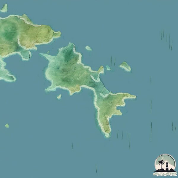
Welcome to Soya-do, a Continental island in the Yellow Sea, part of the majestic Pacific Ocean. This guide offers a comprehensive overview of what makes Soya-do unique – from its geography and climate to its population, infrastructure, and beyond. Dive into the details:
- Geography and Size: Explore the island’s size and location.
- Climate and Weather: Weather patterns and temperature.
- Topography and Nature: Uncover the natural wonders of the island.
- Infrastructure and Travelling: Insights on reaching, staying, and making the most of your visit.
- News and Headlines: Latest News.
Geography and size of Soya-do
Size: 3.509 km²
Coastline: 17 km
Ocean: Pacific Ocean
Sea: Yellow Sea
Continent: Asia
Soya-do is a Small Island spanning 3.5 km² with a coastline of 17 km.
Archipel: –
Tectonic Plate: Amur – A minor tectonic plate in the region of the Amur River at the border of Russia and China, involved in complex interactions with the Pacific and Eurasian plates.
The geographic heart of the island is pinpointed at these coordinates:
Latitude: 37.21350367 / Longitude: 126.17418933
Climate and weather of Soya-do
Climate Zone: Continental
Climate Details: Monsoon-Influenced Hot-Summer Humid Continental Climate
Temperature: Hot Summer
Climate Characteristics: Hot summers with monsoon rains, contrasting with dry, cold winters. Typical of east Asian continental edges.
Topography and nature of Soya-do
Timezone: UTC+09:00
Timezone places: Asia/Tokyo
Max. Elevation: 57 m
Mean Elevation: 37 m
Vegetation: Evergreen Needleleaf Forest
Tree Coverage: 56%
The mean elevation is 37 m. The highest elevation on the island reaches approximately 57 meters above sea level. The island is characterized by Plains: Flat, low-lying lands characterized by a maximum elevation of up to 200 meters. On islands, plains are typically coastal lowlands or central flat areas.
Dominating Vegetation: Evergreen Needleleaf Forest
Dominated by evergreen coniferous trees such as pines and firs, which retain their needle-like leaves throughout the year. These forests are often found in cooler climates. Soya-do has a tree cover of 56 %.
Vegetation: 6 vegetation zones – Very Highly Diverse Island
Islands in this range are ecological powerhouses, showcasing a wide array of vegetation zones. Each zone, from lush rainforests to arid scrublands, coastal mangroves to mountainous regions, contributes to a complex and interdependent ecosystem. These islands are often hotspots of biodiversity, supporting numerous species and intricate ecological processes.
Infrastructure and Travelling to Soya-do
Does the island have a public airport? no.
There is no public and scheduled airport on Soya-do. The nearest airport is Incheon International Airport, located 41 km away.
Does the island have a major port? no.
There are no major ports on Soya-do. The closest major port is DAESAN HANG, approximately 31 km away.
The mean population of Soya-do is 75 per km². Soya-do is Gently Populated. The island belongs to South Korea.
Continuing your journey, Deokjeokdo is the next notable island, situated merely km away.
덕적도, 소야도 Duckjeonkdo island & Soyado Island - 걷는 남자

South Korea is classified as Emerging region: MIKT: Mexico, Indonesia, South Korea, and Turkey – Economies recognized for their development potential and emerging market status. The level of income is High income: OECD.
News – Latest Updates and Headlines from Soya-do
Stay informed with the most recent news and important headlines from Soya-do. Here’s a roundup of the latest developments.
Please note: The data used here has been primarily extracted from satellite readings. Deviations from exact values may occur, particularly regarding the height of elevations and population density. Land area and coastline measurements refer to average values at mean high tide.