Welcome to St. Kilda, a Temperate island in the North Atlantic Ocean, part of the majestic Atlantic Ocean. This guide offers a comprehensive overview of what makes St. Kilda unique – from its geography and climate to its population, infrastructure, and beyond. Dive into the details:
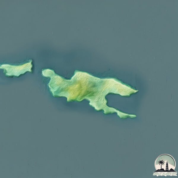
Geography and size of St. Kilda
Size: 6.354 km²
Coastline: 16.1 km
Ocean: Atlantic Ocean
Sea: North Atlantic Ocean
Continent: Europe
St. Kilda is a Small Island spanning 6.4 km² with a coastline of 16.1 km.
Archipel: –
Tectonic Plate: Eurasia – One of the world’s largest tectonic plates, the Eurasian Plate covers a significant portion of Europe and Asia. It’s characterized by diverse geological features, including the Ural Mountains, the European Plain, and the Himalayas formed from its collision with the Indian Plate.
The geographic heart of the island is pinpointed at these coordinates:
Latitude: 57.81534006 / Longitude: -8.58406151
Climate and weather of St. Kilda
Climate Zone: Temperate
Climate Details: Temperate Oceanic Climate
Temperature: Warm Summer
Climate Characteristics: Known for its moderate year-round temperatures with ample rainfall and no dry season. Warm summers are characteristic.
Topography and nature of St. Kilda
Timezone: UTC±00:00
Timezone places: Europe/London
Max. Elevation: 238 m
Mean Elevation: 145 m
Vegetation: Agricultural Mosaic
Tree Coverage: 34%
The mean elevation is 145 m. The highest elevation on the island reaches approximately 238 meters above sea level. The island is characterized by Hills: Gently sloping landforms with rounded tops, having a maximum elevation between 200 and 500 meters. Hills contribute to a varied landscape on islands.
Dominating Vegetation: Agricultural Mosaic
A mix of cropland and natural vegetation, often seen in rural landscapes where agricultural fields are interspersed with patches of natural habitats. St. Kilda has a tree cover of 34 %.
Vegetation: 10 vegetation zones – Very Highly Diverse Island
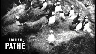
Islands in this range are ecological powerhouses, showcasing a wide array of vegetation zones. Each zone, from lush rainforests to arid scrublands, coastal mangroves to mountainous regions, contributes to a complex and interdependent ecosystem. These islands are often hotspots of biodiversity, supporting numerous species and intricate ecological processes.
Infrastructure and Travelling to St. Kilda
Does the island have a public airport? no.
There is no public and scheduled airport on St. Kilda. The nearest airport is Benbecula Airport, located 137 km away.
Does the island have a major port? no.
There are no major ports on St. Kilda. The closest major port is CASTLE BAY, approximately 152 km away.
The mean population of St. Kilda is 3 per km². St. Kilda is Gently Populated. The island belongs to United Kingdom.
Continuing your journey, Baleshare is the next notable island, situated merely km away.
St Kilda: The Abandoned Scottish Archipelago || Hirta Island || Soay Island
This is St Kilda Island, the westernmost island of the Hebrides of Scotland. Why was it abandoned? MAP OF ENGLAND AND ...St Kilda: The Abandoned Scottish Archipelago || Hirta Island || Soay Island
This is St Kilda Island, the westernmost island of the Hebrides of ...
This is St Kilda Island, the westernmost island of the Hebrides of Scotland. Why was it abandoned? MAP OF ENGLAND AND ...
St Kilda, Scotland
St Kilda (Scottish Gaelic: Hiort) is an isolated archipelago 64 ...
St Kilda (Scottish Gaelic: Hiort) is an isolated archipelago 64 kilometres west-northwest of North Uist in the North Atlantic Ocean.
Visiting The Evacuated Scottish Island | St. Kilda
Get 10% off your Manta Sleep Mask by using the code "RUTHAISLING” at ...
Stac an Armin, Stac Lee, Hirta, Soay, St. Kilda isles, 11th May 2017
In May 2017, I went on a day trip to the St. Kilda islands. I spent ...
In May 2017, I went on a day trip to the St. Kilda islands. I spent most of the day on Hirta, the biggest of the islands. The last part ...of ...[+] Show More St Kilda | An Abandoned Island in Scotland | Hirta | Travel Vlog
Join me as I explore the island of St Kilda, one of the most remote ...
Join me as I explore the island of St Kilda, one of the most remote and hauntingly beautiful abandoned islands in Scotland.
How To Visit Scotland's Most Remote Islands - St Kilda
I hope you enjoy this trip to St Kilda, Scotland's most remote ...
I hope you enjoy this trip to St Kilda, Scotland's most remote islands, as much as I did! Sitting 40 miles from their nearest ...
St Kilda - CLIFFS of HIRTA and DUN
St Kilda - The spectacular sea cliffs on the south side of Hirta and ...
St Kilda - The spectacular sea cliffs on the south side of Hirta and Dun from Claigeann Mor, 282mtrs, July 2009.
The Island Of St. Kilda (1908)
Unused / unissued material - Full title reads: "The Island of St. ...
Unused / unissued material - Full title reads: "The Island of St. Kilda. Outer Hebrides of Scotland". Introductory intertitle reads: The ...
Hirta, Stac Lee, Boreray, St. Kilda islands, 11th May 2017
LEAVING the ST KILDA ISLANDS
St Kilda- Leaving the St Kilda Islands, looking back at Dun, Hirta, ...
St Kilda- Leaving the St Kilda Islands, looking back at Dun, Hirta, Soay,Stac Lee, Stac An Armin and Boreray onboard 'Orca II', ...
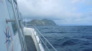
Approaching Hirta, panning round north to Stac Lee and Boreray; St. Kilda islands, 11th May 2017
Approaching Hirta,, with views sweeping round north to Stac Lee and ...
Approaching Hirta,, with views sweeping round north to Stac Lee and Boreray, St. Kilda islands.
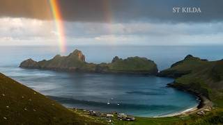
Scotland's Most Remote Archipelago - St Kilda!
St Kilda
My mid summer (June 2011) visit to the archipelago of St Kilda, ashore ...
My mid summer (June 2011) visit to the archipelago of St Kilda, ashore on Hirta and cruising around 'Boreray' 'Stac Lee' Stac an ...
St Kilda - STAC AN ARMIN and BORERAY
St Kilda, Stac An Armin and Boneray with thousands of Gannets nesting ...
St Kilda, Stac An Armin and Boneray with thousands of Gannets nesting and flying overhead. Due to the rough conditions all of ...
St Kilda - the piece and quiet of HIRTA
St Kilda, Hirta, You cannot help but pause for a moment and take in ...
St Kilda, Hirta, You cannot help but pause for a moment and take in the silence, and the noises of nature, and imagine the past life ...
St Kilda The Movie 425ABCB5 AAB4 4C7C 80FF B417143F25D7
St Kilda, Highlands, Scotland, Hirta, Soay, Boreray, Stac an Armin, ...
St Kilda, Highlands, Scotland, Hirta, Soay, Boreray, Stac an Armin, Stac Lee, Cambir, Conachair, Glen Bay, Village Bay, skua, ...
The Evacuation of St Kilda | St Kilda | Poverty | Dangers of the Mainland | Scotland | 1972
Some extracts from a Thames television Documentary on the islands of ...
Some extracts from a Thames television Documentary on the islands of St Kilda. In these extracts we hear from some of the ...
St Kilda | Outer Hebrides, Scotland | Hirta | Evacuated Island | Cleits
Join me as I travel to the remote Archipelago of St Kilda, one of the ...
Join me as I travel to the remote Archipelago of St Kilda, one of the most isolated places in Scotland. For centuries, people ...
Stuck On The UK's Most Remote Island | St. Kilda
I am stuck on St. Kilda, the UK's most remote island. The St. Kilda ...
I am stuck on St. Kilda, the UK's most remote island. The St. Kilda archipelago sits in the Atlantic, about 110 miles from mainland ...
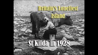
Life On St Kilda Island, 1910 - Film 37331
Saint Kilda or St Kilda, Scottish island. Outer Hebrides. General view ...
Saint Kilda or St Kilda, Scottish island. Outer Hebrides. General view of bay and village of St. Kilda. Old woman at spinning wheel.
Kilda cruises. St kilda
Stac an armin. Stac lee. Boreray and Hirta in the background. Great ...
Stac an armin. Stac lee. Boreray and Hirta in the background. Great day out on orca 3 with Kilda cruises.
Stac Lee, Boreray, St. Kilda, 11th May 2017
St Kilda, Scotland's Island on the Edge (scenic film + guide)
ST KILDA TRAVEL GUIDE ...
St Kilda, evacuated in 1930.
Join me as I walk down a street that was occupied for thousands of ...
Join me as I walk down a street that was occupied for thousands of years but now lies empty. Only sheep move around the street ...
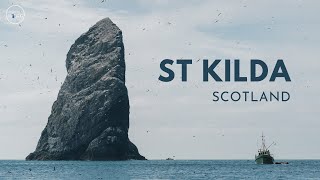
A Visit to St Kilda, 1928 - Rare Footage of Britain’s Loneliest Island
Journey back to 1928 and explore Britain's loneliest island — St ...
Journey back to 1928 and explore Britain's loneliest island — St Kilda, a remote archipelago off the coast of Scotland. This rare ...
United Kingdom is classified as Developed region: G7: Group of Seven – Major advanced economies, including Canada, France, Germany, Italy, Japan, the United Kingdom, and the United States. The level of income is High income: OECD.
News – Latest Updates and Headlines from St. Kilda
Stay informed with the most recent news and important headlines from St. Kilda. Here’s a roundup of the latest developments.
Loading...
Please note: The data used here has been primarily extracted from satellite readings. Deviations from exact values may occur, particularly regarding the height of elevations and population density. Land area and coastline measurements refer to average values at mean high tide.