Welcome to Staro, a Continental island in the Baltic Sea, part of the majestic Atlantic Ocean. This guide offers a comprehensive overview of what makes Staro unique – from its geography and climate to its population, infrastructure, and beyond. Dive into the details:
Geography and size of Staro
Size: 1.372 km²
Coastline: 10.3 km
Ocean: Atlantic Ocean
Sea: Baltic Sea
Continent: Europe
Staro is a Small Island spanning 1.4 km² with a coastline of 10.3 km.
Archipel: –
Tectonic Plate: Eurasia – One of the world’s largest tectonic plates, the Eurasian Plate covers a significant portion of Europe and Asia. It’s characterized by diverse geological features, including the Ural Mountains, the European Plain, and the Himalayas formed from its collision with the Indian Plate.
The geographic heart of the island is pinpointed at these coordinates:
Latitude: 57.18929536 / Longitude: 16.48665269
Climate and weather of Staro
Climate Zone: Continental
Climate Details: Warm-Summer Humid Continental Climate
Temperature: Warm Summer
Climate Characteristics: Features warm summers and cold winters with consistent precipitation, common in higher latitudes.
Topography and nature of Staro
Timezone: UTC+01:00
Timezone places: Europe/Paris
Max. Elevation: 5 m
Mean Elevation: 1 m
Vegetation: Evergreen Needleleaf Forest
Tree Coverage: 100%
The mean elevation is 1 m. The highest elevation on the island reaches approximately 5 meters above sea level. The island is characterized by Plains: Flat, low-lying lands characterized by a maximum elevation of up to 200 meters. On islands, plains are typically coastal lowlands or central flat areas.
Dominating Vegetation: Evergreen Needleleaf Forest
Dominated by evergreen coniferous trees such as pines and firs, which retain their needle-like leaves throughout the year. These forests are often found in cooler climates. Staro has a tree cover of 100 %.
Vegetation: 4 vegetation zones – Diverse Island
Four distinct vegetation zones mark these islands as ecologically diverse. They might feature varied landscapes such as forests, beaches, grasslands, and rocky areas. Such diversity reflects the island’s complex ecological interactions and varied habitats, which can support a rich array of wildlife and plant species.
Infrastructure and Travelling to Staro
Does the island have a public airport? no.
There is no public and scheduled airport on Staro. The nearest airport is Kalmar Airport, located 59 km away.
Does the island have a major port? no.
There are no major ports on Staro. The closest major port is OSKARSHAMN, approximately 9 km away.
The mean population of Staro is 13 per km². Staro is Gently Populated. The island belongs to Sweden.
Continuing your journey, Ekno is the next notable island, situated merely km away.
Rick Ross, Meek Mill - Star Island (Visualizer)
Official visualizer for Rick Ross & Meek Mill “Star Island” “Too Good To Be True” available everywhere now: ...Rick Ross, Meek Mill - Star Island (Visualizer)
Official visualizer for Rick Ross & Meek Mill “Star Island” “Too Good ...
Official visualizer for Rick Ross & Meek Mill “Star Island” “Too Good To Be True” available everywhere now: ...
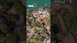
Star Island: Residence of the upper class and Hollywood stars
Star Island is an artificial archipelago reserved for the Elite ...
Star Island is an artificial archipelago reserved for the Elite located in biscan Bay Miami Beach Florida this island is famous for its ...
Star Island - Walking Miami Millionaire's Row 🌴🏠
Join me on an exclusive walking tour of Star Island, Miami, where the ...
Join me on an exclusive walking tour of Star Island, Miami, where the rich and famous reside! I was thrilled to discover that the ...
Stromae - Alors On Danse (Dubdogz Remix) / The Suicide Squad [Starro the Conqueror]
ALL #12 ROMANCEABLE Characters Confirmed in Starsand Island #starsandisland
NOT Sponsored. Official links: Steam: ...
Star Island: Ultimate Luxury for the Rich and Famous
realestate #money #usa #news #architecture #miami #beach #blue #water ...
realestate #money #usa #news #architecture #miami #beach #blue #water #star #famousshorts #luxury #rich #mansion ...
Star Island Resort - Orlando, Florida #travel #vacation
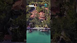
The most expensive house on Star Island
this is the best priced home on Star Island currently worth $90 ...
this is the best priced home on Star Island currently worth $90 million the home is nearly 24000 ft and sits on a 40000 square ft lot ...
Diddy’s Star Island Gets RAIDED! 🤯 #shorts #news #diddy
SUBSCRIBE for exclusive Full Send Clips! ⭐️ Rick Ross talking about ...
SUBSCRIBE for exclusive Full Send Clips! ⭐️ Rick Ross talking about Diddy's Star Island house on the Full Send Podcast.
Super luxurious $40 million villa of singer Gloria Estefan on Star Island
singer Gloria eston's $40 million home on Star Island the Island of ...
singer Gloria eston's $40 million home on Star Island the Island of the middle class is 8000 square ft and sits on 1.34 Acres the ...
Star Island: Florida's "Almost Lost World"
"This approximately 100-acre location is inside the most remote and ...
"This approximately 100-acre location is inside the most remote and wildest one square mile of the entire 2700 square mile plus ...
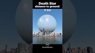
The Death Star approaching Earth! 🤯✨
The Death Star (Star Wars) was 160 kilometers (or 100 miles) wide at ...
The Death Star (Star Wars) was 160 kilometers (or 100 miles) wide at its equator and took countless years, innumerable workers, ...
"RAT-POCALYPSE SAVES THE DAY! How Harley Quinn & Ratcatcher TOOK DOWN a GIANT STARFISH 🐀💥
WARNING: This is the WILDEST boss fight you'll ever see! In The ...
WARNING: This is the WILDEST boss fight you'll ever see! In The Suicide Squad (2021), chaos erupts when Starro the ...
Diddy's lavish mansion on Star Island
wow this is Diddy's house on Star Island Miami a place where the elite ...
wow this is Diddy's house on Star Island Miami a place where the elite live it was purchased from Gloria and Emilio estan ino for ...
Antique Shotgun 18th Century British Masterpiece | 18th Century British Shotgun A Legendary Firearm
18th Century British Shotgun A Legendary Firearm Vintage Firepower ...
18th Century British Shotgun A Legendary Firearm Vintage Firepower 18th Century British Shotgun Review Antique Shotgun 18th ...
Star Island
Provided to YouTube by CDBaby Star Island · Tim Janis Water's Edge ℗ ...
Provided to YouTube by CDBaby Star Island · Tim Janis Water's Edge ℗ 2000 Tim Janis Released on: 2000-01-01 ...
@cash and @nico core
funny #memes #cash #cashandnico #nico #shorts cash and Nico roleplay ...
funny #memes #cash #cashandnico #nico #shorts cash and Nico roleplay funny laugh try not to laugh Minecraft vlogs irl ...
Jaime is impressed by Qyburn's treatment and thinks he's better than Pycelle
Rick Ross on Star Island In Miami at his Mansion
P Diddy sending love from his miami star island Mansion.#pdiddy
How to clean the filter in your extractor fan?😄
Star Island Resort | Room & Property 4K FULL Tour & Review | Kissimmee, Florida
This is our 4K Tour & Review of Star Island Resort & Club in ...
This is our 4K Tour & Review of Star Island Resort & Club in Kissimmee, FL from our family's Disney vacation (September 2024).
Celebrity Homes on Star Island #celebrityhomes #StarIsland #celebritynews #Diddy #jenniferlopez #Fyp
Inside Miami's Extravagant Star Island Mansions
Join us as we take an exclusive tour of Miami's Star Island Mansions, ...
Join us as we take an exclusive tour of Miami's Star Island Mansions, a haven for the rich and famous who come to party in style.
Sweden is classified as Developed region: nonG7: Developed economies outside of the Group of Seven, characterized by high income and advanced economic structures. The level of income is High income: OECD.
News – Latest Updates and Headlines from Staro
Stay informed with the most recent news and important headlines from Staro. Here’s a roundup of the latest developments.
Loading...
Please note: The data used here has been primarily extracted from satellite readings. Deviations from exact values may occur, particularly regarding the height of elevations and population density. Land area and coastline measurements refer to average values at mean high tide.


![Stromae - Alors On Danse (Dubdogz Remix) / The Suicide Squad [Starro the Conqueror]](https://i.ytimg.com/vi/Y_i3VLsUXRE/mqdefault.jpg)