Store Kamoya
Welcome to Store Kamoya, a Continental island in the Norwegian Sea, part of the majestic Arctic Ocean. This guide offers a comprehensive overview of what makes Store Kamoya unique – from its geography and climate to its population, infrastructure, and beyond. Dive into the details:
- Geography and Size: Explore the island’s size and location.
- Climate and Weather: Weather patterns and temperature.
- Topography and Nature: Uncover the natural wonders of the island.
- Infrastructure and Travelling: Insights on reaching, staying, and making the most of your visit.
- News and Headlines: Latest News.
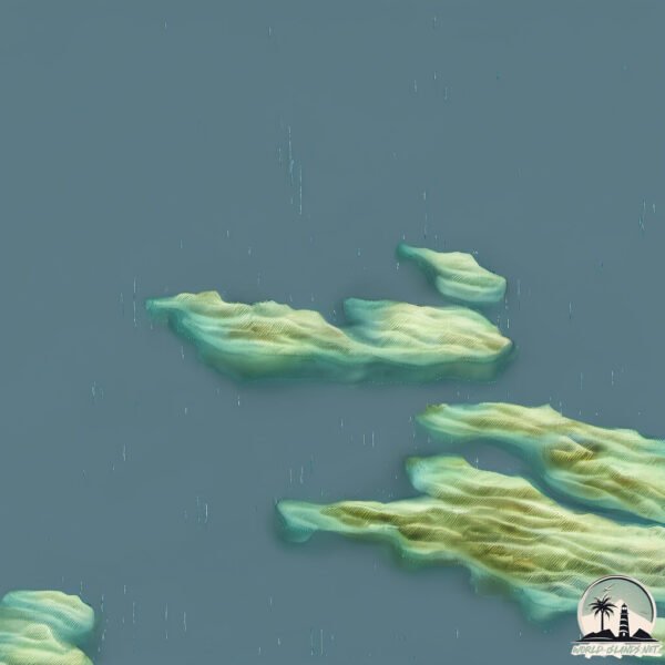
Geography and size of Store Kamoya
Size: 4.222 km²
Coastline: 13 km
Ocean: Arctic Ocean
Sea: Norwegian Sea
Continent: Europe
Store Kamoya is a Small Island spanning 4.2 km² with a coastline of 13 km.
Archipel: –
Tectonic Plate: Eurasia – One of the world’s largest tectonic plates, the Eurasian Plate covers a significant portion of Europe and Asia. It’s characterized by diverse geological features, including the Ural Mountains, the European Plain, and the Himalayas formed from its collision with the Indian Plate.
The geographic heart of the island is pinpointed at these coordinates:
Latitude: 70.83907177 / Longitude: 23.03220572
Climate and weather of Store Kamoya
Climate Zone: Continental
Climate Details: Subarctic Climate
Temperature: Cold Summer
Climate Characteristics: Characterized by long, extremely cold winters and short, cool summers, often found in northern latitudes of North America and Eurasia.
Topography and nature of Store Kamoya
Timezone: UTC+01:00
Timezone places: Europe/Paris
Max. Elevation: 257 m
Mean Elevation: 148 m
Vegetation: Herbaceous Cover
Tree Coverage: 54%
The mean elevation is 148 m. The highest elevation on the island reaches approximately 257 meters above sea level. The island is characterized by Hills: Gently sloping landforms with rounded tops, having a maximum elevation between 200 and 500 meters. Hills contribute to a varied landscape on islands.
Dominating Vegetation: Herbaceous Cover
Comprising mainly of grasses, herbs, and ferns, these areas are common in prairies, meadows, and savannas, and can vary widely in species composition. Store Kamoya has a tree cover of 54 %.
Vegetation: 4 vegetation zones – Diverse Island
Four distinct vegetation zones mark these islands as ecologically diverse. They might feature varied landscapes such as forests, beaches, grasslands, and rocky areas. Such diversity reflects the island’s complex ecological interactions and varied habitats, which can support a rich array of wildlife and plant species.
Infrastructure and Travelling to Store Kamoya
Does the island have a public airport? no.
There is no public and scheduled airport on Store Kamoya. The nearest airport is Hammerfest Airport, located 68 km away.
Does the island have a major port? no.
There are no major ports on Store Kamoya. The closest major port is HAMMERFEST, approximately 68 km away.
The mean population of Store Kamoya is 12 per km². Store Kamoya is Gently Populated. The island belongs to Norway.
Continuing your journey, Soroya is the next notable island, situated merely km away.
Mermaid climbs onto a raft and splashes around (East Jordan, MI)


Norway is classified as Developed region: nonG7: Developed economies outside of the Group of Seven, characterized by high income and advanced economic structures. The level of income is High income: OECD.
News – Latest Updates and Headlines from Store Kamoya
Stay informed with the most recent news and important headlines from Store Kamoya. Here’s a roundup of the latest developments.
- Meet Soraya Martinez Ferrada, Montreal's next mayor - CBCby "Soroya island" - Google News on 3 November 2025
Meet Soraya Martinez Ferrada, Montreal's next mayor CBC
- How Soraya Martinez Ferrada won Montreal, and what's next - CBCby "Soroya island" - Google News on 3 November 2025
How Soraya Martinez Ferrada won Montreal, and what's next CBC
- Former federal minister Soraya Martinez Ferrada elected mayor of Montreal - Global Newsby "Soroya island" - Google News on 2 November 2025
Former federal minister Soraya Martinez Ferrada elected mayor of Montreal Global News
- Vote Soraya! Save Montreal! - TheSuburban.comby "Soroya island" - Google News on 31 October 2025
Vote Soraya! Save Montreal! TheSuburban.com
- Our Community: Winners announced for Island Health awards, cyclists celebrate Pandora bike lane - Times Colonistby "Soroya island" - Google News on 11 May 2025
Our Community: Winners announced for Island Health awards, cyclists celebrate Pandora bike lane Times Colonist
- Cermaq approves €60 million post-smolt RAS - The Fish Siteby "Soroya island" - Google News on 9 June 2023
Cermaq approves €60 million post-smolt RAS The Fish Site
- New book to document mission to bring refugees to Neilston - Barrhead Newsby "Soroya island" - Google News on 27 April 2023
New book to document mission to bring refugees to Neilston Barrhead News
- Hammerfest: The Town of Norway’s High North - Life in Norwayby "Soroya island" - Google News on 7 July 2020
Hammerfest: The Town of Norway’s High North Life in Norway
- Norwegian dignitaries trace WW2 refugees back to Greenock - Inverclyde Councilby "Soroya island" - Google News on 6 March 2020
Norwegian dignitaries trace WW2 refugees back to Greenock Inverclyde Council
- Neilston to honour refugee story - Barrhead Newsby "Soroya island" - Google News on 1 February 2020
Neilston to honour refugee story Barrhead News
Please note: The data used here has been primarily extracted from satellite readings. Deviations from exact values may occur, particularly regarding the height of elevations and population density. Land area and coastline measurements refer to average values at mean high tide.