Sukhoy
Welcome to Sukhoy, a Polar island in the Kara Sea, part of the majestic Arctic Ocean. This guide offers a comprehensive overview of what makes Sukhoy unique – from its geography and climate to its population, infrastructure, and beyond. Dive into the details:
- Geography and Size: Explore the island’s size and location.
- Climate and Weather: Weather patterns and temperature.
- Topography and Nature: Uncover the natural wonders of the island.
- Infrastructure and Travelling: Insights on reaching, staying, and making the most of your visit.
- News and Headlines: Latest News.
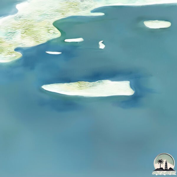
Geography and size of Sukhoy
Size: 2.453 km²
Coastline: 10.8 km
Ocean: Arctic Ocean
Sea: Kara Sea
Continent: Asia
Sukhoy is a Small Island spanning 2.5 km² with a coastline of 10.8 km.
Archipel: Severnaya Zemlya – Located in the Russian high Arctic, these islands are known for their extreme northern latitude and harsh polar conditions.
Tectonic Plate: Sunda – Extends across Southeast Asia, encompassing parts of the Sunda Shelf, known for its interaction with the Australian Plate, contributing to volcanic activity in Indonesia.
The geographic heart of the island is pinpointed at these coordinates:
Latitude: 79.56262473 / Longitude: 100.09695012
Climate and weather of Sukhoy
Climate Zone: Polar
Climate Details: Tundra
Temperature: Cold
Climate Characteristics: The tundra climate features long, extremely cold winters and short, cool summers. Vegetation is limited to mosses, lichens, and small shrubs due to the low temperatures and short growing seasons. Biodiversity is low, but some specialized species thrive.
Topography and nature of Sukhoy
Timezone: UTC+08:00
Timezone places: Australia/Perth
Max. Elevation: 24 m
Mean Elevation: 13 m
Vegetation: Sparse Vegetation
Tree Coverage: 0%
The mean elevation is 13 m. The highest elevation on the island reaches approximately 24 meters above sea level. The island is characterized by Plains: Flat, low-lying lands characterized by a maximum elevation of up to 200 meters. On islands, plains are typically coastal lowlands or central flat areas.
Dominating Vegetation: Sparse Vegetation
These regions have limited plant growth, typically due to extreme conditions like aridity or poor soils. Vegetation is scattered and consists of hardy plant species. Sukhoy has a tree cover of 0 %.
Vegetation: 2 vegetation zones – Low Diversity Island
Islands with two distinct vegetation zones offer slightly more ecological variety. These zones could be due to differences in elevation, moisture, or other environmental factors. While still limited in biodiversity, these islands may offer a contrast between the two zones, such as a coastline with mangroves and an inland area with grassland.
Infrastructure and Travelling to Sukhoy
Does the island have a public airport? no.
There is no public and scheduled airport on Sukhoy. The nearest airport is Khatanga Airport, located 882 km away.
Does the island have a major port? no.
There are no major ports on Sukhoy. The closest major port is DUDINKA, approximately 1912 km away.
The mean population of Sukhoy is 0 per km². Sukhoy is Uninhabited. The island belongs to Russia.
Continuing your journey, Ostrov Arngol’da is the next notable island, situated merely km away.
Biggest Nuclear Test EVER 😱 (too big)


Russia is classified as Emerging region: BRIC: Brazil, Russia, India, and China – Economies noted for their rapid growth and increasing influence on global affairs. The level of income is Upper middle income.
News – Latest Updates and Headlines from Sukhoy
Stay informed with the most recent news and important headlines from Sukhoy. Here’s a roundup of the latest developments.
Please note: The data used here has been primarily extracted from satellite readings. Deviations from exact values may occur, particularly regarding the height of elevations and population density. Land area and coastline measurements refer to average values at mean high tide.