Sukomo Banare
Welcome to Sukomo Banare, a Temperate island in the Eastern China Sea, part of the majestic Pacific Ocean. This guide offers a comprehensive overview of what makes Sukomo Banare unique – from its geography and climate to its population, infrastructure, and beyond. Dive into the details:
- Geography and Size: Explore the island’s size and location.
- Climate and Weather: Weather patterns and temperature.
- Topography and Nature: Uncover the natural wonders of the island.
- Infrastructure and Travelling: Insights on reaching, staying, and making the most of your visit.
- News and Headlines: Latest News.
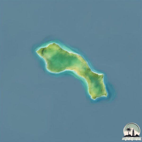
Geography and size of Sukomo Banare
Size: 0.9 km²
Coastline: 6.1 km
Ocean: Pacific Ocean
Sea: Eastern China Sea
Continent: Asia
Sukomo Banare is a Tiny Island spanning 0.9 km² with a coastline of 6.1 km.
Archipel: Ryukyu Islands – A chain of Japanese islands stretching southwest from Kyushu to Taiwan, known for their unique Okinawan culture and subtropical climate.
Tectonic Plate: Okinawa – Located in the East China Sea, near the Ryukyu Islands and Taiwan, it’s involved in the subduction zone between the Philippine Sea Plate and the Eurasian Plate.
The geographic heart of the island is pinpointed at these coordinates:
Latitude: 28.11708717 / Longitude: 129.16853276
Climate and weather of Sukomo Banare
Climate Zone: Temperate
Climate Details: Humid Subtropical Climate
Temperature: Hot Summer
Climate Characteristics: With continuous rainfall and hot summers, this climate is common in some coastal regions, supporting diverse vegetation.
Topography and nature of Sukomo Banare
Timezone: UTC+09:00
Timezone places: Asia/Tokyo
Max. Elevation: 34 m
Mean Elevation: 14 m
Vegetation: Deciduous Broadleaf Forest
Tree Coverage: 83%
The mean elevation is 14 m. The highest elevation on the island reaches approximately 34 meters above sea level. The island is characterized by Plains: Flat, low-lying lands characterized by a maximum elevation of up to 200 meters. On islands, plains are typically coastal lowlands or central flat areas.
Dominating Vegetation: Deciduous Broadleaf Forest
Composed of broadleaf trees that shed their leaves seasonally. These forests are commonly found in temperate zones and experience distinct seasonal changes. Sukomo Banare has a tree cover of 83 %.
Vegetation: 3 vegetation zones – Moderately Diverse Island
These islands start to show a broader range of ecological niches. With three vegetation zones, they may offer a mix of ecosystems like coastal areas, inland woods, and perhaps a distinct wetland or dry area. This diversity supports a wider range of flora and fauna, making these islands more ecologically complex than those with minimal diversity.
Infrastructure and Travelling to Sukomo Banare
Does the island have a public airport? no.
There is no public and scheduled airport on Sukomo Banare. The nearest airport is Tokunoshima Airport, located 44 km away.
Does the island have a major port? no.
There are no major ports on Sukomo Banare. The closest major port is KIN WAN, approximately 235 km away.
The mean population of Sukomo Banare is 38 per km². Sukomo Banare is Gently Populated. The island belongs to Japan.
Continuing your journey, Kakeromajima is the next notable island, situated merely km away.
加計呂麻島 / Kakeromajima Island, Japan(ドローン空撮 4K)


![鹿児島 奄美群島 加計呂麻島 [Mavic Air & Gopro 4K Movie]](https://i.ytimg.com/vi/JWH3B-SPQtc/mqdefault.jpg)
Japan is classified as Developed region: G7: Group of Seven – Major advanced economies, including Canada, France, Germany, Italy, Japan, the United Kingdom, and the United States. The level of income is High income: OECD.
News – Latest Updates and Headlines from Sukomo Banare
Stay informed with the most recent news and important headlines from Sukomo Banare. Here’s a roundup of the latest developments.
Please note: The data used here has been primarily extracted from satellite readings. Deviations from exact values may occur, particularly regarding the height of elevations and population density. Land area and coastline measurements refer to average values at mean high tide.