Sunadhar
Welcome to Sunadhar, a Tropical island in the Bay of Bengal, part of the majestic Indian Ocean. This guide offers a comprehensive overview of what makes Sunadhar unique – from its geography and climate to its population, infrastructure, and beyond. Dive into the details:
- Geography and Size: Explore the island’s size and location.
- Climate and Weather: Weather patterns and temperature.
- Topography and Nature: Uncover the natural wonders of the island.
- Infrastructure and Travelling: Insights on reaching, staying, and making the most of your visit.
- News and Headlines: Latest News.
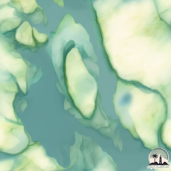
Geography and size of Sunadhar
Size: 1.074 km²
Coastline: 5.7 km
Ocean: Indian Ocean
Sea: Bay of Bengal
Continent: Asia
Sunadhar is a Small Island spanning 1.1 km² with a coastline of 5.7 km.
Archipel: –
Tectonic Plate: India – A major tectonic plate that initially moved northward at a rapid pace before colliding with the Eurasian Plate. This collision is responsible for the uplift of the Himalayas and the Tibetan Plateau.
The geographic heart of the island is pinpointed at these coordinates:
Latitude: 19.99512256 / Longitude: 86.33335626
Climate and weather of Sunadhar
Climate Zone: Tropical
Climate Details: Tropical Savanna, Wet
Temperature: Hot
Climate Characteristics: Defined by distinct wet and dry seasons with high temperatures year-round. Pronounced rainfall occurs during the wet season, while the dry season is marked by drought.
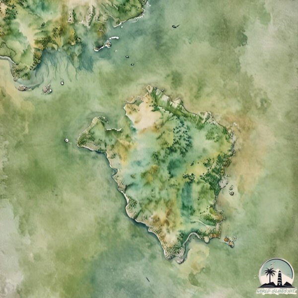
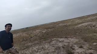
Topography and nature of Sunadhar
Timezone: UTC+05:30
Timezone places: Asia/Kolkata
Max. Elevation: 4 m
Mean Elevation: 2 m
Vegetation: Sparse Vegetation
Tree Coverage: 6%
The mean elevation is 2 m. The highest elevation on the island reaches approximately 4 meters above sea level. The island is characterized by Plains: Flat, low-lying lands characterized by a maximum elevation of up to 200 meters. On islands, plains are typically coastal lowlands or central flat areas.
Dominating Vegetation: Sparse Vegetation
These regions have limited plant growth, typically due to extreme conditions like aridity or poor soils. Vegetation is scattered and consists of hardy plant species. Sunadhar has a tree cover of 6 %.
Vegetation: 2 vegetation zones – Low Diversity Island
Islands with two distinct vegetation zones offer slightly more ecological variety. These zones could be due to differences in elevation, moisture, or other environmental factors. While still limited in biodiversity, these islands may offer a contrast between the two zones, such as a coastline with mangroves and an inland area with grassland.
Infrastructure and Travelling to Sunadhar
Does the island have a public airport? no.
There is no public and scheduled airport on Sunadhar. The nearest airport is Biju Patnaik Airport, located 63 km away.
Does the island have a major port? no.
There are no major ports on Sunadhar. The closest major port is PARADIP, approximately 49 km away.
The mean population of Sunadhar is 630 per km². Sunadhar is Densely Populated. The island belongs to India.
Continuing your journey, Chellikulia is the next notable island, situated merely km away.
UNMANNED ISLAND TRIP


India is classified as Emerging region: BRIC: Brazil, Russia, India, and China – Economies noted for their rapid growth and increasing influence on global affairs. The level of income is Lower middle income.
News – Latest Updates and Headlines from Sunadhar
Stay informed with the most recent news and important headlines from Sunadhar. Here’s a roundup of the latest developments.
Please note: The data used here has been primarily extracted from satellite readings. Deviations from exact values may occur, particularly regarding the height of elevations and population density. Land area and coastline measurements refer to average values at mean high tide.