Tahiti
Welcome to Tahiti, a Tropical island in the South Pacific Ocean, part of the majestic Pacific Ocean. This guide offers a comprehensive overview of what makes Tahiti unique – from its geography and climate to its population, infrastructure, and beyond. Dive into the details:
- Geography and Size: Explore the island’s size and location.
- Climate and Weather: Weather patterns and temperature.
- Topography and Nature: Uncover the natural wonders of the island.
- Infrastructure and Travelling: Insights on reaching, staying, and making the most of your visit.
- News and Headlines: Latest News.
Geography and size of Tahiti
Size: 1051 km²
Coastline: 216 km
Ocean: Pacific Ocean
Sea: South Pacific Ocean
Continent: Oceania
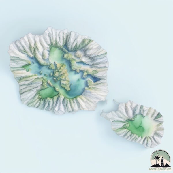
Tahiti is a Very Large Island spanning 1051 km² with a coastline of 216 km.
Archipel: Society Islands – A group of islands in the South Pacific Ocean, part of French Polynesia, famous for their idyllic beauty, including Tahiti and Bora Bora.
Tectonic Plate: Pacific – The world’s largest tectonic plate, covering much of the Pacific Ocean, known for the Pacific Ring of Fire with extensive seismic and volcanic activity.
The geographic heart of the island is pinpointed at these coordinates:
Latitude: -17.67719018 / Longitude: -149.40057082
Climate and weather of Tahiti
Climate Zone: Tropical
Climate Details: Tropical Rainforest Climate
Temperature: Hot
Climate Characteristics: This climate is typified by heavy rainfall throughout the year, high humidity, and consistently high temperatures, leading to lush rainforests and rich biodiversity. Seasonal temperature variations are minimal.
Topography and nature of Tahiti
Timezone: UTC-10:00
Timezone places: Pacific/Honolulu
Max. Elevation: 2241 m Mt. Orohena
Mean Elevation: 424 m
Vegetation: Evergreen Broadleaf Forest
Tree Coverage: 72%
The mean elevation is 424 m. Dominating the island’s landscape, the majestic “Mt. Orohena” rises as the highest peak, soaring to impressive heights. The island is characterized by Mountains: High, steeply elevated landforms. Characterized by both a high maximum elevation (over 500 meters) and a high mean elevation, creating rugged, mountainous terrains on islands.
Dominating Vegetation: Evergreen Broadleaf Forest
Characterized by dense, lush canopies of broadleaf trees that retain their leaves year-round. These forests are typically found in tropical and subtropical regions and are known for their high biodiversity. Tahiti has a tree cover of 72 %.
Vegetation: 12 vegetation zones – Exceptionally Diverse Island
Islands with more than ten vegetation zones are among the most ecologically rich and varied in the world. These islands are akin to miniature continents, boasting an incredible array of ecosystems. The sheer range of habitats, from high peaks to deep valleys, rainforests to deserts, creates a mosaic of life that is unparalleled. They are crucial for conservation and ecological studies.
Infrastructure and Travelling to Tahiti
Does the island have a public airport? yes.
Tahiti has a public and scheduled airport. The following airports are located on this island: Faa’a International Airport.
Does the island have a major port? no.
There are no major ports on Tahiti. The closest major port is PAPEETE, approximately 1 km away.
The mean population of Tahiti is 191 per km². Tahiti is Moderately Inhabited. The island belongs to France.
The name of the island resonates across different cultures and languages. Here is how it is known around the world: Arabic: تاهيتي; Spanish: Tahití; French: Tahiti; Portuguese: Taiti; Russian: Таити; Chinese: 大溪地
Continuing your journey, Moorea is the next notable island, situated merely km away.
TAHITI, FRENCH POLYNESIA (2026) | 10 Best Things To Do On The Island Of Tahiti


France is classified as Developed region: G7: Group of Seven – Major advanced economies, including Canada, France, Germany, Italy, Japan, the United Kingdom, and the United States. The level of income is High income: OECD.
News – Latest Updates and Headlines from Tahiti
Stay informed with the most recent news and important headlines from Tahiti. Here’s a roundup of the latest developments.
Social Media Posts about Tahiti
Please note: The data used here has been primarily extracted from satellite readings. Deviations from exact values may occur, particularly regarding the height of elevations and population density. Land area and coastline measurements refer to average values at mean high tide.