Welcome to Tano Kojima, a Temperate island in the Japan Sea, part of the majestic Pacific Ocean. This guide offers a comprehensive overview of what makes Tano Kojima unique – from its geography and climate to its population, infrastructure, and beyond. Dive into the details:
Geography and size of Tano Kojima
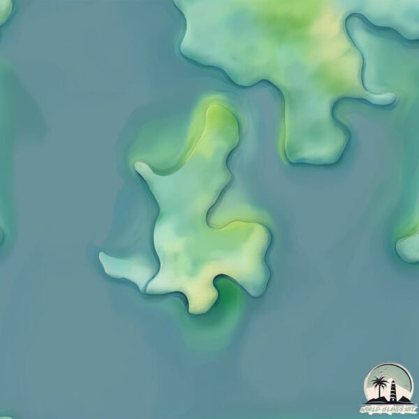
Size: 0.243 km²
Coastline: 3.3 km
Ocean: Pacific Ocean
Sea: Japan Sea
Continent: Asia
Tano Kojima is a Tiny Island spanning 0.243 km² with a coastline of 3.3 km.
Archipel: Japan – An East Asian archipelago comprising four main islands and numerous smaller ones, known for its rich history, technological advances, and distinct culture.
Tectonic Plate: Amur – A minor tectonic plate in the region of the Amur River at the border of Russia and China, involved in complex interactions with the Pacific and Eurasian plates.
The geographic heart of the island is pinpointed at these coordinates:
Latitude: 32.85742969 / Longitude: 129.002866
Climate and weather of Tano Kojima
Climate Zone: Temperate
Climate Details: Humid Subtropical Climate
Temperature: Hot Summer
Climate Characteristics: With continuous rainfall and hot summers, this climate is common in some coastal regions, supporting diverse vegetation.
Topography and nature of Tano Kojima
Timezone: UTC+09:00
Timezone places: Asia/Tokyo
Max. Elevation: 14 m
Mean Elevation: 3 m
Vegetation: Evergreen Broadleaf Forest
Tree Coverage: 90%
The mean elevation is 3 m. The highest elevation on the island reaches approximately 14 meters above sea level. The island is characterized by Plains: Flat, low-lying lands characterized by a maximum elevation of up to 200 meters. On islands, plains are typically coastal lowlands or central flat areas.
Dominating Vegetation: Evergreen Broadleaf Forest
Characterized by dense, lush canopies of broadleaf trees that retain their leaves year-round. These forests are typically found in tropical and subtropical regions and are known for their high biodiversity. Tano Kojima has a tree cover of 90 %.
Vegetation: 2 vegetation zones – Low Diversity Island
Islands with two distinct vegetation zones offer slightly more ecological variety. These zones could be due to differences in elevation, moisture, or other environmental factors. While still limited in biodiversity, these islands may offer a contrast between the two zones, such as a coastline with mangroves and an inland area with grassland.
Infrastructure and Travelling to Tano Kojima
Does the island have a public airport? no.
There is no public and scheduled airport on Tano Kojima. The nearest airport is Fukue Airport, located 28 km away.
Does the island have a major port? no.
There are no major ports on Tano Kojima. The closest major port is AOKATA, approximately 15 km away.
The mean population of Tano Kojima is 92 per km². Tano Kojima is Gently Populated. The island belongs to Japan.
Continuing your journey, Wakamatsu Jima is the next notable island, situated merely km away.
Lost Civilizations | Collapses and Ancient Ruins
A journey through the great civilizations of history and the causes that led to their fall.Lost Civilizations | Collapses and Ancient Ruins
A journey through the great civilizations of history and the causes ...
A journey through the great civilizations of history and the causes that led to their fall.
1996 - When the Bullet Hits the Bone - They always take death as a risk
Prescription: Vengeance! A doctor's war against the drug cartel ...
Prescription: Vengeance! A doctor's war against the drug cartel becomes a lethal dose of justice. Haunted by ER horrors, Dr. Jack ...
Zombie Land Saga: Yumeginga Paradise | Official Trailer | Crunchyroll
Crunchyroll Anime Nights brings you Zombie Land Saga: Yumeginga ...
Crunchyroll Anime Nights brings you Zombie Land Saga: Yumeginga Paradise exclusively to theaters on January 19!
Ethereal Encounters-Humanoid Beings, Missing Time, Physical Evidence with Preston Dennett
Ethereal Encounters Unveiled welcomes back fellow UPRN Host of The ...
Ethereal Encounters Unveiled welcomes back fellow UPRN Host of The Light Gate, Preston Dennett Date: March 6, 2026 Time: ...
Ahsoka Tano - Face Animation Showcase [Gotham Knights Mod]
Footage of a WIP mod for Gotham Knights.
Footage of a WIP mod for Gotham Knights.
The New Silk Road: The Global Ambitions of the Chinese Economy
The new Silk Road makes it possible to transport a pair of sneakers by ...
The new Silk Road makes it possible to transport a pair of sneakers by train from China to France in less than two weeks, and is ...
Mui was puzzled when Hang's mother approached him to ask for an advance on Nhat's salary
To continue watching the next videos, please like and subscribe to the ...
To continue watching the next videos, please like and subscribe to the channel. Thank you very much ...
Blair Witch - Trailer #2
So it turns out The Woods is actually a direct sequel to the first ...
So it turns out The Woods is actually a direct sequel to the first Blair Witch Project! ---------------------------------- Follow IGN for more!
A scientist has isolated a new species of dangerous zombie mushrooms
Movie title: z nation Season 3: episode 1. Season 1: Episodes 1, 2: ...
Spot Wisata Menarik di Prefektur Ehime
Bosan liburan ke Tokyo? Prefektur Ehime menawarkan destinasi wisata ...
Bosan liburan ke Tokyo? Prefektur Ehime menawarkan destinasi wisata yang ga kalah seru Untuk info lengkapnya silahkan klik ...
Lost Ancient Technologies Science Can’t Explain
For thousands of years, ancient civilizations have left behind ...
For thousands of years, ancient civilizations have left behind colossal monuments, sacred temples, and mysterious artifacts that ...
Full video: TU is overjoyed to learn that the family is about to welcome a new member.
To continue watching the next videos, please like and subscribe to the ...
To continue watching the next videos, please like and subscribe to the channel. Thank you very much.
GTA 6, Crysis 4, Українська Hogwarts Legacy, Jedi Survivor, Dead Island 2, Cyberpunk, Клоунада Sony🤡
Ігрові новини (игровые новости) українською у бліц⚡ форматі XGTV* ...
California Trip Vlog 16 - Chappa, Taiko Cat and Goodbye PJ!
Chao Pho Khao Yai Shrine: Tajomný čínsky chrám na ostrove Ko Sichang 🇹🇭
Viac informácií z tohto videa nájdete zadarmo na: ...
Viac informácií z tohto videa nájdete zadarmo na:
https://fjuniverse.com Chao Pho Khao Yai Shrine - tajomná čínska svätyňa ...
28년만에 진실을 보다 지옥과 천국을 본증인 이단 탈출기
임사체험간증#천국과지옥실화#12구덩이#영생교진실#이단탈퇴간증#성령훼방죄#우상숭배 #예수님만진리#크리스천간증#천국 ...
임사체험간증#천국과지옥실화#12구덩이#영생교진실#이단탈퇴간증#성령훼방죄#우상숭배 #예수님만진리#크리스천간증#천국 ...
PLAYSTATION SHOWCASE ESTA CERCA❗FINAL FANTASY 16 Y GOD OF WAR RAGNAROK JUNTOS❗SALEN ESTE AÑO 👀 ps5
Únete a este canal para el soporte y mejorar el contenido: ...
Demo Técnica Del Nuevo Silent Hill
Hola Amigos les traigo un corto del que sera el nuevo vídeo juego de ...
Hola Amigos les traigo un corto del que sera el nuevo vídeo juego de silent hill por kojima y del toro mírenlo hasta el final, ...
Le Cercle Gamer - Le Youtuber: Définition? Argent? Devoir? + Prix Oculus Rift et Kojima
Ahah ça fait ultra pute à clics, sauf que non c'est pas un débat troll ...
Ahah ça fait ultra pute à clics, sauf que non c'est pas un débat troll mais un véritable questionnement sans animosité et sans non ...
Step aside Luke! Jedi Master Brie Larson to lead next Star Wars trilogy?!
Reports are now saying that Brie Larson is being considered for the ...
Reports are now saying that Brie Larson is being considered for the lead of the next Star Wars movie? Right on the heels of a fan ...
Japan is classified as Developed region: G7: Group of Seven – Major advanced economies, including Canada, France, Germany, Italy, Japan, the United Kingdom, and the United States. The level of income is High income: OECD.
News – Latest Updates and Headlines from Tano Kojima
Stay informed with the most recent news and important headlines from Tano Kojima. Here’s a roundup of the latest developments.
Loading...
Please note: The data used here has been primarily extracted from satellite readings. Deviations from exact values may occur, particularly regarding the height of elevations and population density. Land area and coastline measurements refer to average values at mean high tide.


![Ahsoka Tano - Face Animation Showcase [Gotham Knights Mod]](https://i.ytimg.com/vi/CGJPa0slc44/mqdefault.jpg)