Welcome to Teresa, a Temperate island in the South Pacific Ocean, part of the majestic Pacific Ocean. This guide offers a comprehensive overview of what makes Teresa unique – from its geography and climate to its population, infrastructure, and beyond. Dive into the details:
Geography and size of Teresa
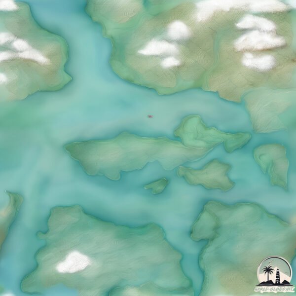
Size: 21.9 km²
Coastline: 39.9 km
Ocean: Pacific Ocean
Sea: South Pacific Ocean
Continent: South America
Teresa is a Medium Island spanning 22 km² with a coastline of 40 km.
Archipel: –
Tectonic Plate: South America – A major plate covering the South American continent and part of the Atlantic Ocean, known for the Andes mountain range and significant seismic and volcanic activity.
The geographic heart of the island is pinpointed at these coordinates:
Latitude: -47.82151551 / Longitude: -73.65241257
Climate and weather of Teresa
Climate Zone: Temperate
Climate Details: Temperate Oceanic Climate
Temperature: Warm Summer
Climate Characteristics: Known for its moderate year-round temperatures with ample rainfall and no dry season. Warm summers are characteristic.
Topography and nature of Teresa
Timezone: UTC-04:00
Timezone places: America/La_Paz
Max. Elevation: 452 m
Mean Elevation: 191 m
Vegetation: Evergreen Broadleaf Forest
Tree Coverage: 73%
The mean elevation is 191 m. The highest elevation on the island reaches approximately 452 meters above sea level. The island is characterized by Hills: Gently sloping landforms with rounded tops, having a maximum elevation between 200 and 500 meters. Hills contribute to a varied landscape on islands.
Dominating Vegetation: Evergreen Broadleaf Forest
Characterized by dense, lush canopies of broadleaf trees that retain their leaves year-round. These forests are typically found in tropical and subtropical regions and are known for their high biodiversity. Teresa has a tree cover of 73 %.
Vegetation: 6 vegetation zones – Very Highly Diverse Island
Islands in this range are ecological powerhouses, showcasing a wide array of vegetation zones. Each zone, from lush rainforests to arid scrublands, coastal mangroves to mountainous regions, contributes to a complex and interdependent ecosystem. These islands are often hotspots of biodiversity, supporting numerous species and intricate ecological processes.
Infrastructure and Travelling to Teresa
Does the island have a public airport? no.
There is no public and scheduled airport on Teresa. The nearest airport is Balmaceda Airport, located 298 km away.
Does the island have a major port? no.
There are no major ports on Teresa. The closest major port is PUERTO CHACABUCO, approximately 273 km away.
The mean population of Teresa is 0 per km². Teresa is Uninhabited. The island belongs to Chile.
Continuing your journey, Barrios is the next notable island, situated merely km away.
Teressa Island - The Hidden New Zealand of India | Serene Scapes
Teressa Island, a secluded gem of the Nicobar Islands, remains untouched and off-limits to most travelers, requiring special ...Teressa Island - The Hidden New Zealand of India | Serene Scapes
Teressa Island, a secluded gem of the Nicobar Islands, remains ...
Teressa Island, a secluded gem of the Nicobar Islands, remains untouched and off-limits to most travelers, requiring special ...
What Really Happened to Theresa Caputo from Long Island Medium #longislandmedium #theresacaputo #tlc
Teressa Island🏝️
Know about Andaman and Nicobar Islands Hello friends Welcome to my ...
Know about Andaman and Nicobar Islands Hello friends Welcome to my YouTube channel like share and subscribe ...
Spirit is still communicating with me... || STEVE HARVEY
Everyone's favorite medium, THERESA CAPUTO from TLC's “Long Island ...
Everyone's favorite medium, THERESA CAPUTO from TLC's “Long Island Medium” stops by to talk to Steve about the new season ...
Theresa Reads A Woman Who's Fiancé Committed Suicide | Long Island Medium
Theresa reads a woman who's fiancé who shot himself during an internet ...
Theresa reads a woman who's fiancé who shot himself during an internet video chat with her. Stream Full Episodes of Long Island ...
Theresa Caputo Reads Ellen's Audience
She had an incredible experience with several people in Ellen's ...
She had an incredible experience with several people in Ellen's audience. Like all things with the Long Island Medium, you have ...
Theresa Gives Shockingly Accurate Readings From A Crowd Of 800 People | Long Island Medium
Theresa Caputo decides she wants to tackle her massive wait list head ...
Theresa Caputo decides she wants to tackle her massive wait list head on and dedicates time to some large group readings.
Teressa islands, Andman & Nicobar Islands, India, #india #nature #beach
In 15 Years This Has Never Happened | Long Island Medium
In 15 Years of reading people, something happens to Theresa that she ...
In 15 Years of reading people, something happens to Theresa that she have never experienced before. #LongIslandMedium ...
Theresa Helps Sceptic Son Release His Anger After His Mum's Mysterious Passing | Long Island Medium
Subscribe to TLC UK for more great clips:
https://bit.ly/3WstgiZ Theresa helps a departed mum connect with her son who has been ...
JOE DOLAN - Teresa (1969)
Theresa Caputo's Daughter Speaks on Her Mom | Beyond the Readings | Lifetime | #Shorts
Theresa Caputo's daughter speaks on her mom! #TheresaCaputo Lifetime® ...
Theresa Caputo's daughter speaks on her mom! #TheresaCaputo Lifetime® is a premier female-focused entertainment ...
Theresa Connects With Holocaust Survivor During Group Reading For Sceptics | Long Island Medium
Catch full episodes of your favourite TLC shows on discovery+: ...
Catch full episodes of your favourite TLC shows on discovery+:
https://bit.ly/3yGHxhO Theresa connects with the spirit of a ...
Teresa Gives A Reading While Buying A Juicer | Long Island Medium
Teresa wants to lose weight in 5 days through juicing! While buying a ...
Teresa wants to lose weight in 5 days through juicing! While buying a juicer, she gives a surprise reading to the head buyer of the ...
Theresa Caputo & Husband Larry Visit Where They First Met! 🥺 💘
Theresa and her husband Larry are revisiting important places ...
Theresa and her husband Larry are revisiting important places throughout their 25-year relationship, including the office where ...
Teressa – A Land of Wind, Grass, and Solitude | Andaman & Nicobar Island
Discover the quiet elegance of Teressa Island—where nature paints the ...
Discover the quiet elegance of Teressa Island—where nature paints the earth in endless greens. This video offers a peaceful ...
Theresa Brings Closure To A Heartbroken Family #LongIslandMedium #short
Subscribe to LOVE PARANORMAL for more great clips: ...
Subscribe to LOVE PARANORMAL for more great clips:
https://bit.ly/3NQmSkx While at a restaurant, Theresa feels a spiritual ...
Theresa Caputo Tastes A Disgusting Tragedy | Howie Mandel Does Stuff
A beautiful Teressa Island#Nicobar District #shots #souravjoshivlogs #souravjoshivlogs #dailyvlog
#short #ytshorts #viral TERESSA ISLAND
CHOWRA AUR TERESSA ISLAND KE PUBLIC AYESE CHADHTE UTHARTE HAI SHIP SE ...
CHOWRA AUR TERESSA ISLAND KE PUBLIC AYESE CHADHTE UTHARTE HAI SHIP SE AGAR ISLANDS ME JANA AANA ...
Theresa Stops A Reading When A Spirit's Emotions Take Over Her #LongIslandMedium #Shorts
Subscribe to LOVE PARANORMAL for more great clips: ...
Subscribe to LOVE PARANORMAL for more great clips:
https://bit.ly/3NQmSkx Theresa Stops A Reading When A Spirit's ...
"Hocus Pocus" Skeptic Changes Mind After Meeting Medium Theresa Caputo! | Long Island Medium
Theresa manages to change a sceptic's mind on the afterlife after ...
Theresa manages to change a sceptic's mind on the afterlife after having an emotional group reading! From season 8 episode 14.
Andaman & Nicobar Island | Teresa Island #vlog #travel #shorts
Chile is classified as Emerging region: G20: Group of Twenty – Major economies comprising both developed and emerging countries, representing the world’s largest economies. The level of income is Upper middle income.
News – Latest Updates and Headlines from Teresa
Stay informed with the most recent news and important headlines from Teresa. Here’s a roundup of the latest developments.
Loading...
Please note: The data used here has been primarily extracted from satellite readings. Deviations from exact values may occur, particularly regarding the height of elevations and population density. Land area and coastline measurements refer to average values at mean high tide.