Welcome to Texel, a Temperate island in the North Sea, part of the majestic Atlantic Ocean. This guide offers a comprehensive overview of what makes Texel unique – from its geography and climate to its population, infrastructure, and beyond. Dive into the details:
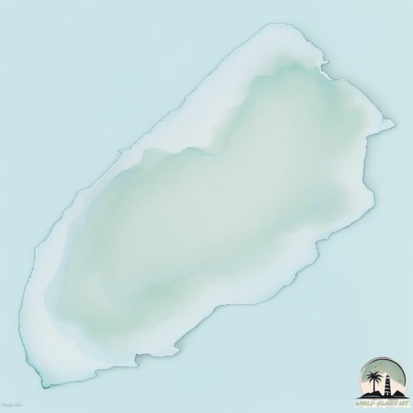
Geography and size of Texel
Size: 162.4 km²
Coastline: 68.8 km
Ocean: Atlantic Ocean
Sea: North Sea
Continent: Europe
Texel is a Large Island spanning 162 km² with a coastline of 69 km.
Archipel: Frisian Islands – A chain of islands in the North Sea, off the coasts of the Netherlands, Germany, and Denmark, known for their distinctive culture and natural beauty.
Tectonic Plate: South America – A major plate covering the South American continent and part of the Atlantic Ocean, known for the Andes mountain range and significant seismic and volcanic activity.
The geographic heart of the island is pinpointed at these coordinates:
Latitude: 53.08252528 / Longitude: 4.80951002
Climate and weather of Texel
Climate Zone: Temperate
Climate Details: Temperate Oceanic Climate
Temperature: Warm Summer
Climate Characteristics: Known for its moderate year-round temperatures with ample rainfall and no dry season. Warm summers are characteristic.
Topography and nature of Texel
Timezone: UTC+01:00
Timezone places: Europe/Paris
Max. Elevation: 13 m
Mean Elevation: 1 m
Vegetation: Agricultural Mosaic
Tree Coverage: 25%
The mean elevation is 1 m. The highest elevation on the island reaches approximately 13 meters above sea level. The island is characterized by Plains: Flat, low-lying lands characterized by a maximum elevation of up to 200 meters. On islands, plains are typically coastal lowlands or central flat areas.
Dominating Vegetation: Agricultural Mosaic
A mix of cropland and natural vegetation, often seen in rural landscapes where agricultural fields are interspersed with patches of natural habitats. Texel has a tree cover of 25 %.
Vegetation: 13 vegetation zones – Exceptionally Diverse Island
Islands with more than ten vegetation zones are among the most ecologically rich and varied in the world. These islands are akin to miniature continents, boasting an incredible array of ecosystems. The sheer range of habitats, from high peaks to deep valleys, rainforests to deserts, creates a mosaic of life that is unparalleled. They are crucial for conservation and ecological studies.
Infrastructure and Travelling to Texel
Does the island have a public airport? no.
There is no public and scheduled airport on Texel. The nearest airport is Amsterdam Airport Schiphol, located 75 km away.
Does the island have a major port? no.
There are no major ports on Texel. The closest major port is DEN HELDER, approximately 3 km away.
The mean population of Texel is 85 per km². Texel is Gently Populated. The island belongs to Netherlands.
Continuing your journey, Vlieland is the next notable island, situated merely km away.
🇳🇱 Five must-sees on Texel Island (👉🏻 find all the info in description)
Five must-sees on Texel Island (Netherlands) 1️⃣ Lighthouse 2️⃣ Ecomare 3️⃣ Oosterend 4️⃣ Den Hoorn 5️⃣ ...🇳🇱 Five must-sees on Texel Island (👉🏻 find all the info in description)
Five must-sees on Texel Island (Netherlands) 1️⃣ Lighthouse 2️⃣ ...
Five must-sees on Texel Island (Netherlands) 1️⃣ Lighthouse 2️⃣ Ecomare 3️⃣ Oosterend 4️⃣ Den Hoorn 5️⃣ ...
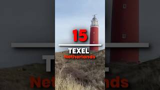
15 Things to do on Texel, Netherlands
My Texel Travel Guide includes 15 best things to do, places to visit ...
My Texel Travel Guide includes 15 best things to do, places to visit and dishes to eat which I carefully selected for the ultimate ...
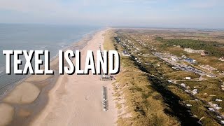
Best Things to do on Texel Island - Travel Guide [4K]
TEXEL | THE MOST BEAUTIFUL Place In The Netherlands!?
Join us as we explore the stunning island of Texel, Netherlands! From ...
Join us as we explore the stunning island of Texel, Netherlands! From renting e-bikes to tasting delicious local cheese and ...
Amazing Things to Do in Texel Island in Holland & Top Texel Attractions
Discover with us the most amazing things to do in Texel & Top Texel ...
Discover with us the most amazing things to do in Texel & Top Texel attractions. If you look for beautiful nature and lovely Dutch ...
Why Texel is a MUST VISIT island in The Netherlands!
Just 1 hour north of Amsterdam you can grab the ferry to the Dutch ...
Just 1 hour north of Amsterdam you can grab the ferry to the Dutch island of Texel. Whether it is a day trip or a multi-day trip, Texel ...
"Texel Island, The Netherlands: Discovering the Gem of the Dutch Wadden Sea" #travel
Part of the Wadden Sea, a UNESCO World Heritage Site. It is known for ...
Part of the Wadden Sea, a UNESCO World Heritage Site. It is known for its sandy beaches, wildlife, and cycling routes.
Exploring Texel Island | village Netherlands , #texel #island #travel #netherlands #village #nature
The beautiful Wadden island of Texel - Holland Holiday
Texel, beautiful island in the Wadden Sea. In the North of Holland ...
Texel, beautiful island in the Wadden Sea. In the North of Holland there are 5 inhabitant wadden islands. They border the North ...
🇳🇱 Animals on Texel Island (👉🏻 find all the info in description)
Animals on Texel Island (Netherlands) On Texel Island in the north of ...
Animals on Texel Island (Netherlands) On Texel Island in the north of the Netherlands, you can see many animals: sheeps, ...
Day trip to Texel - The Netherlands 🇳🇱
visiting Texel during a day trip, sadly to much wind to fly the drone. ...
visiting Texel during a day trip, sadly to much wind to fly the drone. but what a beautiful island.
I Texel I Island I Netherlands I Natural I Place I
texel #island #nederland #netherlands #natural #place #beutifull ...
texel #island #nederland #netherlands #natural #place #beutifull #travel #mustwatch #holiday #photography.
Texel Island, Netherlands by Drone #DJIMavicPro #2023 | Shiela Piet
🏝️ Texel | Most Amazing Places in The Netherlands | Ultimate Europe Travel Guide 🇳🇱
Discover Texel – The Largest Wadden Island in The Netherlands! ✨ Texel ...
Discover Texel – The Largest Wadden Island in The Netherlands! ✨ Texel is one of the most beautiful Dutch islands, known ...
Texel, the Dutch island - day to night by drone - DJI Mini2 4K
Texel is flat and, when I was there, experienced a fair amount of ...
Texel is flat and, when I was there, experienced a fair amount of 'weather'. This lead to some amazing sunsets punctuated by ...
Oudeschild Texel: A Dutch Paradise - Breathtaking 4K Drone Footage
Welcome to Oudeschild Texel, a picturesque village located on the ...
Welcome to Oudeschild Texel, a picturesque village located on the island of Texel in the Netherlands. Today, we invite you to ...
sunset on Texel island, Netherlands, be with nature to revive your mind
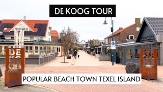
DE KOOG TEXEL TOUR | Popular Beach Town Texel Island | De Koog Texel Shops, Restaurants, Supermarket
De Koog is one of the most popular cities on Texel. Texel is an island ...
De Koog is one of the most popular cities on Texel. Texel is an island right off the coast of The Netherlands. De Koog is super ...
🏝️ You have to visit this island in the Netherlands 🇳🇱 #netherlands #travelvlog #texel
Exploring Texel Island | village Netherlands , #texel #island #travel #netherlands #village #nature
Texel is one of the Dutch Wadden Islands, off the coast of the ...
Texel is one of the Dutch Wadden Islands, off the coast of the Netherlands. It's known for the bird-rich Dunes of Texel National ...
😍 TEXEL ISLAND | Perfect for long walks! #texel #beachwalk #netherlands
Texel island. Perfect for long walks! #texel #beachwalk #netherlands.
Texel island. Perfect for long walks! #texel #beachwalk #netherlands.
MUST VISIT ISLAND IN THE NETHERLANDS 📍Texel #netherlands #holland #travel #dutch #nederlands
TEXEL ISLAND ● The Netherlands 【4K】 Cinematic [2018]
Texel #Netherlands #Netherlands4k Texel Wadden Islands - Netherlands | ...
Texel #Netherlands #Netherlands4k Texel Wadden Islands - Netherlands | 4K Ultra HD Texel is one of the Dutch Wadden Islands, ...
Texel Island of The Netherlands Roadtrip & Texel City Center Walk tour
Texel Netherlands is an island in the West Frisian Islands region of ...
Texel Netherlands is an island in the West Frisian Islands region of the Netherlands. Tourists and birds are abundant. The tourists ...
Netherlands is classified as Developed region: nonG7: Developed economies outside of the Group of Seven, characterized by high income and advanced economic structures. The level of income is High income: OECD.
News – Latest Updates and Headlines from Texel
Stay informed with the most recent news and important headlines from Texel. Here’s a roundup of the latest developments.
Loading...
Please note: The data used here has been primarily extracted from satellite readings. Deviations from exact values may occur, particularly regarding the height of elevations and population density. Land area and coastline measurements refer to average values at mean high tide.


![Best Things to do on Texel Island - Travel Guide [4K]](https://i.ytimg.com/vi/NWKTeo-0xOE/mqdefault.jpg)


![TEXEL ISLAND ● The Netherlands 【4K】 Cinematic [2018]](https://i.ytimg.com/vi/F8uz1bTE8VM/mqdefault.jpg)
