Thilafushi
Welcome to Thilafushi, a Tropical island in the Laccadive Sea, part of the majestic Indian Ocean. This guide offers a comprehensive overview of what makes Thilafushi unique – from its geography and climate to its population, infrastructure, and beyond. Dive into the details:
- Geography and Size: Explore the island’s size and location.
- Climate and Weather: Weather patterns and temperature.
- Topography and Nature: Uncover the natural wonders of the island.
- Infrastructure and Travelling: Insights on reaching, staying, and making the most of your visit.
- News and Headlines: Latest News.
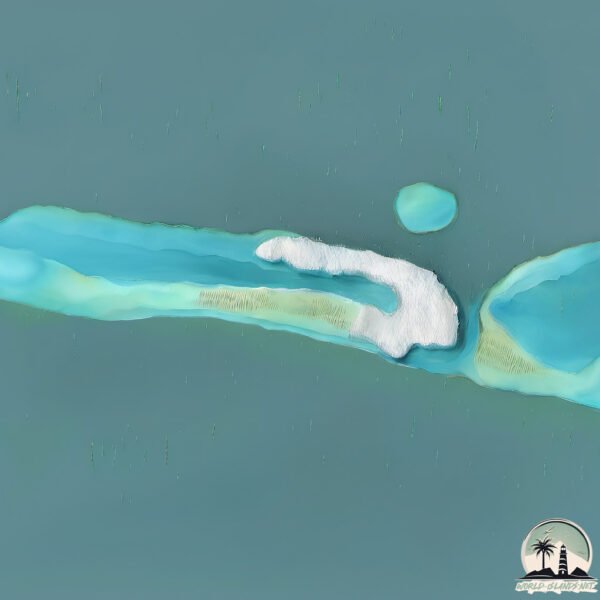
Geography and size of Thilafushi
Size: 1.048 km²
Coastline: 11.5 km
Ocean: Indian Ocean
Sea: Laccadive Sea
Continent: Seven seas (open ocean)
Thilafushi is a Small Island spanning 1 km² with a coastline of 11.5 km.
Archipel: Maldive Islands – A tropical paradise in the Indian Ocean, known for their stunning coral reefs, diverse marine life, and luxury resorts.
Tectonic Plate: India – A major tectonic plate that initially moved northward at a rapid pace before colliding with the Eurasian Plate. This collision is responsible for the uplift of the Himalayas and the Tibetan Plateau.
The geographic heart of the island is pinpointed at these coordinates:
Latitude: 4.18249362 / Longitude: 73.44194196
Climate and weather of Thilafushi
Climate Zone: Tropical
Climate Details: Tropical Monsoon Climate
Temperature: Hot
Climate Characteristics: Characterized by heavy rainfall, high humidity, and uniformly high temperatures, but with a distinct short dry season. It features a seasonal reversal of prevailing wind directions.
Topography and nature of Thilafushi
Timezone: UTC+05:00
Timezone places: Asia/Karachi
Max. Elevation: -51 m
Mean Elevation: -140 m
Vegetation: Urban Area
Tree Coverage: 80%
The mean elevation is -140 m. Remarkably, this unique island barely emerges above the sea level, showcasing nature’s fascinating interplay with the ocean. The island is characterized by Plains: Flat, low-lying lands characterized by a maximum elevation of up to 200 meters. On islands, plains are typically coastal lowlands or central flat areas.
Dominating Vegetation: Urban Area
Regions dominated by human development, including cities and towns, characterized by buildings, roads, and minimal vegetation. Thilafushi has a tree cover of 80 %.
Vegetation: 1 vegetation zones – Minimal Diversity Island
These islands exhibit the most basic level of ecological diversity, often characterized by a single dominant vegetation type. This could be due to extreme environmental conditions, limited land area, or significant human impact. They represent unique ecosystems where specific species have adapted to thrive in these singular environments.
Infrastructure and Travelling to Thilafushi
Does the island have a public airport? no.
There is no public and scheduled airport on Thilafushi. The nearest airport is Malé International Airport, located 9 km away.
Does the island have a major port? no.
There are no major ports on Thilafushi. The closest major port is MALE, approximately 5 km away.
The mean population of Thilafushi is 0 per km². Thilafushi is Uninhabited. The island belongs to Maldives.
Continuing your journey, Vypīn Island is the next notable island, situated merely km away.
Maldives is classified as Developing region: Regions characterized by lower income levels, with economies in the process of industrialization and modernization. The level of income is Upper middle income.
News – Latest Updates and Headlines from Thilafushi
Stay informed with the most recent news and important headlines from Thilafushi. Here’s a roundup of the latest developments.
- ‘Toxic bomb’ ticks on Maldives rubbish island - sundayindependent.co.zaby "Thilafushi island" - Google News on 8 March 2026
‘Toxic bomb’ ticks on Maldives rubbish island sundayindependent.co.za
- Villa Shipping buys two land plots from Thilafushi for MVR 228 million - Edition.mvby "Thilafushi island" - Google News on 19 February 2026
Villa Shipping buys two land plots from Thilafushi for MVR 228 million Edition.mv
- BML launches ATM service in Thilafushi - Edition.mvby "Thilafushi island" - Google News on 30 January 2026
BML launches ATM service in Thilafushi Edition.mv
- Kerala's tide of trouble - The New Indian Expressby "Vypīn Island island" - Google News on 24 October 2025
Kerala's tide of trouble The New Indian Express
- Vypin’s narrow roads struggle as buses block both sides - Onmanoramaby "Vypīn Island island" - Google News on 9 October 2025
Vypin’s narrow roads struggle as buses block both sides Onmanorama
- 65 years on, Cherai bridge still stands as Vypin’s gateway to the world - Onmanoramaby "Vypīn Island island" - Google News on 1 October 2025
65 years on, Cherai bridge still stands as Vypin’s gateway to the world Onmanorama
- MTCC to procure compactor for Thilafushi landfill - Edition.mvby "Thilafushi island" - Google News on 29 September 2025
MTCC to procure compactor for Thilafushi landfill Edition.mv
- Vypeen to host Tourism Day celebrations - The Hinduby "Vypīn Island island" - Google News on 25 September 2025
Vypeen to host Tourism Day celebrations The Hindu
- Land plots in Thilafushi now up for sale, exclusively for Maldivian buyers - Edition.mvby "Thilafushi island" - Google News on 20 September 2025
Land plots in Thilafushi now up for sale, exclusively for Maldivian buyers Edition.mv
- Bookmark This: 7 Underrated Island Escapes In India - Travel and Leisure Asiaby "Vypīn Island island" - Google News on 2 September 2025
Bookmark This: 7 Underrated Island Escapes In India Travel and Leisure Asia
Please note: The data used here has been primarily extracted from satellite readings. Deviations from exact values may occur, particularly regarding the height of elevations and population density. Land area and coastline measurements refer to average values at mean high tide.