Turneffe Atoll
Welcome to Turneffe Atoll, a Tropical island in the Caribbean Sea, part of the majestic Atlantic Ocean. This guide offers a comprehensive overview of what makes Turneffe Atoll unique – from its geography and climate to its population, infrastructure, and beyond. Dive into the details:
- Geography and Size: Explore the island’s size and location.
- Climate and Weather: Weather patterns and temperature.
- Topography and Nature: Uncover the natural wonders of the island.
- Infrastructure and Travelling: Insights on reaching, staying, and making the most of your visit.
- News and Headlines: Latest News.
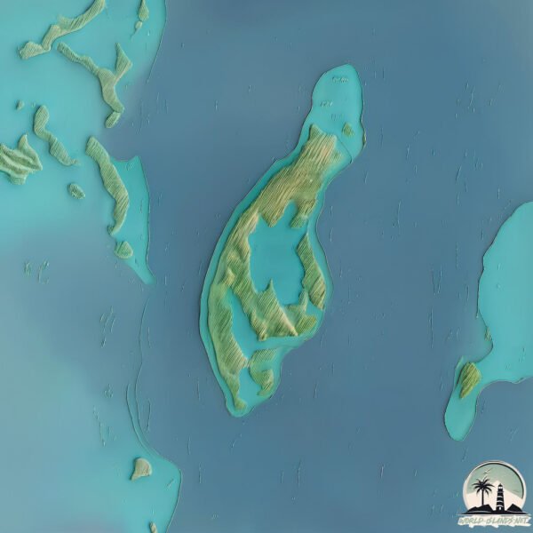
Geography and size of Turneffe Atoll
Size: 8.32 km²
Coastline: 31.3 km
Ocean: Atlantic Ocean
Sea: Caribbean Sea
Continent: North America
Turneffe Atoll is a Small Island spanning 8.3 km² with a coastline of 31.3 km.
Archipel: –
Tectonic Plate: Caribbean – Covering the Caribbean Sea and surrounding regions, this plate is bordered by the North American Plate and the South American Plate. Known for seismic activity, including earthquakes and volcanic eruptions, and features like the Puerto Rico Trench.
The geographic heart of the island is pinpointed at these coordinates:
Latitude: 17.40697072 / Longitude: -87.85708365
Climate and weather of Turneffe Atoll
Climate Zone: Tropical
Climate Details: Tropical Monsoon Climate
Temperature: Hot
Climate Characteristics: Characterized by heavy rainfall, high humidity, and uniformly high temperatures, but with a distinct short dry season. It features a seasonal reversal of prevailing wind directions.
Topography and nature of Turneffe Atoll
Timezone: UTC-06:00
Timezone places: America/Chicago
Max. Elevation: 6 m
Mean Elevation: 2 m
Vegetation: Mangrove Forest
Tree Coverage: 82%
The mean elevation is 2 m. The highest elevation on the island reaches approximately 6 meters above sea level. The island is characterized by Plains: Flat, low-lying lands characterized by a maximum elevation of up to 200 meters. On islands, plains are typically coastal lowlands or central flat areas.
Dominating Vegetation: Mangrove Forest
Found in coastal areas and river deltas, these unique wetland ecosystems are adapted to saline conditions and are crucial for coastal protection and biodiversity. Turneffe Atoll has a tree cover of 82 %.
Vegetation: 11 vegetation zones – Exceptionally Diverse Island
Islands with more than ten vegetation zones are among the most ecologically rich and varied in the world. These islands are akin to miniature continents, boasting an incredible array of ecosystems. The sheer range of habitats, from high peaks to deep valleys, rainforests to deserts, creates a mosaic of life that is unparalleled. They are crucial for conservation and ecological studies.
Infrastructure and Travelling to Turneffe Atoll
Does the island have a public airport? no.
There is no public and scheduled airport on Turneffe Atoll. The nearest airport is Caye Chapel Airport, located 30 km away.
Does the island have a major port? no.
There are no major ports on Turneffe Atoll. The closest major port is BELIZE CITY, approximately 32 km away.
The mean population of Turneffe Atoll is 49 per km². Turneffe Atoll is Gently Populated. The island belongs to Belize.
Continuing your journey, Blackbird Cay is the next notable island, situated merely km away.
Belize is classified as Developing region: Regions characterized by lower income levels, with economies in the process of industrialization and modernization. The level of income is Lower middle income.
News – Latest Updates and Headlines from Turneffe Atoll
Stay informed with the most recent news and important headlines from Turneffe Atoll. Here’s a roundup of the latest developments.
- Belize’s Turneffe Atoll Set for Major Upgrades to Protect Reef and Boost Tourism – A Game-Changer for Eco-Tourism in Central America! - Travel And Tour Worldby "Turneffe Atoll island" - Google News on 18 March 2026
Belize’s Turneffe Atoll Set for Major Upgrades to Protect Reef and Boost Tourism – A Game-Changer for Eco-Tourism in Central America! Travel And Tour World
- Turneffe Upgrades Aim to Protect Reef and Visitors - Greater Belize Mediaby "Turneffe Atoll island" - Google News on 18 March 2026
Turneffe Upgrades Aim to Protect Reef and Visitors Greater Belize Media
- Enhancing Tourism in Turneffe Atoll Featured on “Open Your Eyes” - Greater Belize Mediaby "Turneffe Atoll island" - Google News on 17 March 2026
Enhancing Tourism in Turneffe Atoll Featured on “Open Your Eyes” Greater Belize Media
- ARTHUR F. JECZALA Obituary (2026) - Schaumburg, IL - Michaels Funeral Home and Cremation Care - Legacyby "Blackbird Cay island" - Google News on 13 March 2026
ARTHUR F. JECZALA Obituary (2026) - Schaumburg, IL - Michaels Funeral Home and Cremation Care Legacy
- Belize City Earthquakes Archive: Past Quakes on Thursday, February 26th, 2026 - Volcano Discoveryby "Blackbird Cay island" - Google News on 27 February 2026
Belize City Earthquakes Archive: Past Quakes on Thursday, February 26th, 2026 Volcano Discovery
- Dredging Policies Are Failing Belize’s Marine Reserves - The San Pedro Sunby "Turneffe Atoll island" - Google News on 8 November 2025
Dredging Policies Are Failing Belize’s Marine Reserves The San Pedro Sun
- The Perfect Belize Escape for Every Kind of Traveler - InsideHookby "Turneffe Atoll island" - Google News on 3 October 2025
The Perfect Belize Escape for Every Kind of Traveler InsideHook
- International Belize Belize City Belize City North End Estate Road , Belize City, Belize - Realtor.comby "Turneffe Atoll island" - Google News on 2 August 2025
International Belize Belize City Belize City North End Estate Road , Belize City, Belize Realtor.com
- International Belize Belize City Manatee Bar Mouth , Gales Point, Belize - Realtor.comby "Turneffe Atoll island" - Google News on 2 August 2025
International Belize Belize City Manatee Bar Mouth , Gales Point, Belize Realtor.com
- Join TASA in protecting Turneffe Atoll Marine Reserve - ArcGIS StoryMapsby "Blackbird Cay island" - Google News on 7 July 2025
Join TASA in protecting Turneffe Atoll Marine Reserve ArcGIS StoryMaps
Please note: The data used here has been primarily extracted from satellite readings. Deviations from exact values may occur, particularly regarding the height of elevations and population density. Land area and coastline measurements refer to average values at mean high tide.