Welcome to Uzunada, a Temperate island in the Aegean Sea, part of the majestic Atlantic Ocean. This guide offers a comprehensive overview of what makes Uzunada unique – from its geography and climate to its population, infrastructure, and beyond. Dive into the details:
Geography and size of Uzunada
Size: 25.9 km²
Coastline: 32.6 km
Ocean: Atlantic Ocean
Sea: Aegean Sea
Continent: Asia
Uzunada is a Medium Island spanning 26 km² with a coastline of 33 km.
Archipel: –
Tectonic Plate: Eurasia – One of the world’s largest tectonic plates, the Eurasian Plate covers a significant portion of Europe and Asia. It’s characterized by diverse geological features, including the Ural Mountains, the European Plain, and the Himalayas formed from its collision with the Indian Plate.
The geographic heart of the island is pinpointed at these coordinates:
Latitude: 38.49838988 / Longitude: 26.71857624
Climate and weather of Uzunada
Climate Zone: Temperate
Climate Details: Hot-Summer Mediterranean Climate
Temperature: Hot Summer
Climate Characteristics: Characterized by hot, dry summers and mild, wet winters, typical of coastal areas with abundant sunshine.
Topography and nature of Uzunada
Timezone: UTC+02:00
Timezone places: Europe/Mariehamn
Max. Elevation: 131 m
Mean Elevation: 50 m
Vegetation: Sparse Vegetation with Trees/Shrubs
Tree Coverage: 34%
The mean elevation is 50 m. The highest elevation on the island reaches approximately 131 meters above sea level. The island is characterized by Plains: Flat, low-lying lands characterized by a maximum elevation of up to 200 meters. On islands, plains are typically coastal lowlands or central flat areas.
Dominating Vegetation: Sparse Vegetation with Trees/Shrubs
Areas where grasses and other herbaceous plants are prevalent, but with occasional presence of trees and shrubs. Often found in semi-arid regions or grasslands. Uzunada has a tree cover of 34 %.
Vegetation: 6 vegetation zones – Very Highly Diverse Island
Islands in this range are ecological powerhouses, showcasing a wide array of vegetation zones. Each zone, from lush rainforests to arid scrublands, coastal mangroves to mountainous regions, contributes to a complex and interdependent ecosystem. These islands are often hotspots of biodiversity, supporting numerous species and intricate ecological processes.
Infrastructure and Travelling to Uzunada
Does the island have a public airport? no.
There is no public and scheduled airport on Uzunada. The nearest airport is Adnan Menderes International Airport, located 50 km away.
Does the island have a major port? no.
There are no major ports on Uzunada. The closest major port is NEMRUT LIMANI BAY, approximately 33 km away.
The mean population of Uzunada is 71 per km². Uzunada is Gently Populated. The island belongs to Turkey.
Continuing your journey, Nisí Oinoússes is the next notable island, situated merely km away.
Uzunada
Video Software we use: https://amzn.to/2KpdCQF Ad-free videos. You can support us by purchasing something through our ...Uzunada
Video Software we use:
https://amzn.to/2KpdCQF Ad-free videos. You can support us by purchasing something through our ...
Aegean Sea, 13 km North of Uzunada Island, Izmir, Turkey Earthquake today now
Earthquakes : Earthquake today now news update #earthquake : erdhejî ...
Earthquakes : Earthquake today now news update #earthquake : erdhejî A moderate magnitude 3.7 earthquake occurred, ...
#yassıca # fethiye #gocek #ada #island #doğalgüzellikler
YASSICA ISLANDS
COORDINATE 36°42'37.41" N - 28°55'59.26" E MAP NUMBER 312 Red Island ...
COORDINATE 36°42'37.41" N - 28°55'59.26" E MAP NUMBER 312 Red Island East Bay 36°42'37”N - 28°55'57”E Between ...
Aegean Sea, 4.5 km East of Uzunada Island, Izmir, Turkey Earthquake today now
Earthquakes : Earthquake today now news update #earthquake : erdhejî ...
Earthquakes : Earthquake today now news update #earthquake : erdhejî A light magnitude 2.5 earthquake occurred, in the ...
Uzun Ada
Uzun Ada, Ege bölgesinde yer almakta olup, Muğla iline bağlıdır. Uzun ...
Uzun Ada, Ege bölgesinde yer almakta olup, Muğla iline bağlıdır. Uzun Ada bağlı olduğu Muğla iline 65 kilometre mesafe ...
2.9 Ege Denizi Uzunada Urla İZMİR 04.05.2025 18:59:54 T19.18km *Deprem Bilgi Sistemi
Türkei - Stadt Urla - ehemaliges Vourla in Kleinasien
Das Video zeigt Aufnahmen aus Urla, einer Stadt im Westen der Türkei, ...
Das Video zeigt Aufnahmen aus Urla, einer Stadt im Westen der Türkei, etwa 36 Kilometer von Izmir entfernt. Der frühere Name ...
Aegean Sea, 26 km Northwest of Uzunada Island, Izmir, Turkey Earthquake today now
Earthquakes : Earthquake today now news update #earthquake : erdhejî ...
Earthquakes : Earthquake today now news update #earthquake : erdhejî A light magnitude 3.5 earthquake occurred, in the ...
4K Drone Göcek yassicaada
Discover the serene beauty of Yassıca Island in Göcek with this ...
Discover the serene beauty of Yassıca Island in Göcek with this breathtaking 4K drone footage. Fly over crystal-clear waters and ...
4.8 Earthquake Urla, Turkey 7-16-20
Shorts #Shorts #Shorts #Shorts #Shorts #Shorts #Urla #Turkey ...
Shorts #Shorts #Shorts #Shorts #Shorts #Shorts #Urla #Turkey #Earthquake on July 16th, 2020. Don't forget to subscribe for ...
Urla | A stunning and unforgettable place in Izmir.
Discover the timeless beauty of Urla, where the stunning Aegean ...
Discover the timeless beauty of Urla, where the stunning Aegean coastline meets a serene and picturesque countryside.
Hekim Adası Beach
Hekim Adası (Pele Adası, Kilise Adası, Yatros Adası) İzmir Körfezinde ...
Hekim Adası (Pele Adası, Kilise Adası, Yatros Adası) İzmir Körfezinde yer alan adalardan biridir. Üzerinde yerleşim yeri yoktur.
Урла - это прекрасный город, расположенный на берегу Черного моря в Турции
Урла - это прекрасный город, расположенный на берегу Черного моря в ...
Урла - это прекрасный город, расположенный на берегу Черного моря в Турции. Его историческое наследие, культурные ...
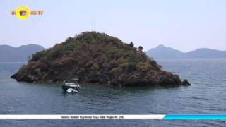
Yassıca Adaları Büyükova Koyu Arası Muğla 4K UHD
ISBN 978-605-88104-0-2 Yassıca Adaları Büyükova Koyu Arası Muğla 4K ...
ISBN 978-605-88104-0-2 Yassıca Adaları Büyükova Koyu Arası Muğla 4K UHD Yassıcalar Takımadaları; Fethiye ve Göcek'in ...
URLA Turkuaz KOYLAR ve Gizli MAĞARA Nerede? Demircili, Altınköy, Yağcılar, Aktaş
Urla Süper Gizli Koylara Sahip İzmir'in güzel ilçelerinden biri. ...
Urla Süper Gizli Koylara Sahip İzmir'in güzel ilçelerinden biri. Urla'da sadece turkuaz denizli sahilleri değil gördüğüm en büyük ...
URLA | IZMİR Walking Tour | Quarantine İsland | Çeşmealtı | 4k ultra hd [june 2021]
Walking Tour in urla. this part is the quarentine part of urla. ...
Walking Tour in urla. this part is the quarentine part of urla. Quarantine Island is an island in the Urla district of Izmir. urla is ...
Yassıca Adaları-Göcek (Kemer Sailing)
COAST OF URLA • IZMIR, TURKEY 🇹🇷
shorts #urla #coast #beach #izmir #turkey #2023 #travel #vlog #gopro.
shorts #urla #coast #beach #izmir #turkey #2023 #travel #vlog #gopro.
Göcek - Yassıca Adaları - Yassıca Island
Sizi, Türkiye'nin Göcek kasabasına yakın, Ege Denizi'ndeki Fethiye ...
Sizi, Türkiye'nin Göcek kasabasına yakın, Ege Denizi'ndeki Fethiye Körfezi'nde bulunan muhteşem Yassıca Adaları ile tanıştırmak ...
ÖZGÜRLÜK-lll Uzunada
İskele-Menteş (Yasak Bölge) Sancak-Uzunada (Yasak Bölge) ...
İskele-Menteş (Yasak Bölge) Sancak-Uzunada (Yasak Bölge) Pruva-Balıklıova,Mordoğan Pupa-Hekim Adası.
Hekim Adası
Hekim Adası (Pele Adası, Kilise Adası, Yatros Adası) İzmir Körfezinde ...
Hekim Adası (Pele Adası, Kilise Adası, Yatros Adası) İzmir Körfezinde yer alan adalardan biridir. Üzerinde yerleşim yeri yoktur.
Exploring Urla from a Bird's Eye View: A Stunning Aerial Tour of Turkey's Coastal Gem
Feeling like a free bird soaring above the beautiful landscapes of ...
Feeling like a free bird soaring above the beautiful landscapes of Urla. This charming coastal town in Turkey is truly a paradise ...
Turkey is classified as Emerging region: MIKT: Mexico, Indonesia, South Korea, and Turkey – Economies recognized for their development potential and emerging market status. The level of income is Upper middle income.
News – Latest Updates and Headlines from Uzunada
Stay informed with the most recent news and important headlines from Uzunada. Here’s a roundup of the latest developments.
Loading...
Please note: The data used here has been primarily extracted from satellite readings. Deviations from exact values may occur, particularly regarding the height of elevations and population density. Land area and coastline measurements refer to average values at mean high tide.


![URLA | IZMİR Walking Tour | Quarantine İsland | Çeşmealtı | 4k ultra hd [june 2021]](https://i.ytimg.com/vi/KZY0h9h7Rjc/mqdefault.jpg)


