Welcome to Valiha, a Tropical island in the Mozambique Channel, part of the majestic Indian Ocean. This guide offers a comprehensive overview of what makes Valiha unique – from its geography and climate to its population, infrastructure, and beyond. Dive into the details:
Geography and size of Valiha
Size: 8.175 km²
Coastline: 13.8 km
Ocean: Indian Ocean
Sea: Mozambique Channel
Continent: Africa
Valiha is a Small Island spanning 8.2 km² with a coastline of 13.8 km.
Archipel: –
Tectonic Plate: New Hebrides – A small plate in the southwestern Pacific Ocean, responsible for the New Hebrides Trench and known for its complex interaction with the Australian Plate.
The geographic heart of the island is pinpointed at these coordinates:
Latitude: -14.16549096 / Longitude: 47.81322452
Climate and weather of Valiha
Climate Zone: Tropical
Climate Details: Tropical Savanna, Wet
Temperature: Hot
Climate Characteristics: Defined by distinct wet and dry seasons with high temperatures year-round. Pronounced rainfall occurs during the wet season, while the dry season is marked by drought.
Topography and nature of Valiha
Timezone: UTC+03:00
Timezone places: Asia/Riyadh
Max. Elevation: 106 m
Mean Elevation: 50 m
Vegetation: Evergreen Broadleaf Forest
Tree Coverage: 76%
The mean elevation is 50 m. The highest elevation on the island reaches approximately 106 meters above sea level. The island is characterized by Plains: Flat, low-lying lands characterized by a maximum elevation of up to 200 meters. On islands, plains are typically coastal lowlands or central flat areas.
Dominating Vegetation: Evergreen Broadleaf Forest
Characterized by dense, lush canopies of broadleaf trees that retain their leaves year-round. These forests are typically found in tropical and subtropical regions and are known for their high biodiversity. Valiha has a tree cover of 76 %.
Vegetation: 4 vegetation zones – Diverse Island
Four distinct vegetation zones mark these islands as ecologically diverse. They might feature varied landscapes such as forests, beaches, grasslands, and rocky areas. Such diversity reflects the island’s complex ecological interactions and varied habitats, which can support a rich array of wildlife and plant species.
Infrastructure and Travelling to Valiha
Does the island have a public airport? no.
There is no public and scheduled airport on Valiha. The nearest airport is Analalava Airport, located 50 km away.
Does the island have a major port? no.
There are no major ports on Valiha. The closest major port is ANDOANY, approximately 99 km away.
The mean population of Valiha is 21 per km². Valiha is Gently Populated. The island belongs to Madagascar.
Continuing your journey, Nosy Berafia is the next notable island, situated merely km away.
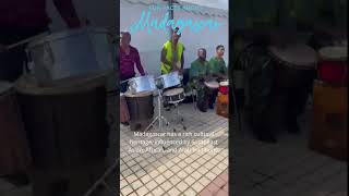
Madagascar Horizons, Island Resonance, Valiha Journey
Valiha Melodic Flow 🌴 Dreamy Island Lofi Beats
Drift into the dreamy flow of the Valiha, a traditional Malagasy ...
Drift into the dreamy flow of the Valiha, a traditional Malagasy instrument that shimmers like a harp. Gentle hip-hop beats, warm ...
Exploring Madagascar's Vibrant Cultural Heritage
The Malagasy people have a rich history influenced by Southeast Asian, ...
The Malagasy people have a rich history influenced by Southeast Asian, African, and Arab traditions. One of the most iconic ...
Villa Valiha EXPERIENCE
VILLA VALIHA BOUTIQUE HOTEL NOSY BE , MADAGASCAR THE JOURNEY THROUGHT ...
VILLA VALIHA BOUTIQUE HOTEL NOSY BE , MADAGASCAR THE JOURNEY THROUGHT THE EYES SEIZES THE MIND AND ...
Madagascar Island #travel #nature #geography #history #adventure #madagascar #africa #island
adventure #madagascar #travel #Africa #island Madagascar, located off ...
adventure #madagascar #travel #Africa #island Madagascar, located off the southeastern coast of Africa in the Indian Ocean, ...
Valiha - Traditional Bamboo Harp of Madagascar
The valiha is a beautiful instrument and an echo from the Indian ...
The valiha is a beautiful instrument and an echo from the Indian ocean. This bamboo tube zither originated from Southeast Asia ...
Madagascar - Song with Valiha (01s)
Madagascar - Song with Valiha (Ny Antsaly) NO INFRINGEMENT OF ...
Madagascar - Song with Valiha (Ny Antsaly) NO INFRINGEMENT OF COPYRIGHT IS INTENDED. ArsX YouTube Channel: ...
VILLA VALIHA EXPERIENCE 1
Rajery
Madagascar's Rajery, his full name is Germain Randrianrisoa is a ...
Madagascar's Rajery, his full name is Germain Randrianrisoa is a Renaissance man. Not only is he a master of the valiha, the ...
🎵 Malagasy Salegy Nights | Afro Island Vibes | Afrikana Best Sounds
Quand la nuit tombe sur Madagascar, le Salegy s'allume ! “Malagasy ...
Quand la nuit tombe sur Madagascar, le Salegy s'allume ! “Malagasy Salegy Nights” te transporte dans l'énergie tropicale des ...
Madagascar, East Africa 🌍 #shorts #viral #africa
Welcome to our captivating journey through the stunning landscapes and ...
Welcome to our captivating journey through the stunning landscapes and rich biodiversity of Madagascar, the gem of East Africa!
Madagascar Island #travel #africa #nature #geography #history #island #adventure #madagascar #facts
adventure #madagascar #travel #Africa #island Madagascar, located off ...
adventure #madagascar #travel #Africa #island Madagascar, located off the southeastern coast of Africa in the Indian Ocean, ...
Rajery
The Malagasy singer-songwriter Rajery is a complete musician and one ...
The Malagasy singer-songwriter Rajery is a complete musician and one of today's most brilliant and innovative masters of the ...
Valiha Fire | Madagascar’s Shimmering Tube Zither (Traditional Instrumental Music) (Country#83)
Feel the bright sparkle of the valiha — Madagascar's bamboo tube ...
Feel the bright sparkle of the valiha — Madagascar's bamboo tube zither — in this 3m14s traditional instrumental from Vagrant ...
How the Malagasy Valiha Conquered World Music
Discover the magical journey of the Malagasy valiha, from island ...
Discover the magical journey of the Malagasy valiha, from island tradition to global sensation! Ever heard this bamboo harp?
Madagascar: A Cultural and Natural Wonderland | Explore with The Azmip
Embark on a captivating journey through Madagascar with The Azmip, ...
Embark on a captivating journey through Madagascar with The Azmip, where ancient traditions meet astounding biodiversity.
Villa Valiha Hotel 24
Villa Valiha Boutique Hôtel – Nosy Be Situé sur la magnifique plage de ...
Villa Valiha Boutique Hôtel – Nosy Be Situé sur la magnifique plage de Madirokely, Villa Valiha offre l'expérience idéale pour les ...
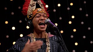
Small Island Big Song - Sarbon (Live on KEXP)
http://KEXP.ORG presents Small Island Big Song performing “Sarbon” live in the KEXP studio. Recorded February 21, 2024.
NY Malagasy Orkestra perform in Lyon Opera House
In order to view exclusive films with NO ADVERTS and HELP Altea Media ...
In order to view exclusive films with NO ADVERTS and HELP Altea Media restore in UHD resolution new productions, please join ...
Razafindrahety memory
Razafindrahety is the name of the queen of Madagascar. This name ...
Razafindrahety is the name of the queen of Madagascar. This name describe also the beauty of the big island.
Nosy Antanimora Madagascar
Radama Islands Resort.
Radama Islands Resort.
The VALIHA: Strings Of The Island Sky. #music #inspiration #beautiful #folklore #creative #best
Mikahely - Rocket Shop - 18 November 2020 -- Valiha and Acoustic Guitar music of Madagascar
Mikahely hails from the beautiful island of Madagascar, but his music ...
Mikahely hails from the beautiful island of Madagascar, but his music is out of this world! A self-taught musician, he draws ...
Razafindrahety pic
Razafindrahety is the name of the queen of Madagascar. This name also ...
Razafindrahety is the name of the queen of Madagascar. This name also describe the beauty of the big island.
The Enigmatic Beauty of Madagascar: Exploring a Unique Island Paradise| Madagascar | Antananarivo
Madagascar, the awe-inspiring island adrift in the vastness of the ...
Madagascar, the awe-inspiring island adrift in the vastness of the Indian Ocean off the southeastern coast of Africa, beckons with ...
Madagascar is classified as Least developed region: Countries that exhibit the lowest indicators of socioeconomic development, with the lowest Human Development Index ratings. The level of income is Low income.
News – Latest Updates and Headlines from Valiha
Stay informed with the most recent news and important headlines from Valiha. Here’s a roundup of the latest developments.
Loading...
Please note: The data used here has been primarily extracted from satellite readings. Deviations from exact values may occur, particularly regarding the height of elevations and population density. Land area and coastline measurements refer to average values at mean high tide.