Vallarpadam
Welcome to Vallarpadam, a Tropical island in the Laccadive Sea, part of the majestic Indian Ocean. This guide offers a comprehensive overview of what makes Vallarpadam unique – from its geography and climate to its population, infrastructure, and beyond. Dive into the details:
- Geography and Size: Explore the island’s size and location.
- Climate and Weather: Weather patterns and temperature.
- Topography and Nature: Uncover the natural wonders of the island.
- Infrastructure and Travelling: Insights on reaching, staying, and making the most of your visit.
- News and Headlines: Latest News.
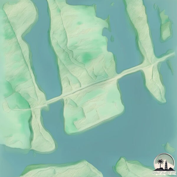
Geography and size of Vallarpadam
Size: 2.1 km²
Coastline: 8.4 km
Ocean: Indian Ocean
Sea: Laccadive Sea
Continent: Asia
Vallarpadam is a Small Island spanning 2.1 km² with a coastline of 8.4 km.
Archipel: –
Tectonic Plate: India – A major tectonic plate that initially moved northward at a rapid pace before colliding with the Eurasian Plate. This collision is responsible for the uplift of the Himalayas and the Tibetan Plateau.
The geographic heart of the island is pinpointed at these coordinates:
Latitude: 9.98493132 / Longitude: 76.25141604
Climate and weather of Vallarpadam
Climate Zone: Tropical
Climate Details: Tropical Monsoon Climate
Temperature: Hot
Climate Characteristics: Characterized by heavy rainfall, high humidity, and uniformly high temperatures, but with a distinct short dry season. It features a seasonal reversal of prevailing wind directions.
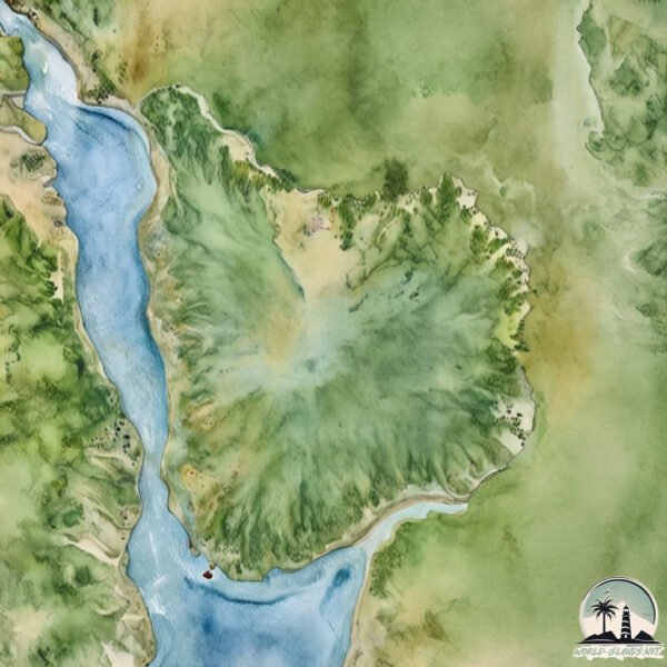
Topography and nature of Vallarpadam
Timezone: UTC+05:30
Timezone places: Asia/Kolkata
Max. Elevation: 6 m
Mean Elevation: 5 m
Vegetation: Rice Paddy
Tree Coverage: 16%
The mean elevation is 5 m. The highest elevation on the island reaches approximately 6 meters above sea level. The island is characterized by Plains: Flat, low-lying lands characterized by a maximum elevation of up to 200 meters. On islands, plains are typically coastal lowlands or central flat areas.
Dominating Vegetation: Rice Paddy
Specifically designed for rice cultivation, these fields are flooded with water during the growing season. Paddy fields are a common sight in many parts of Asia. Vallarpadam has a tree cover of 16 %.
Vegetation: 4 vegetation zones – Diverse Island
Four distinct vegetation zones mark these islands as ecologically diverse. They might feature varied landscapes such as forests, beaches, grasslands, and rocky areas. Such diversity reflects the island’s complex ecological interactions and varied habitats, which can support a rich array of wildlife and plant species.
Infrastructure and Travelling to Vallarpadam
Does the island have a public airport? no.
There is no public and scheduled airport on Vallarpadam. The nearest airport is Cochin International Airport, located 24 km away.
Does the island have a major port? no.
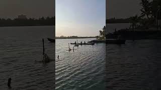
There are no major ports on Vallarpadam. The closest major port is KOCHI (COCHIN), approximately 2 km away.
The mean population of Vallarpadam is 5358 per km². Vallarpadam is Densely Populated. The island belongs to India.
Continuing your journey, Vypīn Island is the next notable island, situated merely km away.
An Ad shoot done at The Island House Homestay Vallarpadam Kochi, for Edu Acharya.


India is classified as Emerging region: BRIC: Brazil, Russia, India, and China – Economies noted for their rapid growth and increasing influence on global affairs. The level of income is Lower middle income.
News – Latest Updates and Headlines from Vallarpadam
Stay informed with the most recent news and important headlines from Vallarpadam. Here’s a roundup of the latest developments.
Please note: The data used here has been primarily extracted from satellite readings. Deviations from exact values may occur, particularly regarding the height of elevations and population density. Land area and coastline measurements refer to average values at mean high tide.