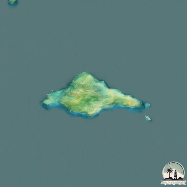
Vsevidof
Welcome to Vsevidof, a Temperate island in the North Pacific Ocean, part of the majestic Pacific Ocean. This guide offers a comprehensive overview of what makes Vsevidof unique – from its geography and climate to its population, infrastructure, and beyond. Dive into the details:
- Geography and Size: Explore the island’s size and location.
- Climate and Weather: Weather patterns and temperature.
- Topography and Nature: Uncover the natural wonders of the island.
- Infrastructure and Travelling: Insights on reaching, staying, and making the most of your visit.
- News and Headlines: Latest News.
Geography and size of Vsevidof
Size: 2.023 km²
Coastline: 13.3 km
Ocean: Pacific Ocean
Sea: North Pacific Ocean
Continent: North America
Vsevidof is a Small Island spanning 2 km² with a coastline of 13.3 km.
Archipel: Aleutian Islands – A chain of islands stretching from Alaska to Russia, known for their rugged beauty, abundant wildlife, and volcanic activity.
Tectonic Plate: North America – Covers North America and parts of the Atlantic and Arctic Oceans, characterized by diverse geological features and varying levels of seismic activity.
The geographic heart of the island is pinpointed at these coordinates:
Latitude: 52.98253979 / Longitude: -168.46708932
Climate and weather of Vsevidof
Climate Zone: Temperate
Climate Details: Subpolar Oceanic Climate
Temperature: Cold Summer
Climate Characteristics: Predominantly cold with cool summers and no dry season. Often found in coastal areas at higher latitudes or on islands.
Topography and nature of Vsevidof
Timezone: UTC-09:00
Timezone places: America/Anchorage
Max. Elevation: 76 m
Mean Elevation: 48 m
Vegetation: Herbaceous Cover
Tree Coverage: 30%
The mean elevation is 48 m. The highest elevation on the island reaches approximately 76 meters above sea level. The island is characterized by Plains: Flat, low-lying lands characterized by a maximum elevation of up to 200 meters. On islands, plains are typically coastal lowlands or central flat areas.
Dominating Vegetation: Herbaceous Cover
Comprising mainly of grasses, herbs, and ferns, these areas are common in prairies, meadows, and savannas, and can vary widely in species composition. Vsevidof has a tree cover of 30 %.
Vegetation: 5 vegetation zones – Highly Diverse Island
With five different vegetation zones, these islands offer a rich tapestry of ecosystems. The variety could include dense forests, open meadows, wetlands, coastal zones, and more. This level of diversity supports an intricate web of life, with each zone playing a vital role in the overall ecological health and balance of the island.
Infrastructure and Travelling to Vsevidof
Does the island have a public airport? no.
There is no public and scheduled airport on Vsevidof. The nearest airport is Tom Madsen (Dutch Harbor) Airport, located 235 km away.
Does the island have a major port? no.
There are no major ports on Vsevidof. The closest major port is MAKUSHIN, approximately 185 km away.
The mean population of Vsevidof is 0 per km². Vsevidof is Uninhabited. The island belongs to United States of America.
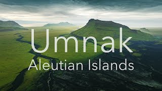
Continuing your journey, Umnak is the next notable island, situated merely km away.
The Active Volcano in Alaska; Vsevidof


United States of America is classified as Developed region: G7: Group of Seven – Major advanced economies, including Canada, France, Germany, Italy, Japan, the United Kingdom, and the United States. The level of income is High income: OECD.
News – Latest Updates and Headlines from Vsevidof
Stay informed with the most recent news and important headlines from Vsevidof. Here’s a roundup of the latest developments.
Please note: The data used here has been primarily extracted from satellite readings. Deviations from exact values may occur, particularly regarding the height of elevations and population density. Land area and coastline measurements refer to average values at mean high tide.