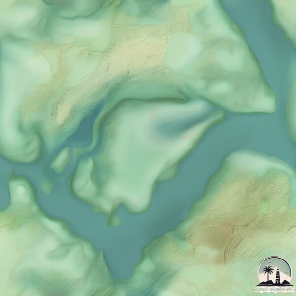
Welcome to Waringa Island, a Temperate island in the Coral Sea, part of the majestic Pacific Ocean. This guide offers a comprehensive overview of what makes Waringa Island unique – from its geography and climate to its population, infrastructure, and beyond. Dive into the details:
Geography and size of Waringa Island
Size: 1.307 km²
Coastline: 6.3 km
Ocean: Pacific Ocean
Sea: Coral Sea
Continent: Oceania
Waringa Island is a Small Island spanning 1.3 km² with a coastline of 6.3 km.
Archipel: –
Tectonic Plate: Africa – One of the world’s largest tectonic plates, covering the African continent and parts of the surrounding oceans, known for its stability with some active rift zones.
The geographic heart of the island is pinpointed at these coordinates:
Latitude: -29.41561675 / Longitude: 153.31258119
Climate and weather of Waringa Island
Climate Zone: Temperate
Climate Details: Humid Subtropical Climate
Temperature: Hot Summer
Climate Characteristics: With continuous rainfall and hot summers, this climate is common in some coastal regions, supporting diverse vegetation.
Topography and nature of Waringa Island
Timezone: UTC+10:00
Timezone places: Australia/Sydney
Max. Elevation: 2 m
Mean Elevation: 2 m
Vegetation: Evergreen Broadleaf Forest
Tree Coverage: 58%
The mean elevation is 2 m. The highest elevation on the island reaches approximately 2 meters above sea level. The island is characterized by Plains: Flat, low-lying lands characterized by a maximum elevation of up to 200 meters. On islands, plains are typically coastal lowlands or central flat areas.
Dominating Vegetation: Evergreen Broadleaf Forest
Characterized by dense, lush canopies of broadleaf trees that retain their leaves year-round. These forests are typically found in tropical and subtropical regions and are known for their high biodiversity. Waringa Island has a tree cover of 58 %.
Vegetation: 2 vegetation zones – Low Diversity Island
Islands with two distinct vegetation zones offer slightly more ecological variety. These zones could be due to differences in elevation, moisture, or other environmental factors. While still limited in biodiversity, these islands may offer a contrast between the two zones, such as a coastline with mangroves and an inland area with grassland.
Infrastructure and Travelling to Waringa Island
Does the island have a public airport? no.
There is no public and scheduled airport on Waringa Island. The nearest airport is Lismore Airport, located 65 km away.
Does the island have a major port? no.
There are no major ports on Waringa Island. The closest major port is BALLINA, approximately 66 km away.
The mean population of Waringa Island is 18 per km². Waringa Island is Gently Populated. The island belongs to Australia.
Continuing your journey, Harwood is the next notable island, situated merely km away.
Never Visit This Island…
Would you visit the North Sentinel Island? All credit goes to the original creator: @nelkfilmz Join this channel to get access to ...Never Visit This Island…
Would you visit the North Sentinel Island? All credit goes to the ...
Would you visit the North Sentinel Island? All credit goes to the original creator: @nelkfilmz Join this channel to get access to ...
The island of Queimada Grande, where the only living thing is hundreds of thousands of snakes,
The island of Queimada Grande, where the only living thing is hundreds ...
The island of Queimada Grande, where the only living thing is hundreds of thousands of snakes,
Surviving the World's Most Deadliest Islands!
We regret going to these islands! special thanks to ...
We regret going to these islands! special thanks to @JayPrehistoricPetsTV for helping with snake island and special thanks to ...
Jason Derulo, Frozy & Tomo - From The Islands (Kompa Passion) (Official Music Video)
Lyrics: (JASON) She said she's from the Islands And I'm just tryna ...
Lyrics: (JASON) She said she's from the Islands And I'm just tryna find her girl You are my desire You're all that I require (TOMO) ...
Dolly Parton, Kenny Rogers - Islands In the Stream (Lyrics)
Follow the official 7clouds playlist on Spotify : ...
Follow the official 7clouds playlist on Spotify :
http://spoti.fi/2SJsUcZ Dolly Parton, Kenny Rogers - Islands In the Stream ...
фрози (frozy), Tomo - Islands (kompa pasión) (Lyrics)
фрози (frozy), Tomo - Islands (kompa pasión) Stream/Download: ...
фрози (frozy), Tomo - Islands (kompa pasión) Stream/Download: (Lyrics): [Intro] (frozy) [Chorus: Tomo] She said she's from the ...
This is the World's Most Remote Island..
The World's Most Remote Islands are the Pitcairn Islands located in ...
The World's Most Remote Islands are the Pitcairn Islands located in the south pacific ocean. The town here is known as ...
From The Islands by Jason Derulo, Frozy & Tomo #shorts
EVERY CODE In Island Of Move!
In this short, I'm showing you ALL 6 CODES in Roblox's ISLAND OF MOVE! ...
In this short, I'm showing you ALL 6 CODES in Roblox's ISLAND OF MOVE! Enjoy! SUBSCRIBE & Turn On Notifications To Never ...
The 4 Most Dangerous Islands You’ll NEVER Survive ☠️⚠️ #history #map #island #facts #geotv
The 4 most dangerous island in the world! 🏝️☢️ 🗺️ Subscribe to ...
The 4 most dangerous island in the world! 🏝️☢️ 🗺️ Subscribe to GeoWorldAtlas ...
Skibidi Toilet Appear in island
skibiditoilet#gman#vfx#island#greenscreen.
skibiditoilet#gman#vfx#island#greenscreen.
Snake Island don't Exist?🤯🔥 #shorts #snakeisland #animals
Snake Island don't Exist? #shortsvideo #shorts #animaledit ...
Snake Island don't Exist? #shortsvideo #shorts #animaledit #animalshorts #animalvideos #snakeisland #animals #viral ...
3 Day Survival On Snake Island
Go to
https://ground.news/DT for a better way to stay informed. Subscribe for 40% off unlimited access to world-wide coverage ...
Snake Island #brazil #south #america #earth #climatechange #snake #upsc #ias #animation #gigachad
Welcome to Snake Island | Brazil
Birds seeking shelter from the rain encounter even a bigger problem ...
Birds seeking shelter from the rain encounter even a bigger problem when they land on snake island! ➡ Subscribe: ...
I Found A Secret Hidden Island
Snake Island Brazil #facts #amazingfacts #snake #brazil
Discover the intriguing secrets of Ilha da Queimada Grande, also known ...
Discover the intriguing secrets of Ilha da Queimada Grande, also known as Snake Island! This video explores its unique ...
The Secret US Island Nobody Lives On 🌴🇺🇸 #BakerIsland #USTerritories
Did you know the US has a tiny island in the Pacific that's completely ...
Did you know the US has a tiny island in the Pacific that's completely uninhabited? It's called Baker Island—small, empty, yet still ...
фрози (frozy), Tomo - Islands (kompa pasión) (Official Lyric Video) [Ultra Records]
фрози (frozy), Tomo - Islands (kompa pasión) out now on Ultra Records! ...
фрози (frozy), Tomo - Islands (kompa pasión) out now on Ultra Records! Stream/download:
https://lnk.to/-islands Official Audio for ...
Dangerous Islands You Cannot Visit! 😨
Most Dangerous Island on Earth: Snake Island in Brazil #shorts #travel
Snake Island is the most dangerous island on Earth, according to CNN. ...
Snake Island is the most dangerous island on Earth, according to CNN. The island is located in the middle of the Amazon River ...
Hilbre Island: Meet the Protectors of this Coastal Haven
Join me on a journey to Hilbre Island, a hidden coastal haven that's ...
Join me on a journey to Hilbre Island, a hidden coastal haven that's steeped in natural beauty and history. In this video, I interview ...
She said she’s from the islands…🏝️ zepeto love story💓 #lyrics #song #zepeto
Australia is classified as Developed region: nonG7: Developed economies outside of the Group of Seven, characterized by high income and advanced economic structures. The level of income is High income: OECD.
News – Latest Updates and Headlines from Waringa Island
Stay informed with the most recent news and important headlines from Waringa Island. Here’s a roundup of the latest developments.
Loading...
Please note: The data used here has been primarily extracted from satellite readings. Deviations from exact values may occur, particularly regarding the height of elevations and population density. Land area and coastline measurements refer to average values at mean high tide.


![фрози (frozy), Tomo - Islands (kompa pasión) (Official Lyric Video) [Ultra Records]](https://i.ytimg.com/vi/Fv2Wwu3uqaQ/mqdefault.jpg)


