Welcome to Weizhou Dao, a Temperate island in the South China Sea, part of the majestic Pacific Ocean. This guide offers a comprehensive overview of what makes Weizhou Dao unique – from its geography and climate to its population, infrastructure, and beyond. Dive into the details:
Geography and size of Weizhou Dao
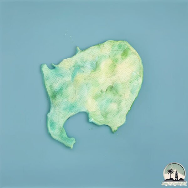
Size: 26 km²
Coastline: 27.8 km
Ocean: Pacific Ocean
Sea: South China Sea
Continent: Asia
Weizhou Dao is a Medium Island spanning 26 km² with a coastline of 28 km.
Archipel: –
Tectonic Plate: Eurasia – One of the world’s largest tectonic plates, the Eurasian Plate covers a significant portion of Europe and Asia. It’s characterized by diverse geological features, including the Ural Mountains, the European Plain, and the Himalayas formed from its collision with the Indian Plate.
The geographic heart of the island is pinpointed at these coordinates:
Latitude: 21.04444672 / Longitude: 109.11158714
Climate and weather of Weizhou Dao
Climate Zone: Temperate
Climate Details: Monsoon-Influenced Humid Subtropical Climate
Temperature: Hot Summer
Climate Characteristics: Known for hot, humid summers with significant monsoon rains, contrasted by mild, drier winters.
Topography and nature of Weizhou Dao
Timezone: UTC+08:00
Timezone places: Australia/Perth
Max. Elevation: 48 m
Mean Elevation: 21 m
Vegetation: Agricultural Mosaic
Tree Coverage: 30%
The mean elevation is 21 m. The highest elevation on the island reaches approximately 48 meters above sea level. The island is characterized by Plains: Flat, low-lying lands characterized by a maximum elevation of up to 200 meters. On islands, plains are typically coastal lowlands or central flat areas.
Dominating Vegetation: Agricultural Mosaic
A mix of cropland and natural vegetation, often seen in rural landscapes where agricultural fields are interspersed with patches of natural habitats. Weizhou Dao has a tree cover of 30 %.
Vegetation: 9 vegetation zones – Very Highly Diverse Island
Islands in this range are ecological powerhouses, showcasing a wide array of vegetation zones. Each zone, from lush rainforests to arid scrublands, coastal mangroves to mountainous regions, contributes to a complex and interdependent ecosystem. These islands are often hotspots of biodiversity, supporting numerous species and intricate ecological processes.
Infrastructure and Travelling to Weizhou Dao
Does the island have a public airport? no.
There is no public and scheduled airport on Weizhou Dao. The nearest airport is Beihai Fucheng Airport, located 55 km away.
Does the island have a major port? no.
There are no major ports on Weizhou Dao. The closest major port is BEIHAI, approximately 46 km away.
The mean population of Weizhou Dao is 361 per km². Weizhou Dao is Moderately Inhabited. The island belongs to China.
Continuing your journey, Vinh Thuc is the next notable island, situated merely km away.
Volcanic island Weizhou, a tourist hotspot in China with fiery origins
Subscribe to our YouTube channel for free here: https://sc.mp/subscribe-youtube Located at the southern tip of China, the volcanic ...Volcanic island Weizhou, a tourist hotspot in China with fiery origins
Subscribe to our YouTube channel for free here: ...
Weizhou island - China’s secret island
Discover the beauty and excitement of Weizhou island, part of Guangxi ...
Discover the beauty and excitement of Weizhou island, part of Guangxi Autonomous Region. This hidden gem is located a short ...
Weizhou Island in Beihai is formed by the volcanic eruption.
Weizhou Island in #Beihai is formed by the volcanic eruption. It is ...
Weizhou Island in #Beihai is formed by the volcanic eruption. It is the largest and youngest volcanic #island in #China. Check out ...
Watch whales in China! Go to Weizhou Island in Guangxi and discover China's giant whale garden
Encounter giant whales on Weizhou Island in Guangxi! Every winter and ...
Encounter giant whales on Weizhou Island in Guangxi! Every winter and spring, this popular tourist island welcomes a large ...
Weizhou Island in China
Let's go to Weizhou Island in China to feel the most comfortable time. ...
Let's go to Weizhou Island in China to feel the most comfortable time. #travel #thebestofchina #ocean.
Guangxi Weizhou Island (2023)
Weizhou Island, Guangxi (2023) | China's Hidden Island Paradise! Join ...
Weizhou Island, Guangxi (2023) | China's Hidden Island Paradise! Join us on a breathtaking journey to Weizhou Island, ...
Explore "The Hidden Beauty of Weizhou Island : A Seaside Paradise in China"- #explore #travel #love
explore "The Hidden Beauty of Weizhou Island: A Seaside Paradise in ...
explore "The Hidden Beauty of Weizhou Island: A Seaside Paradise in China" - beauty of nature SF EXPLORER #explore ...
Weizhou Island & Beihai
Weizhou Island and Beihai. A small island off of the Southern China ...
Weizhou Island and Beihai. A small island off of the Southern China coast line in the Pacific Ocean. Two days on the Island was ...
Improved marine environment sees increase in whale sightings on Weizhou Island
Popular south China tourist hotspot Weizhou Island has witnessed an ...
Popular south China tourist hotspot Weizhou Island has witnessed an increase in sightings of some rather big sea creatures lately ...
Walking in the streets and beach of Dishui fishing village on Weizhou Island, China 走在威州岛迪水的街道和海滩上中国
Hello and welcome to another and last episode of Weizhou. Today we're ...
Hello and welcome to another and last episode of Weizhou. Today we're walking through the small village of Dishui which is a ...
Weizhou Island Travel Vlog/Is Weizhou Island as beautiful as Bali?/Beihai, China
Please turn on 1080p for better watching experience. In this video, I ...
Please turn on 1080p for better watching experience. In this video, I have came all the way to Weizhou Island in Beihai, China, ...
Weizhou Island of china
Weizhou Island is located in Guangxi Beihai city is 21 miles south of ...
Weizhou Island is located in Guangxi Beihai city is 21 miles south of the sea, 36 km from Beihai City, is the youngest volcano ...
WEIZHOU ISLAND VLOG
A Travel vlog to Weizhou island, Guangxi, China.
A Travel vlog to Weizhou island, Guangxi, China.
Discover Weizhou Island: A Hidden Gem in China
Join us on a journey through Weizhou Island, exploring its stunning ...
Join us on a journey through Weizhou Island, exploring its stunning beaches and delicious local cuisine. #WeizhouIsland ...
Traveling weizhou island of China
weizhou island,volcano island.
weizhou island,volcano island.
Beaches in China 中国的海滩 Weizhou Island multicolored Beach 涠洲岛五彩滩发现色彩斑斓的视界
Hello and welcome to another episode of Weizhou. There's one Episode ...
Hello and welcome to another episode of Weizhou. There's one Episode left to come and we move on to Shenyang again. now ...
The Beauty of Weizhou Island, China | #chinatour
Weizhou Island is a hidden gem in China, located off the coast of ...
Weizhou Island is a hidden gem in China, located off the coast of Guangxi Province. It is known for its stunning beaches, ...
Weizhou Dao China. An Island and Tourist Hotspot in the Gulf of Tonkin 涠洲镇 北部湾 旅游热点
Hi Everyone and welcome back to travel in 2021 in China. This time ...
Hi Everyone and welcome back to travel in 2021 in China. This time let's explore Weizhou, the beaches and take a ride through ...
Weizhou in Guangxi, China's youngest volcanic island
Weizhou Island
涠洲岛 2017.8.12-14.
涠洲岛 2017.8.12-14.
Weizhou Island
Mein Lieblingsort in China.
Mein Lieblingsort in China.
Weizhou Island
My trip to Weizhou island. check out my blog ...
My trip to Weizhou island. check out my blog (www.itsdaniels.blogdive.com) for more stories on my trip to china.
Guardians of the Bryde's whales off south China’s Weizhou Island
Subscribe to our YouTube channel for free here: ...
🌏 China’s Best Islands in Seconds! Hainan 🏝️, Weizhou 🌋, Gulangyu 🎶, Putuo ⛩️, Nanji 🌊, Hailing
China's Best Islands in Seconds! | Hainan 🏝️, Weizhou , Gulangyu , ...
China's Best Islands in Seconds! | Hainan 🏝️, Weizhou , Gulangyu , Putuo ⛩️, Nanji , Hailing , Dong'ao ...
China is classified as Emerging region: BRIC: Brazil, Russia, India, and China – Economies noted for their rapid growth and increasing influence on global affairs. The level of income is Upper middle income.
News – Latest Updates and Headlines from Weizhou Dao
Stay informed with the most recent news and important headlines from Weizhou Dao. Here’s a roundup of the latest developments.
Loading...
Please note: The data used here has been primarily extracted from satellite readings. Deviations from exact values may occur, particularly regarding the height of elevations and population density. Land area and coastline measurements refer to average values at mean high tide.