Wrangel
Welcome to Wrangel, a Polar island in the Baffin Bay, part of the majestic Arctic Ocean. This guide offers a comprehensive overview of what makes Wrangel unique – from its geography and climate to its population, infrastructure, and beyond. Dive into the details:
- Geography and Size: Explore the island’s size and location.
- Climate and Weather: Weather patterns and temperature.
- Topography and Nature: Uncover the natural wonders of the island.
- Infrastructure and Travelling: Insights on reaching, staying, and making the most of your visit.
- News and Headlines: Latest News.
Geography and size of Wrangel
Size: 7615 km²
Coastline: 1790 km
Ocean: Arctic Ocean
Sea: Baffin Bay
Continent: Asia
Wrangel is a Very Large Island spanning 7615 km² with a coastline of 1790 km.
Archipel: –
Tectonic Plate: North America – Covers North America and parts of the Atlantic and Arctic Oceans, characterized by diverse geological features and varying levels of seismic activity.
The geographic heart of the island is pinpointed at these coordinates:
Latitude: 71.20207024 / Longitude: -66.21376877
Climate and weather of Wrangel
Climate Zone: Polar
Climate Details: Tundra
Temperature: Cold
Climate Characteristics: The tundra climate features long, extremely cold winters and short, cool summers. Vegetation is limited to mosses, lichens, and small shrubs due to the low temperatures and short growing seasons. Biodiversity is low, but some specialized species thrive.
Topography and nature of Wrangel
Timezone: UTC+12:00
Timezone places: Asia/Kamchatka
Max. Elevation: 995 m
Mean Elevation: 155 m
Vegetation: Sparse Vegetation
Tree Coverage: 13%
The mean elevation is 155 m. The highest elevation on the island reaches approximately 995 meters above sea level. The island is characterized by Plateau: Elevated flatlands rising sharply above the surrounding area, with a maximum elevation over 500 meters but a mean elevation less than 300 meters, forming unique highland areas on islands.
Dominating Vegetation: Sparse Vegetation
These regions have limited plant growth, typically due to extreme conditions like aridity or poor soils. Vegetation is scattered and consists of hardy plant species. Wrangel has a tree cover of 13 %.
Vegetation: 13 vegetation zones – Exceptionally Diverse Island
Islands with more than ten vegetation zones are among the most ecologically rich and varied in the world. These islands are akin to miniature continents, boasting an incredible array of ecosystems. The sheer range of habitats, from high peaks to deep valleys, rainforests to deserts, creates a mosaic of life that is unparalleled. They are crucial for conservation and ecological studies.
Infrastructure and Travelling to Wrangel
Does the island have a public airport? no.
There is no public and scheduled airport on Wrangel. The nearest airport is Ugolny Yuri Ryktheu Airport, located 682 km away.
Does the island have a major port? no.
There are no major ports on Wrangel. The closest major port is PORT BERINGOVSKY, approximately 860 km away.
The mean population of Wrangel is 0 per km². Wrangel is Uninhabited. The island belongs to Russia.
The name of the island resonates across different cultures and languages. Here is how it is known around the world: Arabic: جزيرة رانجل; German: Wrangelinsel; Spanish: Isla de Wrangel; French: Île Wrangel; Portuguese: Ilha de Wrangel; Russian: Остров Врангеля; Chinese: 弗兰格尔岛
Continuing your journey, Ostrov Itygran is the next notable island, situated merely km away.
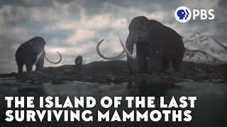
The Island of the Last Surviving Mammoths


Russia is classified as Emerging region: BRIC: Brazil, Russia, India, and China – Economies noted for their rapid growth and increasing influence on global affairs. The level of income is Upper middle income.
News – Latest Updates and Headlines from Wrangel
Stay informed with the most recent news and important headlines from Wrangel. Here’s a roundup of the latest developments.
Social Media Posts about Wrangel
Please note: The data used here has been primarily extracted from satellite readings. Deviations from exact values may occur, particularly regarding the height of elevations and population density. Land area and coastline measurements refer to average values at mean high tide.