Xiachuan Dao
Welcome to Xiachuan Dao, a Temperate island in the South China Sea, part of the majestic Pacific Ocean. This guide offers a comprehensive overview of what makes Xiachuan Dao unique – from its geography and climate to its population, infrastructure, and beyond. Dive into the details:
- Geography and Size: Explore the island’s size and location.
- Climate and Weather: Weather patterns and temperature.
- Topography and Nature: Uncover the natural wonders of the island.
- Infrastructure and Travelling: Insights on reaching, staying, and making the most of your visit.
- News and Headlines: Latest News.
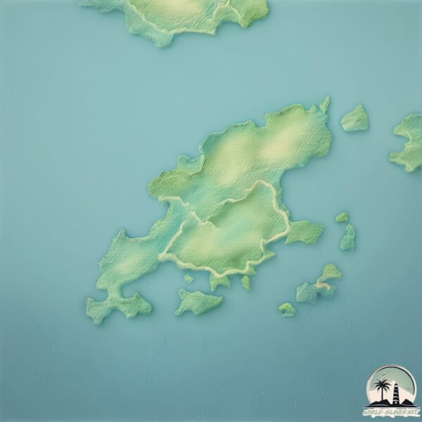
Geography and size of Xiachuan Dao
Size: 84.5 km²
Coastline: 80.2 km
Ocean: Pacific Ocean
Sea: South China Sea
Continent: Asia
Xiachuan Dao is a Medium Island spanning 85 km² with a coastline of 80 km.
Archipel: –
Tectonic Plate: Yangtze – A minor tectonic plate in East Asia, often considered a part of the Eurasian Plate. It’s primarily continental and covers the Yangtze River area in China, playing a significant role in the region’s geological stability.
The geographic heart of the island is pinpointed at these coordinates:
Latitude: 21.65622465 / Longitude: 112.60042214
Climate and weather of Xiachuan Dao
Climate Zone: Temperate
Climate Details: Monsoon-Influenced Humid Subtropical Climate
Temperature: Hot Summer
Climate Characteristics: Known for hot, humid summers with significant monsoon rains, contrasted by mild, drier winters.
Topography and nature of Xiachuan Dao
Timezone: UTC+08:00
Timezone places: Australia/Perth
Max. Elevation: 361 m
Mean Elevation: 106 m
Vegetation: Evergreen Broadleaf Forest
Tree Coverage: 53%
The mean elevation is 106 m. The highest elevation on the island reaches approximately 361 meters above sea level. The island is characterized by Hills: Gently sloping landforms with rounded tops, having a maximum elevation between 200 and 500 meters. Hills contribute to a varied landscape on islands.
Dominating Vegetation: Evergreen Broadleaf Forest
Characterized by dense, lush canopies of broadleaf trees that retain their leaves year-round. These forests are typically found in tropical and subtropical regions and are known for their high biodiversity. Xiachuan Dao has a tree cover of 53 %.
Vegetation: 12 vegetation zones – Exceptionally Diverse Island
Islands with more than ten vegetation zones are among the most ecologically rich and varied in the world. These islands are akin to miniature continents, boasting an incredible array of ecosystems. The sheer range of habitats, from high peaks to deep valleys, rainforests to deserts, creates a mosaic of life that is unparalleled. They are crucial for conservation and ecological studies.
Infrastructure and Travelling to Xiachuan Dao
Does the island have a public airport? no.
There is no public and scheduled airport on Xiachuan Dao. The nearest airport is Zhuhai Jinwan Airport, located 86 km away.
Does the island have a major port? no.
There are no major ports on Xiachuan Dao. The closest major port is MACAU, approximately 113 km away.
The mean population of Xiachuan Dao is 130 per km². Xiachuan Dao is Moderately Inhabited. The island belongs to China.
Continuing your journey, Shangchuan Dao is the next notable island, situated merely km away.
Life in China VLOG | summer holiday at xiachuan island 下川岛 with family 🏝 终于放假了~ [EP. 09]
![Life in China VLOG | summer holiday at xiachuan island 下川岛 with family 🏝 终于放假了~ [EP. 09]](https://i.ytimg.com/vi/eC8Oviq4lns/mqdefault.jpg)


China is classified as Emerging region: BRIC: Brazil, Russia, India, and China – Economies noted for their rapid growth and increasing influence on global affairs. The level of income is Upper middle income.
News – Latest Updates and Headlines from Xiachuan Dao
Stay informed with the most recent news and important headlines from Xiachuan Dao. Here’s a roundup of the latest developments.
Please note: The data used here has been primarily extracted from satellite readings. Deviations from exact values may occur, particularly regarding the height of elevations and population density. Land area and coastline measurements refer to average values at mean high tide.