Yasawa
Welcome to Yasawa, a Tropical island in the South Pacific Ocean, part of the majestic Pacific Ocean. This guide offers a comprehensive overview of what makes Yasawa unique – from its geography and climate to its population, infrastructure, and beyond. Dive into the details:
- Geography and Size: Explore the island’s size and location.
- Climate and Weather: Weather patterns and temperature.
- Topography and Nature: Uncover the natural wonders of the island.
- Infrastructure and Travelling: Insights on reaching, staying, and making the most of your visit.
- News and Headlines: Latest News.
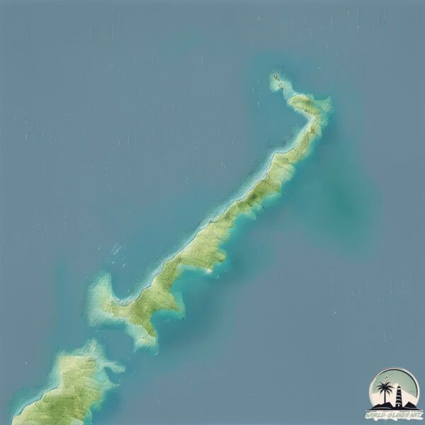
Geography and size of Yasawa
Size: 31.1 km²
Coastline: 82.3 km
Ocean: Pacific Ocean
Sea: South Pacific Ocean
Continent: Oceania
Yasawa is a Medium Island spanning 31 km² with a coastline of 82 km.
Archipel: Fiji – Fiji, an archipelago in the South Pacific Ocean, is composed of more than 300 islands and is famed for its stunning coral reefs, beautiful tropical beaches, and rich cultural heritage. It’s a popular tourist destination, offering a range of activities from snorkeling to exploring traditional Fijian villages. Fiji’s diverse population has created a unique blend of indigenous, Indian, Chinese, and European cultures.
Tectonic Plate: New Hebrides – A small plate in the southwestern Pacific Ocean, responsible for the New Hebrides Trench and known for its complex interaction with the Australian Plate.
The geographic heart of the island is pinpointed at these coordinates:
Latitude: -16.78416024 / Longitude: 177.51119325
Climate and weather of Yasawa
Climate Zone: Tropical
Climate Details: Tropical Monsoon Climate
Temperature: Hot
Climate Characteristics: Characterized by heavy rainfall, high humidity, and uniformly high temperatures, but with a distinct short dry season. It features a seasonal reversal of prevailing wind directions.
Topography and nature of Yasawa
Timezone: UTC+12:00
Timezone places: Pacific/Auckland
Max. Elevation: 67 m
Mean Elevation: 25 m
Vegetation: Evergreen Broadleaf Forest
Tree Coverage: 97%
The mean elevation is 25 m. The highest elevation on the island reaches approximately 67 meters above sea level. The island is characterized by Plains: Flat, low-lying lands characterized by a maximum elevation of up to 200 meters. On islands, plains are typically coastal lowlands or central flat areas.
Dominating Vegetation: Evergreen Broadleaf Forest
Characterized by dense, lush canopies of broadleaf trees that retain their leaves year-round. These forests are typically found in tropical and subtropical regions and are known for their high biodiversity. Yasawa has a tree cover of 97 %.
Vegetation: 6 vegetation zones – Very Highly Diverse Island
Islands in this range are ecological powerhouses, showcasing a wide array of vegetation zones. Each zone, from lush rainforests to arid scrublands, coastal mangroves to mountainous regions, contributes to a complex and interdependent ecosystem. These islands are often hotspots of biodiversity, supporting numerous species and intricate ecological processes.
Infrastructure and Travelling to Yasawa
Does the island have a public airport? no.
There is no public and scheduled airport on Yasawa. The nearest airport is Mana Island Airport, located 99 km away.
Does the island have a major port? no.
There are no major ports on Yasawa. The closest major port is LAUTOKA HARBOR, approximately 84 km away.
The mean population of Yasawa is 25 per km². Yasawa is Gently Populated. The island belongs to Fiji.
Continuing your journey, Nacula Island is the next notable island, situated merely km away.
Yasawa Islands 🇫🇯 Why These Remote Islands are Fiji's Best Kept Secret


Fiji is classified as Developing region: Regions characterized by lower income levels, with economies in the process of industrialization and modernization. The level of income is Lower middle income.
News – Latest Updates and Headlines from Yasawa
Stay informed with the most recent news and important headlines from Yasawa. Here’s a roundup of the latest developments.
Please note: The data used here has been primarily extracted from satellite readings. Deviations from exact values may occur, particularly regarding the height of elevations and population density. Land area and coastline measurements refer to average values at mean high tide.