Yokoate-shima
Welcome to Yokoate-shima, a Temperate island in the Eastern China Sea, part of the majestic Pacific Ocean. This guide offers a comprehensive overview of what makes Yokoate-shima unique – from its geography and climate to its population, infrastructure, and beyond. Dive into the details:
- Geography and Size: Explore the island’s size and location.
- Climate and Weather: Weather patterns and temperature.
- Topography and Nature: Uncover the natural wonders of the island.
- Infrastructure and Travelling: Insights on reaching, staying, and making the most of your visit.
- News and Headlines: Latest News.
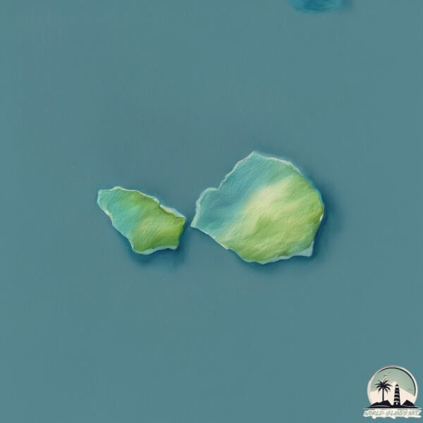
Geography and size of Yokoate-shima
Size: 2.785 km²
Coastline: 10.9 km
Ocean: Pacific Ocean
Sea: Eastern China Sea
Continent: Asia
Yokoate-shima is a Small Island spanning 2.8 km² with a coastline of 10.9 km.
Archipel: –
Tectonic Plate: Okinawa – Located in the East China Sea, near the Ryukyu Islands and Taiwan, it’s involved in the subduction zone between the Philippine Sea Plate and the Eurasian Plate.
The geographic heart of the island is pinpointed at these coordinates:
Latitude: 28.7989624 / Longitude: 128.99121373
Climate and weather of Yokoate-shima
Climate Zone: Temperate
Climate Details: Humid Subtropical Climate
Temperature: Hot Summer
Climate Characteristics: With continuous rainfall and hot summers, this climate is common in some coastal regions, supporting diverse vegetation.
Topography and nature of Yokoate-shima
Timezone: UTC+09:00
Timezone places: Asia/Tokyo
Max. Elevation: 230 m
Mean Elevation: 152 m
Vegetation: Deciduous Broadleaf Forest
Tree Coverage: 86%
The mean elevation is 152 m. The highest elevation on the island reaches approximately 230 meters above sea level. The island is characterized by Hills: Gently sloping landforms with rounded tops, having a maximum elevation between 200 and 500 meters. Hills contribute to a varied landscape on islands.
Dominating Vegetation: Deciduous Broadleaf Forest
Composed of broadleaf trees that shed their leaves seasonally. These forests are commonly found in temperate zones and experience distinct seasonal changes. Yokoate-shima has a tree cover of 86 %.
Vegetation: 5 vegetation zones – Highly Diverse Island
With five different vegetation zones, these islands offer a rich tapestry of ecosystems. The variety could include dense forests, open meadows, wetlands, coastal zones, and more. This level of diversity supports an intricate web of life, with each zone playing a vital role in the overall ecological health and balance of the island.
Infrastructure and Travelling to Yokoate-shima
Does the island have a public airport? no.
There is no public and scheduled airport on Yokoate-shima. The nearest airport is Amami Airport, located 89 km away.
Does the island have a major port? no.
There are no major ports on Yokoate-shima. The closest major port is KIN WAN, approximately 290 km away.
The mean population of Yokoate-shima is 6 per km². Yokoate-shima is Gently Populated. The island belongs to Japan.
Continuing your journey, Amami Ōshima is the next notable island, situated merely km away.
名瀬有良から横当島を撮影2011.07.30


Japan is classified as Developed region: G7: Group of Seven – Major advanced economies, including Canada, France, Germany, Italy, Japan, the United Kingdom, and the United States. The level of income is High income: OECD.
News – Latest Updates and Headlines from Yokoate-shima
Stay informed with the most recent news and important headlines from Yokoate-shima. Here’s a roundup of the latest developments.
Please note: The data used here has been primarily extracted from satellite readings. Deviations from exact values may occur, particularly regarding the height of elevations and population density. Land area and coastline measurements refer to average values at mean high tide.