Welcome to Yokoshima, a Temperate island in the Philippine Sea, part of the majestic Pacific Ocean. This guide offers a comprehensive overview of what makes Yokoshima unique – from its geography and climate to its population, infrastructure, and beyond. Dive into the details:
Geography and size of Yokoshima
Size: 0.161 km²
Coastline: 3.5 km
Ocean: Pacific Ocean
Sea: Philippine Sea
Continent: Asia
Yokoshima is a Tiny Island spanning 0.161 km² with a coastline of 3.5 km.
Archipel: Japan – An East Asian archipelago comprising four main islands and numerous smaller ones, known for its rich history, technological advances, and distinct culture.
Tectonic Plate: Amur – A minor tectonic plate in the region of the Amur River at the border of Russia and China, involved in complex interactions with the Pacific and Eurasian plates.
The geographic heart of the island is pinpointed at these coordinates:
Latitude: 32.93869732 / Longitude: 132.4047399
Climate and weather of Yokoshima
Climate Zone: Temperate
Climate Details: Humid Subtropical Climate
Temperature: Hot Summer
Climate Characteristics: With continuous rainfall and hot summers, this climate is common in some coastal regions, supporting diverse vegetation.
Topography and nature of Yokoshima
Timezone: UTC+09:00
Timezone places: Asia/Tokyo
Max. Elevation: 0 m
Mean Elevation: -2 m
Vegetation: Evergreen Broadleaf Forest
Tree Coverage: 30%
The mean elevation is -2 m. The highest elevation on the island reaches approximately 0 meters above sea level. The island is characterized by Plains: Flat, low-lying lands characterized by a maximum elevation of up to 200 meters. On islands, plains are typically coastal lowlands or central flat areas.
Dominating Vegetation: Evergreen Broadleaf Forest
Characterized by dense, lush canopies of broadleaf trees that retain their leaves year-round. These forests are typically found in tropical and subtropical regions and are known for their high biodiversity. Yokoshima has a tree cover of 30 %.
Vegetation: 1 vegetation zones – Minimal Diversity Island
These islands exhibit the most basic level of ecological diversity, often characterized by a single dominant vegetation type. This could be due to extreme environmental conditions, limited land area, or significant human impact. They represent unique ecosystems where specific species have adapted to thrive in these singular environments.
Infrastructure and Travelling to Yokoshima
Does the island have a public airport? no.
There is no public and scheduled airport on Yokoshima. The nearest airport is Oita Airport, located 95 km away.
Does the island have a major port? no.
There are no major ports on Yokoshima. The closest major port is UWAJIMA KO, approximately 35 km away.
The mean population of Yokoshima is 94 per km². Yokoshima is Gently Populated. The island belongs to Japan.
Continuing your journey, Yashiro-jima is the next notable island, situated merely km away.
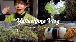
Yakushima: an Oasis of Unspoilt Nature | World Natural Heritage in Japan
Yakushima, located off the southern tip of Kagoshima, is a natural haven filled with enchanting forests, rich biodiversity, and ...Yakushima: an Oasis of Unspoilt Nature | World Natural Heritage in Japan
Yakushima, located off the southern tip of Kagoshima, is a natural ...
Yakushima, located off the southern tip of Kagoshima, is a natural haven filled with enchanting forests, rich biodiversity, and ...
5 days in yakushima | local food, ancient cedar forrest, island reset
This week long retreat at Yakushima gave me a moment to breathe, soak ...
This week long retreat at Yakushima gave me a moment to breathe, soak in nature & absorb the peaceful vibes that radiated from ...
Exploring Hidden Yakushima Island | Japans Secret Paradise
Yakushima Island (屋久島) is a true island paradise, hidden in southern ...
Yakushima Island (屋久島) is a true island paradise, hidden in southern Japan. Yakushima is an island gem that holds many ...
THE MOST MAGICAL PLACE IN JAPAN | Yakushima Island, Kagoshima | Travel Hidden Gem
How is this place real? Shiratani Unsuikyo is definitely THE MOST ...
How is this place real? Shiratani Unsuikyo is definitely THE MOST MAGICAL PLACE IN JAPAN located on Yakushima Island, ...
The Best Healing Experience in Japan! Visit Yakushima🇯🇵
If you come to Japan, there's one place that I recommend to visit even ...
If you come to Japan, there's one place that I recommend to visit even more than Tokyo, Kyoto, or Osaka. Could you guess where ...
What to do in Yakushima ? | Explore Japan
This video introduces Yakushima Island, a World Heritage Site located ...
This video introduces Yakushima Island, a World Heritage Site located in the south of Japan! I visited twice because of its great ...
Spontaneous Yakushima Trip 2 | Waterfalls, Wildlife & Family Chaos
japanvlog #japanesecountryside #countrylife #familyvlog #dailyvlog ...
japanvlog #japanesecountryside #countrylife #familyvlog #dailyvlog #yakushima Welcome back to the remote Japanese ...
The soul of Japan |Yakushima|OFFICIAL TRAILER
People from all over the world agree that Japan is special. The ...
People from all over the world agree that Japan is special. The Japanese spiritual world — where people face nature and life itself ...
4 Days in Yakushima | Exploring Japan’s Most Magical Island
4 Days in Yakushima | Hiking Through The Island That Inspired Princess ...
4 Days in Yakushima | Hiking Through The Island That Inspired Princess Mononoke For four days, my brother and I explored ...
Yakushima Island Frogs | Secret Wilderness: Japan | BBC Earth
On Yakushima Island, we discover that it's wet, has lots of beautiful ...
On Yakushima Island, we discover that it's wet, has lots of beautiful woodland, and frogs. Stunning documentary footage from the ...
Exploring The Mysterious Yakushima Island
Join us on a journey to explore the mysterious beauty of Yakushima ...
Join us on a journey to explore the mysterious beauty of Yakushima Island. From stunning landscapes to exotic foods, this 4k ...
Yakushima - Arriving in Japan's Remote Island
Join us on an unforgettable journey to Yakushima! We took a 4-hour ...
Join us on an unforgettable journey to Yakushima! We took a 4-hour ferry to this hidden gem, rented a car, enjoyed traditional ...
Hiking Japan's Yakushima Island | Wrapped In Green
A big thank you to Macpac Japan, who were excited to work with me to ...
A big thank you to Macpac Japan, who were excited to work with me to tell this story through Yakushima Island. Go check out their ...
I Spent 4 Days Hiking In The RAINIEST Place In Japan: Yakushima
Yakushima has some of the most ancient, wild and untamed landscapes ...
Yakushima has some of the most ancient, wild and untamed landscapes I've ever seen a hiking here was such an highlight.
Yakushima (UNESCO/NHK)
Located in the interior of Yaku Island, at the meeting-point of the ...
Located in the interior of Yaku Island, at the meeting-point of the palaearctic and oriental biotic regions, Yakushima exhibits a rich ...
Postcards from Japan: Hiking on Yakushima island
This week in Postcards we visit Yakushima island off the southernmost ...
This week in Postcards we visit Yakushima island off the southernmost tip of mainland Japan. This site of outstanding natural ...
JAPAN VLOG 10. Walking tours to see the oldest tree in Yakushima, Kagoshima
yakushima #kagoshima #japan #sightseeing #vlog Hi, guys! It's Mayu. ...
yakushima #kagoshima #japan #sightseeing #vlog Hi, guys! It's Mayu. Welcome back to my channel. This was one of the hardest ...
YAKUSHIMA Japans grünste Insel! Am Schauplatz von Prinzessin Mononoke
Dieser Link bringt Euch zu Instagram, Facebook, meinem Podcast und co. ...
Explore Yakushima: Japan’s Wild Island Paradise | Nature, Hiking & Adventure in Kyushu
Just 70 minutes from Fukuoka by direct JAL eco-prop plane, Yakushima ...
Just 70 minutes from Fukuoka by direct JAL eco-prop plane, Yakushima feels like another world. Full report in English ...
We Visited Japan's BEST KEPT SECRET: Yakushima Island
In this travel vlog, we spent an three days on Yakushima Island. Known ...
In this travel vlog, we spent an three days on Yakushima Island. Known for its' lush ancient forests, picturesque waterfalls and ...
Exploring the Enchanting Yakushima: Japan's Natural Wonderland
Discover the enchanting island of Yakushima! This video takes you ...
Discover the enchanting island of Yakushima! This video takes you through the breathtaking landscapes and rich heritage of ...
Exploring Yakushima Island For 48 Hours | This is Princess Mononoke's Island
Get up to 10% off anything on Klook - Use my code: RICHARDLIUKLOOK ...
Exploring Japan's Secret Garden | Yakushima Island
Mystical, unreal, green, and out of this world majestic. Welcome to ...
Mystical, unreal, green, and out of this world majestic. Welcome to the Princess Mononoke inspired island of Yakushima.
The soul of Japan |Yakushima
People from all over the world agree that Japan is a special place. In ...
People from all over the world agree that Japan is a special place. In Japan, there is a spiritual way of life — one that faces each ...
Japan's Secret FairyTale Island You NEED To Visit
This location is absolutely incredible! Most people have never even ...
This location is absolutely incredible! Most people have never even heard of Yakushima, an absolute hidden gem in Southern ...
Japan is classified as Developed region: G7: Group of Seven – Major advanced economies, including Canada, France, Germany, Italy, Japan, the United Kingdom, and the United States. The level of income is High income: OECD.
News – Latest Updates and Headlines from Yokoshima
Stay informed with the most recent news and important headlines from Yokoshima. Here’s a roundup of the latest developments.
Loading...
Please note: The data used here has been primarily extracted from satellite readings. Deviations from exact values may occur, particularly regarding the height of elevations and population density. Land area and coastline measurements refer to average values at mean high tide.