Yuzhny
Welcome to Yuzhny, a Polar island in the Kara Sea, part of the majestic Arctic Ocean. This guide offers a comprehensive overview of what makes Yuzhny unique – from its geography and climate to its population, infrastructure, and beyond. Dive into the details:
- Geography and Size: Explore the island’s size and location.
- Climate and Weather: Weather patterns and temperature.
- Topography and Nature: Uncover the natural wonders of the island.
- Infrastructure and Travelling: Insights on reaching, staying, and making the most of your visit.
- News and Headlines: Latest News.
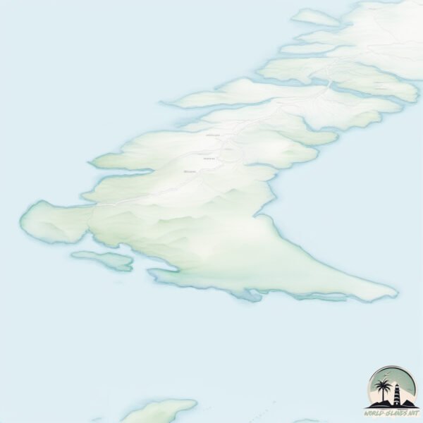
Geography and size of Yuzhny
Size: 32343 km²
Coastline: 5109 km
Ocean: Arctic Ocean
Sea: Kara Sea
Continent: Europe
Yuzhny is a Giant Island spanning 32343 km² with a coastline of 5109 km.
Archipel: Novaya Zemlya – A remote and rugged archipelago in the Arctic Ocean of northern Russia, known for its severe climate and important role in Russian Arctic exploration.
Tectonic Plate: Eurasia – One of the world’s largest tectonic plates, the Eurasian Plate covers a significant portion of Europe and Asia. It’s characterized by diverse geological features, including the Ural Mountains, the European Plain, and the Himalayas formed from its collision with the Indian Plate.
The geographic heart of the island is pinpointed at these coordinates:
Latitude: 71.96951213 / Longitude: 54.39055484
Climate and weather of Yuzhny
Climate Zone: Polar
Climate Details: Tundra
Temperature: Cold
Climate Characteristics: The tundra climate features long, extremely cold winters and short, cool summers. Vegetation is limited to mosses, lichens, and small shrubs due to the low temperatures and short growing seasons. Biodiversity is low, but some specialized species thrive.
Topography and nature of Yuzhny
Timezone: UTC+04:00
Timezone places: Europe/Moscow
Max. Elevation: 1212 m
Mean Elevation: 194 m
Vegetation: Sparse Vegetation
Tree Coverage: 4%
The mean elevation is 194 m. The highest elevation on the island reaches approximately 1212 meters above sea level. The island is characterized by Plateau: Elevated flatlands rising sharply above the surrounding area, with a maximum elevation over 500 meters but a mean elevation less than 300 meters, forming unique highland areas on islands.
Dominating Vegetation: Sparse Vegetation
These regions have limited plant growth, typically due to extreme conditions like aridity or poor soils. Vegetation is scattered and consists of hardy plant species. Yuzhny has a tree cover of 4 %.
Vegetation: 10 vegetation zones – Very Highly Diverse Island
Islands in this range are ecological powerhouses, showcasing a wide array of vegetation zones. Each zone, from lush rainforests to arid scrublands, coastal mangroves to mountainous regions, contributes to a complex and interdependent ecosystem. These islands are often hotspots of biodiversity, supporting numerous species and intricate ecological processes.
Infrastructure and Travelling to Yuzhny
Does the island have a public airport? no.
There is no public and scheduled airport on Yuzhny. The nearest airport is Naryan Mar Airport, located 356 km away.
Does the island have a major port? no.
There are no major ports on Yuzhny. The closest major port is MEZEN, approximately 1040 km away.
The mean population of Yuzhny is 0 per km². Yuzhny is Uninhabited. The island belongs to Russia.
The name of the island resonates across different cultures and languages. Here is how it is known around the world: Arabic: نوفايا زيمليا; German: Nowaja Semlja; Spanish: Nueva Zembla; French: Nouvelle-Zemble; Portuguese: Nova Zembla; Russian: Новая Земля; Chinese: 新地岛
Continuing your journey, Kusova Zemlya is the next notable island, situated merely km away.
Why did Russia set up a human forbidden place in the Arctic Ocean?#map #world


Russia is classified as Emerging region: BRIC: Brazil, Russia, India, and China – Economies noted for their rapid growth and increasing influence on global affairs. The level of income is Upper middle income.
News – Latest Updates and Headlines from Yuzhny
Stay informed with the most recent news and important headlines from Yuzhny. Here’s a roundup of the latest developments.
Social Media Posts about Yuzhny
Please note: The data used here has been primarily extracted from satellite readings. Deviations from exact values may occur, particularly regarding the height of elevations and population density. Land area and coastline measurements refer to average values at mean high tide.