Welcome to Bucare, a Tropical island in the Caribbean Sea, part of the majestic Atlantic Ocean. This guide offers a comprehensive overview of what makes Bucare unique – from its geography and climate to its population, infrastructure, and beyond. Dive into the details:
Geography and size of Bucare
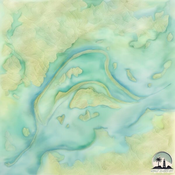
Size: 15.9 km²
Coastline: 24.7 km
Ocean: Atlantic Ocean
Sea: Caribbean Sea
Continent: South America
Bucare is a Medium Island spanning 16 km² with a coastline of 25 km.
Archipel: –
Tectonic Plate: South America – A major plate covering the South American continent and part of the Atlantic Ocean, known for the Andes mountain range and significant seismic and volcanic activity.
The geographic heart of the island is pinpointed at these coordinates:
Latitude: 8.32952714 / Longitude: -63.23036532
Climate and weather of Bucare
Climate Zone: Tropical
Climate Details: Tropical Savanna, Wet
Temperature: Hot
Climate Characteristics: Defined by distinct wet and dry seasons with high temperatures year-round. Pronounced rainfall occurs during the wet season, while the dry season is marked by drought.
Topography and nature of Bucare
Timezone: UTC-04:30
Timezone places: America/Caracas
Max. Elevation: 16 m
Mean Elevation: 15 m
Vegetation: Wetland
Tree Coverage: 22%
The mean elevation is 15 m. The highest elevation on the island reaches approximately 16 meters above sea level. The island is characterized by Plains: Flat, low-lying lands characterized by a maximum elevation of up to 200 meters. On islands, plains are typically coastal lowlands or central flat areas.
Dominating Vegetation: Wetland
These areas are saturated with water, either permanently or seasonally, and support aquatic plants. Wetlands are important for biodiversity and water filtration. Bucare has a tree cover of 22 %.
Vegetation: 9 vegetation zones – Very Highly Diverse Island
Islands in this range are ecological powerhouses, showcasing a wide array of vegetation zones. Each zone, from lush rainforests to arid scrublands, coastal mangroves to mountainous regions, contributes to a complex and interdependent ecosystem. These islands are often hotspots of biodiversity, supporting numerous species and intricate ecological processes.
Infrastructure and Travelling to Bucare
Does the island have a public airport? no.
There is no public and scheduled airport on Bucare. The nearest airport is General Manuel Carlos Piar International Airport, located 48 km away.
Does the island have a major port? no.
There are no major ports on Bucare. The closest major port is CIUDAD BOLIVAR, approximately 37 km away.
The mean population of Bucare is 5 per km². Bucare is Gently Populated. The island belongs to Venezuela.
Continuing your journey, de Mamo is the next notable island, situated merely km away.
How I imagine the Vox and Alastor fight in Season 2 #hazbinhotel
How I imagine the Vox and Alastor fight in Season 2 #hazbinhotel
🐍How To Enter Domains As Megumi🐍 (Roblox Jujutsu Shenanigans) #tsbg #jjk #jujutsushenanigans #roblox
You may also lose a ton of health because of this (it's perfectly ...
You may also lose a ton of health because of this (it's perfectly normal for that to happen)
Have you ever wonder how to duck dive while surfing? This is how you can do it 🏄 #RoadToParis2024
(IG) tombegly Want to watch live sport and original documentaries for ...
(IG) tombegly Want to watch live sport and original documentaries for free? Check out our website: ...
How to drill a hole in a granite countertop #shorts
How to Remove a Conch from the Shell
Luì prova il vento fortissimo in Islanda! #mecontrote
Cutting Corian Solid Surface with a Jigsaw #shorts
In this quick video, we'll show you how to cut Corian – a popular ...
In this quick video, we'll show you how to cut Corian – a popular brand of solid surface countertop material – using a jigsaw.
How to Drill Holes into Quartz & Granite Counter
Quick & EASY Step-by-Step on how to drill your own holes into your ...
Quick & EASY Step-by-Step on how to drill your own holes into your quartz or granite countertops. Or really any solid surface you ...
How to make a hole in granite larger #diy #granite #tools
Bucare nel posto più isolato d'Islanda - [Islanda on the road] #8
Ottavo episodio della serie on the road per l'Islanda. Continua la ...
Ottavo episodio della serie on the road per l'Islanda. Continua la nostra esplorazione dei Fiordi Occidentali, alla scoperta dei ...
Shaggy - Bridges ft. Chronixx (Official Video)
From the album, "Out of Many, One Music". iTunes: ...
The secret to hanging garland on a mantel #homehacks #amazonfinds
How to Find WiFi Password Using CMD (Works on Windows 10/11) 🔐💻 #wifi #cmd #viral #shortsfeed
Forgot Your Wi-Fi Password? Here's How to Find It Using CMD (No Router ...
Forgot Your Wi-Fi Password? Here's How to Find It Using CMD (No Router Login Needed!) In this quick and easy tutorial, learn ...
NEW UPDATED EASIEST WAY TO BREAK BEDROCK IN MINECRAFT 1.21.11
NEW UPDATED EASIEST WAY TO BREAK BEDROCK IN MINECRAFT 1.21.11 ...
NEW UPDATED EASIEST WAY TO BREAK BEDROCK IN MINECRAFT 1.21.11 *Important Info* - *Version:* Minecraft Java ...
Paky - Bronx freestyle (No Flockin RMX)
BUCARE LEON,ILOILO!Come and Visit The Little Bagio of Iloilo
Come and Visit BUCARE LEON,ILOILO!The Little Bagio.
Come and Visit BUCARE LEON,ILOILO!The Little Bagio.
🎄 Holiday Hacks, Part 6: Two Fun Renter Friendly Ways to Hang Garland for a Festive Look!
BOTH Are Temporary & Renter Friendly! Holiday Hacks You Can't ...
BOTH Are Temporary & Renter Friendly! Holiday Hacks You Can't Miss—Part Six! Discover two fabulous ways to secure ...
How To Break Bedrock In Minecraft | Any Java Version
Here's how to break bedrock in Minecraft 1.21.5. This will let you ...
Here's how to break bedrock in Minecraft 1.21.5. This will let you break the nether roof. Shopping List 1 Obsidian (optional) 1 ...
Making Holes In Tinkered | 3D modeling
this is a quick tutorial on how to make holes in tinkered. If there's ...
this is a quick tutorial on how to make holes in tinkered. If there's anything you'd like to learn, leave it in the comments, and maybe ...
Bucare in compagnia (Norma in volo)
Perche' starsene a fare il tergicristallo avanti-indietro sul costone ...
Perche' starsene a fare il tergicristallo avanti-indietro sul costone quando c'e' una bella giornata...fiacca...dove poter bucare con ...
Christmas ORNAMENT CEILING Tutorial!! YOU Can Do It TOO!
Would you LOVE this in your home? CHRISTMASERS like to decorate every ...
Would you LOVE this in your home? CHRISTMASERS like to decorate every inch during the holidays, so I couldn't forget to show ...
Unboxing - - Orinoquia Bucare Y330 (Huawei Ascend Y330)
Despues de tanto tiempo sin subir videos llego nuevamente cargado de ...
Despues de tanto tiempo sin subir videos llego nuevamente cargado de material, si, cargado, compensando tanto tiempo perdido ...
4 inch Diamond core drill cavity wall
4 inch Diamond core drill double skin cavity wall, short arbour ...
4 inch Diamond core drill double skin cavity wall, short arbour Disclaimer Due to factors beyond the control of backstreetmechanic ...
Turn your Apple AirTag into a stealthy item tracker! #Shorts
Apple #AirTags #iPhone Disclaimer: Don't use the methods shown in this ...
Apple #AirTags #iPhone Disclaimer: Don't use the methods shown in this video to discreetly place AirTag trackers on other ...
Quante scavate occorrono per trovare l’acqua del mare in fondo alla spiaggia? 🤙🏻 #bellagianda
Venezuela is classified as Emerging region: G20: Group of Twenty – Major economies comprising both developed and emerging countries, representing the world’s largest economies. The level of income is Upper middle income.
News – Latest Updates and Headlines from Bucare
Stay informed with the most recent news and important headlines from Bucare. Here’s a roundup of the latest developments.
Loading...
Please note: The data used here has been primarily extracted from satellite readings. Deviations from exact values may occur, particularly regarding the height of elevations and population density. Land area and coastline measurements refer to average values at mean high tide.


![Bucare nel posto più isolato d'Islanda - [Islanda on the road] #8](https://i.ytimg.com/vi/y9JAsVqduew/mqdefault.jpg)