
Bekana Island
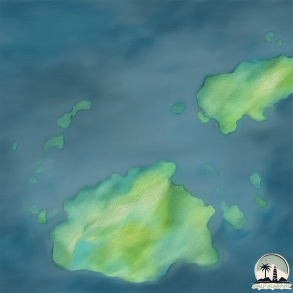
Welcome to Bekana Island, a Tropical island in the South Pacific Ocean, part of the majestic Pacific Ocean. This guide offers a comprehensive overview of what makes Bekana Island unique – from its geography and climate to its population, infrastructure, and beyond. Dive into the details:
- Geography and Size: Explore the island’s size and location.
- Climate and Weather: Weather patterns and temperature.
- Topography and Nature: Uncover the natural wonders of the island.
- Infrastructure and Travelling: Insights on reaching, staying, and making the most of your visit.
- News and Headlines: Latest News.
Geography and size of Bekana Island
Size: 0.913 km²
Coastline: 4.5 km
Ocean: Pacific Ocean
Sea: South Pacific Ocean
Continent: Oceania
Bekana Island is a Tiny Island spanning 0.913 km² with a coastline of 4.5 km.
Archipel: Fiji – Fiji, an archipelago in the South Pacific Ocean, is composed of more than 300 islands and is famed for its stunning coral reefs, beautiful tropical beaches, and rich cultural heritage. It’s a popular tourist destination, offering a range of activities from snorkeling to exploring traditional Fijian villages. Fiji’s diverse population has created a unique blend of indigenous, Indian, Chinese, and European cultures.
Tectonic Plate: Australia – A major tectonic plate covering Australia, New Zealand, and parts of the Indian and Pacific Oceans, known for its relative stability and occasional seismic activity.
The geographic heart of the island is pinpointed at these coordinates:
Latitude: -17.56511241 / Longitude: 177.47083791
Climate and weather of Bekana Island
Climate Zone: Tropical
Climate Details: Tropical Rainforest Climate
Temperature: Hot
Climate Characteristics: This climate is typified by heavy rainfall throughout the year, high humidity, and consistently high temperatures, leading to lush rainforests and rich biodiversity. Seasonal temperature variations are minimal.
Topography and nature of Bekana Island
Timezone: UTC+12:00
Timezone places: Pacific/Auckland
Max. Elevation: 1 m
Mean Elevation: -2 m
Vegetation: Evergreen Broadleaf Forest
Tree Coverage: 86%
The mean elevation is -2 m. The highest elevation on the island reaches approximately 1 meters above sea level. The island is characterized by Plains: Flat, low-lying lands characterized by a maximum elevation of up to 200 meters. On islands, plains are typically coastal lowlands or central flat areas.
Dominating Vegetation: Evergreen Broadleaf Forest
Characterized by dense, lush canopies of broadleaf trees that retain their leaves year-round. These forests are typically found in tropical and subtropical regions and are known for their high biodiversity. Bekana Island has a tree cover of 86 %.
Vegetation: 1 vegetation zones – Minimal Diversity Island
These islands exhibit the most basic level of ecological diversity, often characterized by a single dominant vegetation type. This could be due to extreme environmental conditions, limited land area, or significant human impact. They represent unique ecosystems where specific species have adapted to thrive in these singular environments.
Infrastructure and Travelling to Bekana Island
Does the island have a public airport? no.
There is no public and scheduled airport on Bekana Island. The nearest airport is Nadi International Airport, located 18 km away.
Does the island have a major port? no.
There are no major ports on Bekana Island. The closest major port is LAUTOKA HARBOR, approximately 1 km away.
The mean population of Bekana Island is 420 per km². Bekana Island is Moderately Inhabited. The island belongs to Fiji.
Continuing your journey, Malolo Island is the next notable island, situated merely km away.
Fiji is classified as Developing region: Regions characterized by lower income levels, with economies in the process of industrialization and modernization. The level of income is Lower middle income.
News – Latest Updates and Headlines from Bekana Island
Stay informed with the most recent news and important headlines from Bekana Island. Here’s a roundup of the latest developments.
- Rassie responds to Jake White's claims on Ireland - Rugby365by "fiji" - Google News on 17 November 2026
Rassie responds to Jake White's claims on Ireland Rugby365
- Fiji sugarcane production falls to decade low of 1.1 million tonnes as of October 26, 2026 - ChiniMandiby "fiji" - Google News on 17 November 2026
Fiji sugarcane production falls to decade low of 1.1 million tonnes as of October 26, 2026 ChiniMandi
- Ireland rugby jury: Reviewing the victory over Fiji and looking ahead to Springboks challenge - Irish Independentby "fiji" - Google News on 17 November 2026
Ireland rugby jury: Reviewing the victory over Fiji and looking ahead to Springboks challenge Irish Independent
- Cyclone Xavier set to strengthen to Category 4 near Cook Islands - Pacific Media Networkby "fiji" - Google News on 17 November 2026
Cyclone Xavier set to strengthen to Category 4 near Cook Islands Pacific Media Network
- Skipper Cup and Farebrother performers on Fiji 7s radar - FBC Newsby "fiji" - Google News on 17 November 2026
Skipper Cup and Farebrother performers on Fiji 7s radar FBC News
- Fiji battles rising seas - NHKニュースby "fiji" - Google News on 17 November 2026
Fiji battles rising seas NHKニュース
- White seeks answers as Fiji prepare for Italy test - Pacific Media Networkby "fiji" - Google News on 17 November 2026
White seeks answers as Fiji prepare for Italy test Pacific Media Network
- Poor show | Boivert laments ‘waste of talent’ in Flying Fijians - The Fiji Timesby "fiji" - Google News on 17 November 2026
Poor show | Boivert laments ‘waste of talent’ in Flying Fijians The Fiji Times
- Olympic gold medallist Semi Kunatani to be inducted into Rugbytown Walk of Fame - Fijivillageby "fiji" - Google News on 17 November 2026
Olympic gold medallist Semi Kunatani to be inducted into Rugbytown Walk of Fame Fijivillage
- Fiji Airways National 7s teams present i-tatau ahead of Dubai campaign - Fijivillageby "fiji" - Google News on 17 November 2026
Fiji Airways National 7s teams present i-tatau ahead of Dubai campaign Fijivillage
Please note: The data used here has been primarily extracted from satellite readings. Deviations from exact values may occur, particularly regarding the height of elevations and population density. Land area and coastline measurements refer to average values at mean high tide.