Broughton
Welcome to Broughton, a Temperate island in the Tasman Sea, part of the majestic Pacific Ocean. This guide offers a comprehensive overview of what makes Broughton unique – from its geography and climate to its population, infrastructure, and beyond. Dive into the details:
- Geography and Size: Explore the island’s size and location.
- Climate and Weather: Weather patterns and temperature.
- Topography and Nature: Uncover the natural wonders of the island.
- Infrastructure and Travelling: Insights on reaching, staying, and making the most of your visit.
- News and Headlines: Latest News.
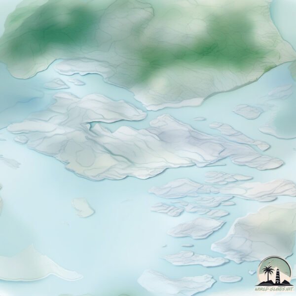
Geography and size of Broughton
Size: 1.491 km²
Coastline: 10.6 km
Ocean: Pacific Ocean
Sea: Tasman Sea
Continent: Oceania
Broughton is a Small Island spanning 1.5 km² with a coastline of 10.6 km.
Archipel: –
Tectonic Plate: Australia – A major tectonic plate covering Australia, New Zealand, and parts of the Indian and Pacific Oceans, known for its relative stability and occasional seismic activity.
The geographic heart of the island is pinpointed at these coordinates:
Latitude: -32.73962582 / Longitude: 149.62415364
Climate and weather of Broughton
Climate Zone: Temperate
Climate Details: Warm-Summer Mediterranean Climate
Temperature: Warm Summer
Climate Characteristics: Characterized by warm, dry summers and mild, wet winters, typical of coastal areas with abundant sunshine Rain is more common in the winter months, maintaining a moderate climate.
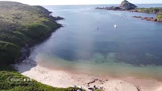
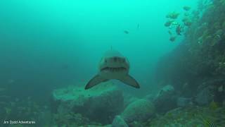
Topography and nature of Broughton
Timezone: UTC+10:00
Timezone places: Australia/Sydney
Max. Elevation: 13 m
Mean Elevation: 4 m
Vegetation: Evergreen Broadleaf Forest
Tree Coverage: 54%
The mean elevation is 4 m. The highest elevation on the island reaches approximately 13 meters above sea level. The island is characterized by Plains: Flat, low-lying lands characterized by a maximum elevation of up to 200 meters. On islands, plains are typically coastal lowlands or central flat areas.
Dominating Vegetation: Evergreen Broadleaf Forest
Characterized by dense, lush canopies of broadleaf trees that retain their leaves year-round. These forests are typically found in tropical and subtropical regions and are known for their high biodiversity. Broughton has a tree cover of 54 %.
Vegetation: 5 vegetation zones – Highly Diverse Island
With five different vegetation zones, these islands offer a rich tapestry of ecosystems. The variety could include dense forests, open meadows, wetlands, coastal zones, and more. This level of diversity supports an intricate web of life, with each zone playing a vital role in the overall ecological health and balance of the island.
Infrastructure and Travelling to Broughton
Does the island have a public airport? no.
There is no public and scheduled airport on Broughton. The nearest airport is Newcastle Airport, located 56 km away.
Does the island have a major port? no.
There are no major ports on Broughton. The closest major port is ESPERANCE, approximately 60 km away.
The mean population of Broughton is 0 per km². Broughton is Uninhabited. The island belongs to Australia.
Continuing your journey, Kooragang is the next notable island, situated merely km away.
Broughton Island Part 1


Australia is classified as Developed region: nonG7: Developed economies outside of the Group of Seven, characterized by high income and advanced economic structures. The level of income is High income: OECD.
News – Latest Updates and Headlines from Broughton
Stay informed with the most recent news and important headlines from Broughton. Here’s a roundup of the latest developments.
Please note: The data used here has been primarily extracted from satellite readings. Deviations from exact values may occur, particularly regarding the height of elevations and population density. Land area and coastline measurements refer to average values at mean high tide.