Galite
Welcome to Galite, a Temperate island in the Mediterranean Sea – Western Basin, part of the majestic Atlantic Ocean. This guide offers a comprehensive overview of what makes Galite unique – from its geography and climate to its population, infrastructure, and beyond. Dive into the details:
- Geography and Size: Explore the island’s size and location.
- Climate and Weather: Weather patterns and temperature.
- Topography and Nature: Uncover the natural wonders of the island.
- Infrastructure and Travelling: Insights on reaching, staying, and making the most of your visit.
- News and Headlines: Latest News.
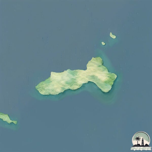
Geography and size of Galite
Size: 7.278 km²
Coastline: 14.8 km
Ocean: Atlantic Ocean
Sea: Mediterranean Sea – Western Basin
Continent: Africa
Galite is a Small Island spanning 7.3 km² with a coastline of 14.8 km.
Archipel: –
Tectonic Plate: Aegean Sea – Located in the eastern Mediterranean, this microplate is characterized by seismic and volcanic activity due to its interaction with the Eurasian and African Plates.
The geographic heart of the island is pinpointed at these coordinates:
Latitude: 37.52566715 / Longitude: 8.9304251
Climate and weather of Galite
Climate Zone: Temperate
Climate Details: Hot-Summer Mediterranean Climate
Temperature: Hot Summer
Climate Characteristics: Characterized by hot, dry summers and mild, wet winters, typical of coastal areas with abundant sunshine.
Topography and nature of Galite
Timezone: UTC+01:00
Timezone places: Europe/Paris
Max. Elevation: 207 m
Mean Elevation: 118 m
Vegetation: Open Woodland
Tree Coverage: 49%
The mean elevation is 118 m. The highest elevation on the island reaches approximately 207 meters above sea level. The island is characterized by Hills: Gently sloping landforms with rounded tops, having a maximum elevation between 200 and 500 meters. Hills contribute to a varied landscape on islands.
Dominating Vegetation: Open Woodland
Characterized by sparsely distributed trees with open canopy allowing sunlight to penetrate, supporting grasses and shrubs underneath. Often found in drier or transitional environments. Galite has a tree cover of 49 %.
Vegetation: 4 vegetation zones – Diverse Island
Four distinct vegetation zones mark these islands as ecologically diverse. They might feature varied landscapes such as forests, beaches, grasslands, and rocky areas. Such diversity reflects the island’s complex ecological interactions and varied habitats, which can support a rich array of wildlife and plant species.
Infrastructure and Travelling to Galite
Does the island have a public airport? no.
There is no public and scheduled airport on Galite. The nearest airport is Tabarka-Aïn Draham International Airport, located 59 km away.
Does the island have a major port? no.
There are no major ports on Galite. The closest major port is TABARKA, approximately 63 km away.
The mean population of Galite is 64 per km². Galite is Gently Populated. The island belongs to Italy.
Continuing your journey, Sant’Antioco is the next notable island, situated merely km away.
Italy is classified as Developed region: G7: Group of Seven – Major advanced economies, including Canada, France, Germany, Italy, Japan, the United Kingdom, and the United States. The level of income is High income: OECD.
News – Latest Updates and Headlines from Galite
Stay informed with the most recent news and important headlines from Galite. Here’s a roundup of the latest developments.
Please note: The data used here has been primarily extracted from satellite readings. Deviations from exact values may occur, particularly regarding the height of elevations and population density. Land area and coastline measurements refer to average values at mean high tide.