
Grafton
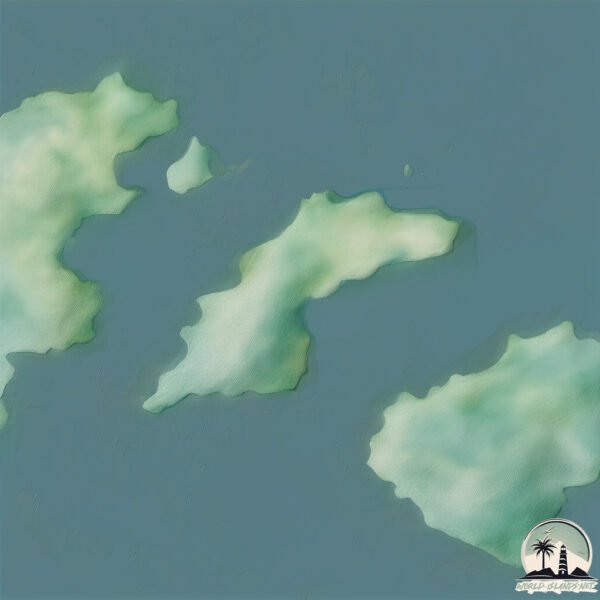
Welcome to Grafton, a Polar island in the South Pacific Ocean, part of the majestic Pacific Ocean. This guide offers a comprehensive overview of what makes Grafton unique – from its geography and climate to its population, infrastructure, and beyond. Dive into the details:
- Geography and Size: Explore the island’s size and location.
- Climate and Weather: Weather patterns and temperature.
- Topography and Nature: Uncover the natural wonders of the island.
- Infrastructure and Travelling: Insights on reaching, staying, and making the most of your visit.
- News and Headlines: Latest News.
Geography and size of Grafton
Size: 1.992 km²
Coastline: 10.6 km
Ocean: Pacific Ocean
Sea: South Pacific Ocean
Continent: South America
Grafton is a Small Island spanning 2 km² with a coastline of 10.6 km.
Archipel: –
Tectonic Plate: Scotia – Situated in the Southern Ocean, surrounding the Scotia Sea, between South America and Antarctica, known for the Scotia Arc and active seismicity.
The geographic heart of the island is pinpointed at these coordinates:
Latitude: -54.16503158 / Longitude: -73.05255869
Climate and weather of Grafton
Climate Zone: Polar
Climate Details: Tundra
Temperature: Cold
Climate Characteristics: The tundra climate features long, extremely cold winters and short, cool summers. Vegetation is limited to mosses, lichens, and small shrubs due to the low temperatures and short growing seasons. Biodiversity is low, but some specialized species thrive.
Topography and nature of Grafton
Timezone: UTC-04:00
Timezone places: America/La_Paz
Max. Elevation: 60 m
Mean Elevation: 49 m
Vegetation: Open Woodland
Tree Coverage: 84%
The mean elevation is 49 m. The highest elevation on the island reaches approximately 60 meters above sea level. The island is characterized by Plains: Flat, low-lying lands characterized by a maximum elevation of up to 200 meters. On islands, plains are typically coastal lowlands or central flat areas.
Dominating Vegetation: Open Woodland
Characterized by sparsely distributed trees with open canopy allowing sunlight to penetrate, supporting grasses and shrubs underneath. Often found in drier or transitional environments. Grafton has a tree cover of 84 %.
Vegetation: 4 vegetation zones – Diverse Island
Four distinct vegetation zones mark these islands as ecologically diverse. They might feature varied landscapes such as forests, beaches, grasslands, and rocky areas. Such diversity reflects the island’s complex ecological interactions and varied habitats, which can support a rich array of wildlife and plant species.
Infrastructure and Travelling to Grafton
Does the island have a public airport? no.
There is no public and scheduled airport on Grafton. The nearest airport is President Carlos Ibañez del Campo International Airport, located 274 km away.
Does the island have a major port? no.
There are no major ports on Grafton. The closest major port is CALETA MINA ELENA, approximately 207 km away.
The mean population of Grafton is 7 per km². Grafton is Gently Populated. The island belongs to Chile.
Continuing your journey, James is the next notable island, situated merely km away.
Chile is classified as Emerging region: G20: Group of Twenty – Major economies comprising both developed and emerging countries, representing the world’s largest economies. The level of income is Upper middle income.
News – Latest Updates and Headlines from Grafton
Stay informed with the most recent news and important headlines from Grafton. Here’s a roundup of the latest developments.
- Margaret Heller Obituary (1939 - 2026) - James Island - Post and Courierby "James island" - Google News on 4 October 2026
Margaret Heller Obituary (1939 - 2026) - James Island Post and Courier
- Northwood, Pinewood cruise as showdown looms; unbeaten James Island keeps rolling - Post and Courierby "James island" - Google News on 3 October 2026
Northwood, Pinewood cruise as showdown looms; unbeaten James Island keeps rolling Post and Courier
- Fort Dorchester vs. James Island | Week 7 football highlights - WCIVby "James island" - Google News on 3 October 2026
Fort Dorchester vs. James Island | Week 7 football highlights WCIV
- This endangered bat adds urgency to tree-clearing plan for new Maybank Highway lane off Johns Island - Post and Courierby "James island" - Google News on 3 October 2026
This endangered bat adds urgency to tree-clearing plan for new Maybank Highway lane off Johns Island Post and Courier
- James Island Town Market returns for First Friday with music, vendors and food trucks - WCIVby "James island" - Google News on 2 October 2026
James Island Town Market returns for First Friday with music, vendors and food trucks WCIV
- James Island First Friday market features 50 vendors, live music, and family fun - WCBD News 2by "James island" - Google News on 2 October 2026
James Island First Friday market features 50 vendors, live music, and family fun WCBD News 2
- How can the city of Charleston manage growth on Johns Island? You can find out. - Post and Courierby "James island" - Google News on 2 October 2026
How can the city of Charleston manage growth on Johns Island? You can find out. Post and Courier
- Controversial James Island development faces another city review as residents call for bigger-picture planning - Live 5 Newsby "James island" - Google News on 1 October 2026
Controversial James Island development faces another city review as residents call for bigger-picture planning Live 5 News
- VIDEO: Controversial James Island development faces another city review as residents call for bigger-picture planning - Live 5 Newsby "James island" - Google News on 1 October 2026
VIDEO: Controversial James Island development faces another city review as residents call for bigger-picture planning Live 5 News
- Crews responded to James Island Walmart late Wednesday - AOL.comby "James island" - Google News on 1 October 2026
Crews responded to James Island Walmart late Wednesday AOL.com
Please note: The data used here has been primarily extracted from satellite readings. Deviations from exact values may occur, particularly regarding the height of elevations and population density. Land area and coastline measurements refer to average values at mean high tide.