Greater Tunb
Welcome to Greater Tunb, a Dry island in the Persian Gulf, part of the majestic Indian Ocean. This guide offers a comprehensive overview of what makes Greater Tunb unique – from its geography and climate to its population, infrastructure, and beyond. Dive into the details:
- Geography and Size: Explore the island’s size and location.
- Climate and Weather: Weather patterns and temperature.
- Topography and Nature: Uncover the natural wonders of the island.
- Infrastructure and Travelling: Insights on reaching, staying, and making the most of your visit.
- News and Headlines: Latest News.
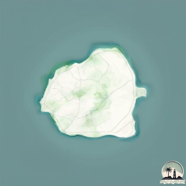
Geography and size of Greater Tunb
Size: 11.1 km²
Coastline: 15.3 km
Ocean: Indian Ocean
Sea: Persian Gulf
Continent: Asia
Greater Tunb is a Medium Island spanning 11 km² with a coastline of 15 km.
Archipel: –
Tectonic Plate: Africa – One of the world’s largest tectonic plates, covering the African continent and parts of the surrounding oceans, known for its stability with some active rift zones.
The geographic heart of the island is pinpointed at these coordinates:
Latitude: 26.26354489 / Longitude: 55.30629892
Climate and weather of Greater Tunb
Climate Zone: Dry
Climate Details: Hot Deserts Climate
Temperature: Hot
Climate Characteristics: Dominated by extremely hot temperatures, this climate is marked by minimal rainfall and barren landscapes. Nights often experience drastic temperature drops.
Topography and nature of Greater Tunb
Timezone: UTC+04:00
Timezone places: Asia/Dubai
Max. Elevation: 37 m
Mean Elevation: 16 m
Vegetation: Sparse Vegetation
Tree Coverage: 10%
The mean elevation is 16 m. The highest elevation on the island reaches approximately 37 meters above sea level. The island is characterized by Plains: Flat, low-lying lands characterized by a maximum elevation of up to 200 meters. On islands, plains are typically coastal lowlands or central flat areas.
Dominating Vegetation: Sparse Vegetation
These regions have limited plant growth, typically due to extreme conditions like aridity or poor soils. Vegetation is scattered and consists of hardy plant species. Greater Tunb has a tree cover of 10 %.
Vegetation: 2 vegetation zones – Low Diversity Island
Islands with two distinct vegetation zones offer slightly more ecological variety. These zones could be due to differences in elevation, moisture, or other environmental factors. While still limited in biodiversity, these islands may offer a contrast between the two zones, such as a coastline with mangroves and an inland area with grassland.
Infrastructure and Travelling to Greater Tunb
Does the island have a public airport? no.
There is no public and scheduled airport on Greater Tunb. The nearest airport is Abu Musa Island Airport, located 51 km away.
Does the island have a major port? no.
There are no major ports on Greater Tunb. The closest major port is HULAYLAH OIL TERMINAL, approximately 74 km away.
The mean population of Greater Tunb is 129 per km². Greater Tunb is Moderately Inhabited. The island belongs to Iran.
Continuing your journey, Abu Musa Island is the next notable island, situated merely km away.
Iran is classified as Emerging region: G20: Group of Twenty – Major economies comprising both developed and emerging countries, representing the world’s largest economies. The level of income is Upper middle income.
News – Latest Updates and Headlines from Greater Tunb
Stay informed with the most recent news and important headlines from Greater Tunb. Here’s a roundup of the latest developments.
- US Military strikes Iran's Greater Tunb Island, targets missile and defence sites - Daily Pioneeron 15 July 2026
US Military strikes Iran's Greater Tunb Island, targets missile and defence sites Daily Pioneer
- US forces strike Iranian coastal defenses on Greater Tunb Island - Crypto Briefingon 15 July 2026
US forces strike Iranian coastal defenses on Greater Tunb Island Crypto Briefing
- US strikes strategic Greater Tunb Island as tensions with Iran escalate - United News of Bangladeshon 15 July 2026
US strikes strategic Greater Tunb Island as tensions with Iran escalate United News of Bangladesh
- CENTCOM: Military facilities on Iran's Greater Tunb Island targeted in 90-minute operation - UPDATED - Apa.azon 15 July 2026
CENTCOM: Military facilities on Iran's Greater Tunb Island targeted in 90-minute operation - UPDATED Apa.az
- US strikes Iran's coastal defences, missile sites on Greater Tunb Island | World News - Hindustan Timeson 15 July 2026
US strikes Iran's coastal defences, missile sites on Greater Tunb Island | World News Hindustan Times
- US launches new attacks on Iran, hits an island in Hormuz - KOHA.neton 15 July 2026
US launches new attacks on Iran, hits an island in Hormuz KOHA.net
- US Centcom strikes target Iranian missile sites on Greater Tunb Island - Crypto Briefingon 15 July 2026
US Centcom strikes target Iranian missile sites on Greater Tunb Island Crypto Briefing
- Iran threatens to halt Mideast energy exports after US reimposes a blockade and intensifies strikes - WJTVon 15 July 2026
Iran threatens to halt Mideast energy exports after US reimposes a blockade and intensifies strikes WJTV
- US military's Central Command says it strikes Greater Tunb Island, targeting Iranian defense and missile sites - wdtimes.comon 15 July 2026
US military's Central Command says it strikes Greater Tunb Island, targeting Iranian defense and missile sites wdtimes.com
- Three Islands, Two Claims: Iran-UAE Territorial Dispute Hardens Into Doctrine – Analysis - Eurasia Reviewon 7 July 2026
Three Islands, Two Claims: Iran-UAE Territorial Dispute Hardens Into Doctrine – Analysis Eurasia Review
Please note: The data used here has been primarily extracted from satellite readings. Deviations from exact values may occur, particularly regarding the height of elevations and population density. Land area and coastline measurements refer to average values at mean high tide.