Johnson Key
Welcome to Johnson Key, a Tropical island in the Gulf of Mexico, part of the majestic Atlantic Ocean. This guide offers a comprehensive overview of what makes Johnson Key unique – from its geography and climate to its population, infrastructure, and beyond. Dive into the details:
- Geography and Size: Explore the island’s size and location.
- Climate and Weather: Weather patterns and temperature.
- Topography and Nature: Uncover the natural wonders of the island.
- Infrastructure and Travelling: Insights on reaching, staying, and making the most of your visit.
- News and Headlines: Latest News.
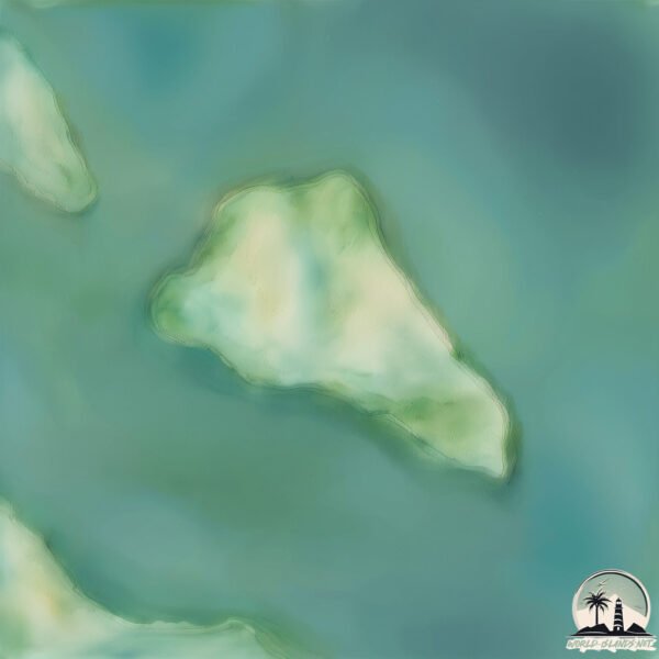
Geography and size of Johnson Key
Size: 1.083 km²
Coastline: 4.6 km
Ocean: Atlantic Ocean
Sea: Gulf of Mexico
Continent: North America
Johnson Key is a Small Island spanning 1.1 km² with a coastline of 4.6 km.
Archipel: –
Tectonic Plate: North America – Covers North America and parts of the Atlantic and Arctic Oceans, characterized by diverse geological features and varying levels of seismic activity.
The geographic heart of the island is pinpointed at these coordinates:
Latitude: 24.75122214 / Longitude: -81.30709716
Climate and weather of Johnson Key
Climate Zone: Tropical
Climate Details: Tropical Savanna, Wet
Temperature: Hot
Climate Characteristics: Defined by distinct wet and dry seasons with high temperatures year-round. Pronounced rainfall occurs during the wet season, while the dry season is marked by drought.
Topography and nature of Johnson Key
Timezone: UTC-05:00
Timezone places: America/New_York
Max. Elevation: 1 m
Mean Elevation: 1 m
Vegetation: Mangrove Forest
Tree Coverage: 59%
The mean elevation is 1 m. The highest elevation on the island reaches approximately 1 meters above sea level. The island is characterized by Plains: Flat, low-lying lands characterized by a maximum elevation of up to 200 meters. On islands, plains are typically coastal lowlands or central flat areas.
Dominating Vegetation: Mangrove Forest
Found in coastal areas and river deltas, these unique wetland ecosystems are adapted to saline conditions and are crucial for coastal protection and biodiversity. Johnson Key has a tree cover of 59 %.
Vegetation: 2 vegetation zones – Low Diversity Island
Islands with two distinct vegetation zones offer slightly more ecological variety. These zones could be due to differences in elevation, moisture, or other environmental factors. While still limited in biodiversity, these islands may offer a contrast between the two zones, such as a coastline with mangroves and an inland area with grassland.
Infrastructure and Travelling to Johnson Key
Does the island have a public airport? no.
There is no public and scheduled airport on Johnson Key. The nearest airport is Key West International Airport, located 54 km away.
Does the island have a major port? no.
There are no major ports on Johnson Key. The closest major port is KEY WEST, approximately 60 km away.
The mean population of Johnson Key is 0 per km². Johnson Key is Uninhabited. The island belongs to United States of America.
Continuing your journey, Big Pine Key is the next notable island, situated merely km away.
United States of America is classified as Developed region: G7: Group of Seven – Major advanced economies, including Canada, France, Germany, Italy, Japan, the United Kingdom, and the United States. The level of income is High income: OECD.
News – Latest Updates and Headlines from Johnson Key
Stay informed with the most recent news and important headlines from Johnson Key. Here’s a roundup of the latest developments.
- Lower Keys Deputy Stanley Jean Baptiste was on hand for the Summer in the Park Showcase at the Pine Channel Nature Park on Big Pine Key! - facebook.comby "Big Pine Key island" - Google News on 17 July 2026
Lower Keys Deputy Stanley Jean Baptiste was on hand for the Summer in the Park Showcase at the Pine Channel Nature Park on Big Pine Key! facebook.com
- The Florida Keys Are Home To A Wildlife Experience You Won’t Find Anywhere Else - Southern Livingby "Big Pine Key island" - Google News on 10 July 2026
The Florida Keys Are Home To A Wildlife Experience You Won’t Find Anywhere Else Southern Living
- Longboat Key pulls all the stops for special Freedom Fest - Your Observerby "Johnson Key island" - Google News on 4 July 2026
Longboat Key pulls all the stops for special Freedom Fest Your Observer
- Stars, stripes and island vibes: Celebrate America’s 250th in the Florida Keys - Keys Weekly Newspapersby "Big Pine Key island" - Google News on 21 June 2026
Stars, stripes and island vibes: Celebrate America’s 250th in the Florida Keys Keys Weekly Newspapers
- Coast Guard rescues five people at sea in two operations on the same day - CiberCubaby "Big Pine Key island" - Google News on 9 June 2026
Coast Guard rescues five people at sea in two operations on the same day CiberCuba
- Memorial fund created for Jocelyn Brown - keysnews.comby "Big Pine Key island" - Google News on 19 May 2026
Memorial fund created for Jocelyn Brown keysnews.com
- Santa Rosa Island Fire Explodes to More than 10,000 Acres over Weekend - independent.comby "Johnson Key island" - Google News on 18 May 2026
Santa Rosa Island Fire Explodes to More than 10,000 Acres over Weekend independent.com
- FLORIDA KEYS COMMUNITY MOURNS DIVER LOST TO BOAT STRIKE - Keys Weekly Newspapersby "Big Pine Key island" - Google News on 14 May 2026
FLORIDA KEYS COMMUNITY MOURNS DIVER LOST TO BOAT STRIKE Keys Weekly Newspapers
- This unique Florida bar is tucked away on a small, secluded island - Fast Food Clubby "Big Pine Key island" - Google News on 6 May 2026
This unique Florida bar is tucked away on a small, secluded island Fast Food Club
- Cool and Unusual Things to Do in Big Pine Key - Atlas Obscuraby "Big Pine Key island" - Google News on 22 April 2026
Cool and Unusual Things to Do in Big Pine Key Atlas Obscura
Please note: The data used here has been primarily extracted from satellite readings. Deviations from exact values may occur, particularly regarding the height of elevations and population density. Land area and coastline measurements refer to average values at mean high tide.