Maytiguid

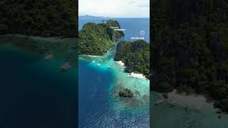
Welcome to Maytiguid, a Tropical island in the Sulu Sea, part of the majestic Pacific Ocean. This guide offers a comprehensive overview of what makes Maytiguid unique – from its geography and climate to its population, infrastructure, and beyond. Dive into the details:
- Geography and Size: Explore the island’s size and location.
- Climate and Weather: Weather patterns and temperature.
- Topography and Nature: Uncover the natural wonders of the island.
- Infrastructure and Travelling: Insights on reaching, staying, and making the most of your visit.
- News and Headlines: Latest News.
Geography and size of Maytiguid
Size: 48.8 km²
Coastline: 49.8 km
Ocean: Pacific Ocean
Sea: Sulu Sea
Continent: Asia
Maytiguid is a Medium Island spanning 49 km² with a coastline of 50 km.
Archipel: Malay Archipelago – The world’s largest archipelago, located between mainland Southeast Asia and Australia, known for its immense biodiversity and cultural diversity.
Tectonic Plate: Pacific – The world’s largest tectonic plate, covering much of the Pacific Ocean, known for the Pacific Ring of Fire with extensive seismic and volcanic activity.
The geographic heart of the island is pinpointed at these coordinates:
Latitude: 11.05105894 / Longitude: 119.5999922
Climate and weather of Maytiguid
Climate Zone: Tropical
Climate Details: Tropical Monsoon Climate
Temperature: Hot
Climate Characteristics: Characterized by heavy rainfall, high humidity, and uniformly high temperatures, but with a distinct short dry season. It features a seasonal reversal of prevailing wind directions.
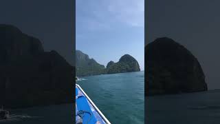
Topography and nature of Maytiguid
Timezone: UTC+08:00
Timezone places: Australia/Perth
Max. Elevation: 228 m
Mean Elevation: 67 m
Vegetation: Evergreen Broadleaf Forest
Tree Coverage: 54%
The mean elevation is 67 m. The highest elevation on the island reaches approximately 228 meters above sea level. The island is characterized by Hills: Gently sloping landforms with rounded tops, having a maximum elevation between 200 and 500 meters. Hills contribute to a varied landscape on islands.
Dominating Vegetation: Evergreen Broadleaf Forest
Characterized by dense, lush canopies of broadleaf trees that retain their leaves year-round. These forests are typically found in tropical and subtropical regions and are known for their high biodiversity. Maytiguid has a tree cover of 54 %.
Vegetation: 9 vegetation zones – Very Highly Diverse Island
Islands in this range are ecological powerhouses, showcasing a wide array of vegetation zones. Each zone, from lush rainforests to arid scrublands, coastal mangroves to mountainous regions, contributes to a complex and interdependent ecosystem. These islands are often hotspots of biodiversity, supporting numerous species and intricate ecological processes.
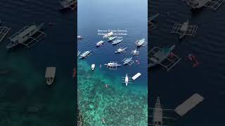
Infrastructure and Travelling to Maytiguid
Does the island have a public airport? no.
There is no public and scheduled airport on Maytiguid. The nearest airport is Cesar Lim Rodriguez (Taytay-Sandoval) Airport, located 4 km away.
Does the island have a major port? no.
There are no major ports on Maytiguid. The closest major port is PUERTO PRINCESA, approximately 171 km away.
The mean population of Maytiguid is 64 per km². Maytiguid is Gently Populated. The island belongs to Philippines.
The name of the island resonates across different cultures and languages. Here is how it is known around the world: Arabic: جزيرة بالاوان; German: Palawan; Spanish: Palawan; French: Palawan; Portuguese: Palawan; Russian: Палаван; Chinese: 巴拉望島
Continuing your journey, Batas is the next notable island, situated merely km away.
Maytegued Island #palawan #marineconservation


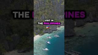


Philippines is classified as Emerging region: G20: Group of Twenty – Major economies comprising both developed and emerging countries, representing the world’s largest economies. The level of income is Lower middle income.
News – Latest Updates and Headlines from Maytiguid
Stay informed with the most recent news and important headlines from Maytiguid. Here’s a roundup of the latest developments.
Please note: The data used here has been primarily extracted from satellite readings. Deviations from exact values may occur, particularly regarding the height of elevations and population density. Land area and coastline measurements refer to average values at mean high tide.