Nantha Kyun
Welcome to Nantha Kyun, a Tropical island in the Bay of Bengal, part of the majestic Indian Ocean. This guide offers a comprehensive overview of what makes Nantha Kyun unique – from its geography and climate to its population, infrastructure, and beyond. Dive into the details:
- Geography and Size: Explore the island’s size and location.
- Climate and Weather: Weather patterns and temperature.
- Topography and Nature: Uncover the natural wonders of the island.
- Infrastructure and Travelling: Insights on reaching, staying, and making the most of your visit.
- News and Headlines: Latest News.
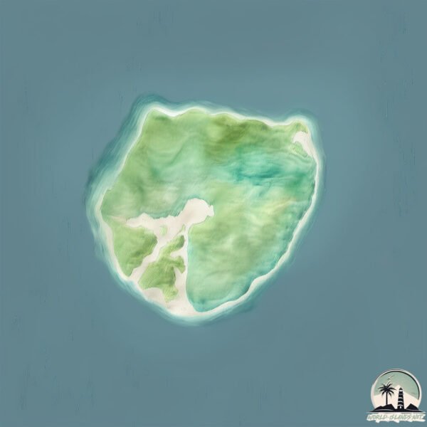
Geography and size of Nantha Kyun
Size: 3.179 km²
Coastline: 6.8 km
Ocean: Indian Ocean
Sea: Bay of Bengal
Continent: Asia
Nantha Kyun is a Small Island spanning 3.2 km² with a coastline of 6.8 km.
Archipel: –
Tectonic Plate: Arabia – A major tectonic plate covering the Arabian Peninsula and parts of the Middle East. The plate is primarily continental and known for its collision with the Eurasian Plate, leading to the uplift of the Zagros Mountains.
The geographic heart of the island is pinpointed at these coordinates:
Latitude: 18.06334873 / Longitude: 94.08943252
Climate and weather of Nantha Kyun
Climate Zone: Tropical
Climate Details: Tropical Monsoon Climate
Temperature: Hot
Climate Characteristics: Characterized by heavy rainfall, high humidity, and uniformly high temperatures, but with a distinct short dry season. It features a seasonal reversal of prevailing wind directions.
Topography and nature of Nantha Kyun
Timezone: UTC+06:00
Timezone places: Asia/Dhaka
Max. Elevation: 70 m
Mean Elevation: 33 m
Vegetation: Evergreen Broadleaf Forest
Tree Coverage: 70%
The mean elevation is 33 m. The highest elevation on the island reaches approximately 70 meters above sea level. The island is characterized by Plains: Flat, low-lying lands characterized by a maximum elevation of up to 200 meters. On islands, plains are typically coastal lowlands or central flat areas.
Dominating Vegetation: Evergreen Broadleaf Forest
Characterized by dense, lush canopies of broadleaf trees that retain their leaves year-round. These forests are typically found in tropical and subtropical regions and are known for their high biodiversity. Nantha Kyun has a tree cover of 70 %.
Vegetation: 5 vegetation zones – Highly Diverse Island
With five different vegetation zones, these islands offer a rich tapestry of ecosystems. The variety could include dense forests, open meadows, wetlands, coastal zones, and more. This level of diversity supports an intricate web of life, with each zone playing a vital role in the overall ecological health and balance of the island.
Infrastructure and Travelling to Nantha Kyun
Does the island have a public airport? no.
There is no public and scheduled airport on Nantha Kyun. The nearest airport is Thandwe Airport, located 49 km away.
Does the island have a major port? no.
There are no major ports on Nantha Kyun. The closest major port is BASSEIN, approximately 158 km away.
The mean population of Nantha Kyun is 32 per km². Nantha Kyun is Gently Populated. The island belongs to Myanmar.
Continuing your journey, Ye Insel is the next notable island, situated merely km away.
Nantha Kyun


Myanmar is classified as Least developed region: Countries that exhibit the lowest indicators of socioeconomic development, with the lowest Human Development Index ratings. The level of income is Low income.
News – Latest Updates and Headlines from Nantha Kyun
Stay informed with the most recent news and important headlines from Nantha Kyun. Here’s a roundup of the latest developments.
Please note: The data used here has been primarily extracted from satellite readings. Deviations from exact values may occur, particularly regarding the height of elevations and population density. Land area and coastline measurements refer to average values at mean high tide.