
Niuafo'ou
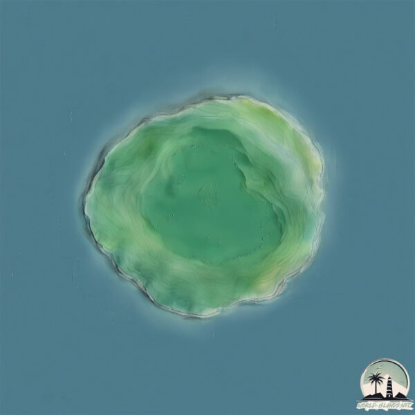
Welcome to Niuafo’ou, a Tropical island in the South Pacific Ocean, part of the majestic Pacific Ocean. This guide offers a comprehensive overview of what makes Niuafo’ou unique – from its geography and climate to its population, infrastructure, and beyond. Dive into the details:
- Geography and Size: Explore the island’s size and location.
- Climate and Weather: Weather patterns and temperature.
- Topography and Nature: Uncover the natural wonders of the island.
- Infrastructure and Travelling: Insights on reaching, staying, and making the most of your visit.
- News and Headlines: Latest News.
Geography and size of Niuafo’ou
Size: 51.7 km²
Coastline: 26.8 km
Ocean: Pacific Ocean
Sea: South Pacific Ocean
Continent: Oceania
Niuafo’ou is a Medium Island spanning 52 km² with a coastline of 27 km.
Archipel: Tonga – A Polynesian kingdom of more than 170 South Pacific islands, known for their white beaches, coral reefs, and rich Polynesian culture.
Tectonic Plate: Pacific – The world’s largest tectonic plate, covering much of the Pacific Ocean, known for the Pacific Ring of Fire with extensive seismic and volcanic activity.
The geographic heart of the island is pinpointed at these coordinates:
Latitude: -15.60267495 / Longitude: -175.63805103
Climate and weather of Niuafo’ou
Climate Zone: Tropical
Climate Details: Tropical Rainforest Climate
Temperature: Hot
Climate Characteristics: This climate is typified by heavy rainfall throughout the year, high humidity, and consistently high temperatures, leading to lush rainforests and rich biodiversity. Seasonal temperature variations are minimal.
Topography and nature of Niuafo’ou
Timezone: UTC+13:00
Timezone places: Pacific/Enderbury
Max. Elevation: 132 m
Mean Elevation: 38 m
Vegetation: Evergreen Broadleaf Forest
Tree Coverage: 89%
The mean elevation is 38 m. The highest elevation on the island reaches approximately 132 meters above sea level. The island is characterized by Plains: Flat, low-lying lands characterized by a maximum elevation of up to 200 meters. On islands, plains are typically coastal lowlands or central flat areas.
Dominating Vegetation: Evergreen Broadleaf Forest
Characterized by dense, lush canopies of broadleaf trees that retain their leaves year-round. These forests are typically found in tropical and subtropical regions and are known for their high biodiversity. Niuafo’ou has a tree cover of 89 %.
Vegetation: 8 vegetation zones – Very Highly Diverse Island
Islands in this range are ecological powerhouses, showcasing a wide array of vegetation zones. Each zone, from lush rainforests to arid scrublands, coastal mangroves to mountainous regions, contributes to a complex and interdependent ecosystem. These islands are often hotspots of biodiversity, supporting numerous species and intricate ecological processes.
Infrastructure and Travelling to Niuafo’ou
Does the island have a public airport? yes.
Niuafo’ou has a public and scheduled airport. The following airports are located on this island: Mata’aho Airport.
Does the island have a major port? no.
There are no major ports on Niuafo’ou. The closest major port is MATA-UTU, approximately 260 km away.
The mean population of Niuafo’ou is 61 per km². Niuafo’ou is Gently Populated. The island belongs to Tonga.
The name of the island resonates across different cultures and languages. Here is how it is known around the world: Arabic: نيوفو; German: Niuafoʻou; Spanish: Niuafo’ou; French: Niuafo’ou; Portuguese: Niuafo’ou; Russian: Ниуафооу; Chinese: 紐阿福歐島
Continuing your journey, Niuatoputapu is the next notable island, situated merely km away.
Tonga is classified as Developing region: Regions characterized by lower income levels, with economies in the process of industrialization and modernization. The level of income is Lower middle income.
News – Latest Updates and Headlines from Niuafo’ou
Stay informed with the most recent news and important headlines from Niuafo’ou. Here’s a roundup of the latest developments.
Please note: The data used here has been primarily extracted from satellite readings. Deviations from exact values may occur, particularly regarding the height of elevations and population density. Land area and coastline measurements refer to average values at mean high tide.