
Pulau Hinako
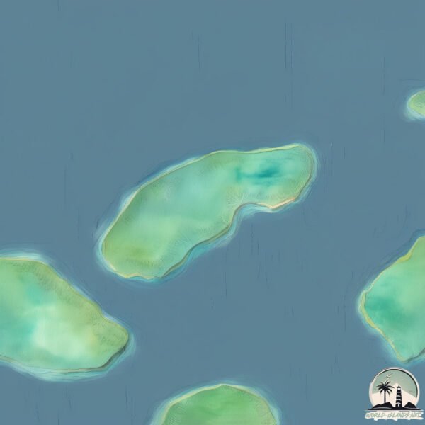
Welcome to Pulau Hinako, a Tropical island in the Indian Ocean, part of the majestic Indian Ocean. This guide offers a comprehensive overview of what makes Pulau Hinako unique – from its geography and climate to its population, infrastructure, and beyond. Dive into the details:
- Geography and Size: Explore the island’s size and location.
- Climate and Weather: Weather patterns and temperature.
- Topography and Nature: Uncover the natural wonders of the island.
- Infrastructure and Travelling: Insights on reaching, staying, and making the most of your visit.
- News and Headlines: Latest News.
Geography and size of Pulau Hinako
Size: 3.391 km²
Coastline: 8.2 km
Ocean: Indian Ocean
Sea: Indian Ocean
Continent: Asia
Pulau Hinako is a Small Island spanning 3.4 km² with a coastline of 8.2 km.
Archipel: Malay Archipelago – The world’s largest archipelago, located between mainland Southeast Asia and Australia, known for its immense biodiversity and cultural diversity.
Tectonic Plate: Sunda – Extends across Southeast Asia, encompassing parts of the Sunda Shelf, known for its interaction with the Australian Plate, contributing to volcanic activity in Indonesia.
The geographic heart of the island is pinpointed at these coordinates:
Latitude: 0.86675715 / Longitude: 97.34275452
Climate and weather of Pulau Hinako
Climate Zone: Tropical
Climate Details: Tropical Rainforest Climate
Temperature: Hot
Climate Characteristics: This climate is typified by heavy rainfall throughout the year, high humidity, and consistently high temperatures, leading to lush rainforests and rich biodiversity. Seasonal temperature variations are minimal.
Topography and nature of Pulau Hinako
Timezone: UTC+07:00
Timezone places: Asia/Jakarta
Max. Elevation: -2 m
Mean Elevation: -6 m
Vegetation: Evergreen Broadleaf Forest
Tree Coverage: 89%
The mean elevation is -6 m. Remarkably, this unique island barely emerges above the sea level, showcasing nature’s fascinating interplay with the ocean. The island is characterized by Plains: Flat, low-lying lands characterized by a maximum elevation of up to 200 meters. On islands, plains are typically coastal lowlands or central flat areas.
Dominating Vegetation: Evergreen Broadleaf Forest
Characterized by dense, lush canopies of broadleaf trees that retain their leaves year-round. These forests are typically found in tropical and subtropical regions and are known for their high biodiversity. Pulau Hinako has a tree cover of 89 %.
Vegetation: 5 vegetation zones – Highly Diverse Island
With five different vegetation zones, these islands offer a rich tapestry of ecosystems. The variety could include dense forests, open meadows, wetlands, coastal zones, and more. This level of diversity supports an intricate web of life, with each zone playing a vital role in the overall ecological health and balance of the island.
Infrastructure and Travelling to Pulau Hinako
Does the island have a public airport? no.
There is no public and scheduled airport on Pulau Hinako. The nearest airport is Binaka Airport, located 50 km away.
Does the island have a major port? no.
There are no major ports on Pulau Hinako. The closest major port is SIBOLGA, approximately 183 km away.
The mean population of Pulau Hinako is 99 per km². Pulau Hinako is Gently Populated. The island belongs to Indonesia.
Continuing your journey, Nias is the next notable island, situated merely km away.
Indonesia is classified as Emerging region: MIKT: Mexico, Indonesia, South Korea, and Turkey – Economies recognized for their development potential and emerging market status. The level of income is Lower middle income.
News – Latest Updates and Headlines from Pulau Hinako
Stay informed with the most recent news and important headlines from Pulau Hinako. Here’s a roundup of the latest developments.
- 6.1-magnitude earthquake strikes off Indonesia's North Sumatra - The Peninsula Qatarby "Nias island" - Google News on 18 August 2026
6.1-magnitude earthquake strikes off Indonesia's North Sumatra The Peninsula Qatar
- North Sumatra hit by 6.1-magnitude earthquake off Indonesia - The Assam Tribuneby "Nias island" - Google News on 18 August 2026
North Sumatra hit by 6.1-magnitude earthquake off Indonesia The Assam Tribune
- Indonesia moves to protect Nias hilltop village from climate risks - ANTARA Newsby "Nias island" - Google News on 29 July 2026
Indonesia moves to protect Nias hilltop village from climate risks ANTARA News
- Swell From Hell: Nias’s Apocalyptic Day of Days - SURFER Magazineby "Nias island" - Google News on 27 July 2026
Swell From Hell: Nias’s Apocalyptic Day of Days SURFER Magazine
- Nias On Steriods: The Biggest Swell of the Year on May 29-30 - The Inertiaby "Nias island" - Google News on 4 June 2026
Nias On Steriods: The Biggest Swell of the Year on May 29-30 The Inertia
- Ingrid disappeared on an Indonesian island in 1976. Now we know what really happened - theguardian.comby "Nias island" - Google News on 2 January 2026
Ingrid disappeared on an Indonesian island in 1976. Now we know what really happened theguardian.com
- At least 17 people killed in Indonesia floods, landslides - Al Jazeeraby "Nias island" - Google News on 26 November 2025
At least 17 people killed in Indonesia floods, landslides Al Jazeera
- Go See ‘Point of Change’ The True History of Nias - Tracks Magazineby "Nias island" - Google News on 26 October 2025
Go See ‘Point of Change’ The True History of Nias Tracks Magazine
- Nias Looked Insanely Fun on October 16th - The Inertiaby "Nias island" - Google News on 22 October 2025
Nias Looked Insanely Fun on October 16th The Inertia
- North Sumatra speeds up Internet access in remote areas - ANTARA Newsby "Nias island" - Google News on 6 October 2025
North Sumatra speeds up Internet access in remote areas ANTARA News
Please note: The data used here has been primarily extracted from satellite readings. Deviations from exact values may occur, particularly regarding the height of elevations and population density. Land area and coastline measurements refer to average values at mean high tide.