Treis Island
Welcome to Treis Island, a Tropical island in the Andaman or Burma Sea, part of the majestic Indian Ocean. This guide offers a comprehensive overview of what makes Treis Island unique – from its geography and climate to its population, infrastructure, and beyond. Dive into the details:
- Geography and Size: Explore the island’s size and location.
- Climate and Weather: Weather patterns and temperature.
- Topography and Nature: Uncover the natural wonders of the island.
- Infrastructure and Travelling: Insights on reaching, staying, and making the most of your visit.
- News and Headlines: Latest News.
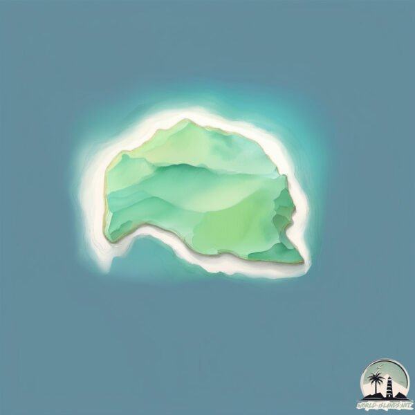
Geography and size of Treis Island
Size: 0.228 km²
Coastline: 2.1 km
Ocean: Indian Ocean
Sea: Andaman or Burma Sea
Continent: Seven seas (open ocean)
Treis Island is a Tiny Island spanning 0.228 km² with a coastline of 2.1 km.
Archipel: Nicobar Islands – Part of a group of islands in the Indian Ocean, these are known for their stunning beaches, diverse ecosystems, and unique indigenous cultures.
Tectonic Plate: Burma – Also known as the Burma Plate, it’s a minor tectonic plate in Southeast Asia, largely covering Burma (Myanmar) and parts of the Indian Ocean. It’s involved in the subduction process under the Eurasian Plate, contributing to seismic activity in the region.
The geographic heart of the island is pinpointed at these coordinates:
Latitude: 7.47298288 / Longitude: 93.64863937
Climate and weather of Treis Island
Climate Zone: Tropical
Climate Details: Tropical Rainforest Climate
Temperature: Hot
Climate Characteristics: This climate is typified by heavy rainfall throughout the year, high humidity, and consistently high temperatures, leading to lush rainforests and rich biodiversity. Seasonal temperature variations are minimal.
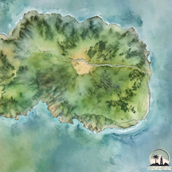
Topography and nature of Treis Island
Timezone: UTC+05:30
Timezone places:
Max. Elevation: 7 m
Mean Elevation: 5 m
Vegetation: Mixed Forest
Tree Coverage: 41%
The mean elevation is 5 m. The highest elevation on the island reaches approximately 7 meters above sea level. The island is characterized by Plains: Flat, low-lying lands characterized by a maximum elevation of up to 200 meters. On islands, plains are typically coastal lowlands or central flat areas.
Dominating Vegetation: Mixed Forest
A combination of both deciduous and evergreen trees, often found in transitional zones between forest types. These forests offer a diverse habitat for various wildlife species. Treis Island has a tree cover of 41 %.
Vegetation: 1 vegetation zones – Minimal Diversity Island
These islands exhibit the most basic level of ecological diversity, often characterized by a single dominant vegetation type. This could be due to extreme environmental conditions, limited land area, or significant human impact. They represent unique ecosystems where specific species have adapted to thrive in these singular environments.
Infrastructure and Travelling to Treis Island
Does the island have a public airport? no.
There is no public and scheduled airport on Treis Island. The nearest airport is Sultan Iskandar Muda International Airport, located 292 km away.
Does the island have a major port? no.
There are no major ports on Treis Island. The closest major port is SABANG, approximately 256 km away.
The mean population of Treis Island is 7 per km². Treis Island is Gently Populated. The island belongs to India.
Continuing your journey, Little Nicobar is the next notable island, situated merely km away.
Three Mile Island - What Really Happened


India is classified as Emerging region: BRIC: Brazil, Russia, India, and China – Economies noted for their rapid growth and increasing influence on global affairs. The level of income is Lower middle income.
News – Latest Updates and Headlines from Treis Island
Stay informed with the most recent news and important headlines from Treis Island. Here’s a roundup of the latest developments.
Please note: The data used here has been primarily extracted from satellite readings. Deviations from exact values may occur, particularly regarding the height of elevations and population density. Land area and coastline measurements refer to average values at mean high tide.