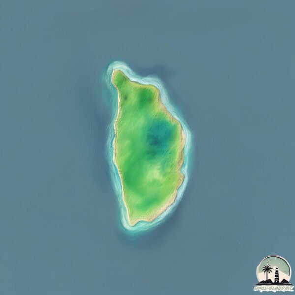
Yami

Welcome to Yami, a Tropical island in the South China Sea, part of the majestic Pacific Ocean. This guide offers a comprehensive overview of what makes Yami unique – from its geography and climate to its population, infrastructure, and beyond. Dive into the details:
- Geography and Size: Explore the island’s size and location.
- Climate and Weather: Weather patterns and temperature.
- Topography and Nature: Uncover the natural wonders of the island.
- Infrastructure and Travelling: Insights on reaching, staying, and making the most of your visit.
- News and Headlines: Latest News.
Geography and size of Yami
Size: 1.148 km²
Coastline: 5.4 km
Ocean: Pacific Ocean
Sea: South China Sea
Continent: Asia
Yami is a Small Island spanning 1.1 km² with a coastline of 5.4 km.
Archipel: Malay Archipelago – The world’s largest archipelago, located between mainland Southeast Asia and Australia, known for its immense biodiversity and cultural diversity.
Tectonic Plate: Eurasia – One of the world’s largest tectonic plates, the Eurasian Plate covers a significant portion of Europe and Asia. It’s characterized by diverse geological features, including the Ural Mountains, the European Plain, and the Himalayas formed from its collision with the Indian Plate.
The geographic heart of the island is pinpointed at these coordinates:
Latitude: 21.11185759 / Longitude: 121.95034321
Climate and weather of Yami
Climate Zone: Tropical
Climate Details: Tropical Rainforest Climate
Temperature: Hot
Climate Characteristics: This climate is typified by heavy rainfall throughout the year, high humidity, and consistently high temperatures, leading to lush rainforests and rich biodiversity. Seasonal temperature variations are minimal.
Topography and nature of Yami
Timezone: UTC+08:00
Timezone places: Australia/Perth
Max. Elevation: 29 m
Mean Elevation: 3 m
Vegetation: Evergreen Broadleaf Forest
Tree Coverage: 40%
The mean elevation is 3 m. The highest elevation on the island reaches approximately 29 meters above sea level. The island is characterized by Plains: Flat, low-lying lands characterized by a maximum elevation of up to 200 meters. On islands, plains are typically coastal lowlands or central flat areas.
Dominating Vegetation: Evergreen Broadleaf Forest
Characterized by dense, lush canopies of broadleaf trees that retain their leaves year-round. These forests are typically found in tropical and subtropical regions and are known for their high biodiversity. Yami has a tree cover of 40 %.
Vegetation: 4 vegetation zones – Diverse Island
Four distinct vegetation zones mark these islands as ecologically diverse. They might feature varied landscapes such as forests, beaches, grasslands, and rocky areas. Such diversity reflects the island’s complex ecological interactions and varied habitats, which can support a rich array of wildlife and plant species.
Infrastructure and Travelling to Yami
Does the island have a public airport? no.
There is no public and scheduled airport on Yami. The nearest airport is Itbayat Jorge Abad Airport, located 45 km away.
Does the island have a major port? no.
There are no major ports on Yami. The closest major port is BASCO, approximately 73 km away.
The mean population of Yami is per km². Yami is . The island belongs to Philippines.
Continuing your journey, Itbayat is the next notable island, situated merely km away.
Philippines is classified as Emerging region: G20: Group of Twenty – Major economies comprising both developed and emerging countries, representing the world’s largest economies. The level of income is Lower middle income.
News – Latest Updates and Headlines from Yami
Stay informed with the most recent news and important headlines from Yami. Here’s a roundup of the latest developments.
- BAGYO UPDATE #NenengPH 🌀 (as of 5 p.m., August 19, 2026) Tropical Depression Neneng slightly weakens. At 4 p.m. Wednesday, it was located 375 kilometers northeast of Itbayat, Batanes. It now packs winds of 45 kph with gusts up to 55 kph and is movin - facebook.comby "Itbayat island" - Google News on 19 August 2026
BAGYO UPDATE #NenengPH 🌀 (as of 5 p.m., August 19, 2026) Tropical Depression Neneng slightly weakens. At 4 p.m. Wednesday, it was located 375 kilometers northeast of Itbayat, Batanes. It now packs winds of 45 kph with gusts up to 55 kph and is […]
- BAGYO UPDATE #NenengPH 🌀 5AM, August 19, 2026 Tropical depression Neneng slightly intensified. At 4 a.m. Wednesday, it was located 675 kilometers east of Itbayat, Batanes. It now packs winds of 55 kph with gusts up to 70 kph and is moving northwest - facebook.comby "Itbayat island" - Google News on 18 August 2026
BAGYO UPDATE #NenengPH 🌀 5AM, August 19, 2026 Tropical depression Neneng slightly intensified. At 4 a.m. Wednesday, it was located 675 kilometers east of Itbayat, Batanes. It now packs winds of 55 kph with gusts up to 70 kph and is moving […]
- Retracing the route of ancient Pacific voyagers - NPRby "Yami island" - Google News on 24 July 2026
Retracing the route of ancient Pacific voyagers NPR
- U.S. Marines insert a NMESIS into the Batanes island chain during KAMANDAG 10 [Image 1 of 24] - DVIDSby "Itbayat island" - Google News on 14 July 2026
U.S. Marines insert a NMESIS into the Batanes island chain during KAMANDAG 10 [Image 1 of 24] DVIDS
- Batanes execs dismiss Chinese sovereignty claim - Inquirer.netby "Itbayat island" - Google News on 11 July 2026
Batanes execs dismiss Chinese sovereignty claim Inquirer.net
- TROPICAL CYCLONE BULLETIN NR. 14 Typhoon #IndayPH (BAVI) Issued at 5:00 AM, 11 July 2026 Valid for broadcast until the next bulletin at 11:00 AM today. “INDAY” IS NOW APPROACHING SAKISHIMA ISLANDS IN SOUTHERN JAPAN. Location of Cen - facebook.comby "Itbayat island" - Google News on 10 July 2026
TROPICAL CYCLONE BULLETIN NR. 14 Typhoon #IndayPH (BAVI) Issued at 5:00 AM, 11 July 2026 Valid for broadcast until the next bulletin at 11:00 AM today. “INDAY” IS NOW APPROACHING SAKISHIMA ISLANDS IN SOUTHERN JAPAN. Location of […]
- BAGYO UPDATE #IndayPH 5 a.m., July 11, 2026 Typhoon Inday is about to exit the Philippine area of responsibility. At 4 a.m. Saturday, Inday was located 500 km northeast of Itbayat, Batanes. It packs winds of 140 kph with gusts up to 170 kph and is moving n - facebook.comby "Itbayat island" - Google News on 10 July 2026
BAGYO UPDATE #IndayPH 5 a.m., July 11, 2026 Typhoon Inday is about to exit the Philippine area of responsibility. At 4 a.m. Saturday, Inday was located 500 km northeast of Itbayat, Batanes. It packs winds of 140 kph with gusts up to 170 kph and is […]
- BAGYO UPDATE #IndayPH 11AM, July 11, 2026 Wind signal no. 1 is still up in Batanes after Typhoon Inday exited the Philippine area of responsibility. At 10 a.m. Saturday, Inday was located 590 km north northeast of Itbayat, Batanes. Inday-enhanced Habag - facebook.comby "Itbayat island" - Google News on 10 July 2026
BAGYO UPDATE #IndayPH 11AM, July 11, 2026 Wind signal no. 1 is still up in Batanes after Typhoon Inday exited the Philippine area of responsibility. At 10 a.m. Saturday, Inday was located 590 km north northeast of Itbayat, Batanes. Inday-enhanced […]
- Itbayat mayor ties China claim over Batanes to Taiwan IP voyage - Inquirer.netby "Itbayat island" - Google News on 10 July 2026
Itbayat mayor ties China claim over Batanes to Taiwan IP voyage Inquirer.net
- BAGYO UPDATE #IndayPH 11AM, July 10, 2026 At 10 a.m. Friday, Typhoon Inday was located 570 km east of Itbayat, Batanes. It packs winds of 140 kph with gusts up to 170 kph and is moving northwestward at 20 kph. Wind signal no. 2 is still up over Batane - facebook.comby "Itbayat island" - Google News on 10 July 2026
BAGYO UPDATE #IndayPH 11AM, July 10, 2026 At 10 a.m. Friday, Typhoon Inday was located 570 km east of Itbayat, Batanes. It packs winds of 140 kph with gusts up to 170 kph and is moving northwestward at 20 kph. Wind signal no. 2 is still up over […]
Please note: The data used here has been primarily extracted from satellite readings. Deviations from exact values may occur, particularly regarding the height of elevations and population density. Land area and coastline measurements refer to average values at mean high tide.
